2.4 km away
Moro Rock Trail
One of the most popular hikes in Sequoia National Park leads to stunning 360-degree views of the region.
Moderate Hiking
- Distance
- 5.8 km
- Ascent
- 219 m
- Descent
- 219 m
A committing crossing of California's Sierra Nevada with the option to summit Mt. Whitney.
Hiking Difficult
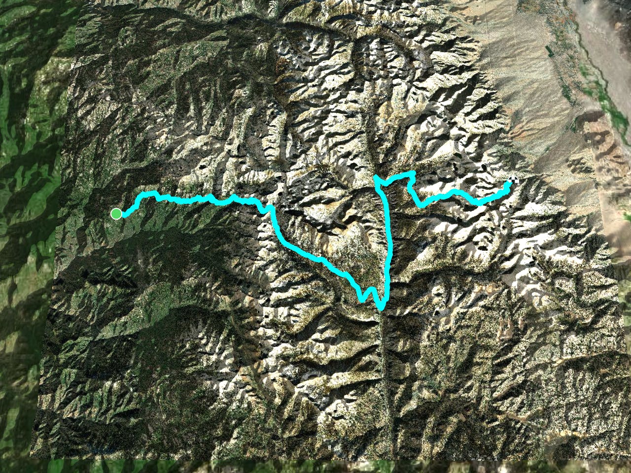
Crossing California’s great mountain range from one side to the other, the High Sierra Trail (HST) is an unbeatable tour of Sequoia National Park. Sloping steeply at both ends and cresting many high ridges in between, its span may hold more lofty panoramas per mile than any other backpacking trail in the Sierra Nevada.
With steep climbs, exposed traverses, stream crossings, towering peaks all around, and the highest summit in the Lower 48 States, the challenges of this journey certainly deserve the rewards. The thru-hike travels from Crescent Meadow to link with the John Muir Trail and finish at Whitney Portal. A side trip to summit Mt. Whitney is optional but, as the highest peak in Lower 48, it’s a primary objective of most HST hikers. Though the trail is stunning in either direction, most choose to travel West to East to save Mt. Whitney for the final climax.
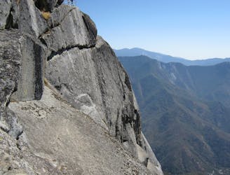
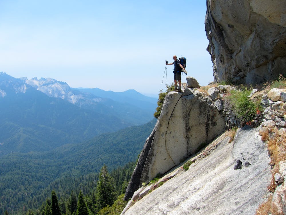
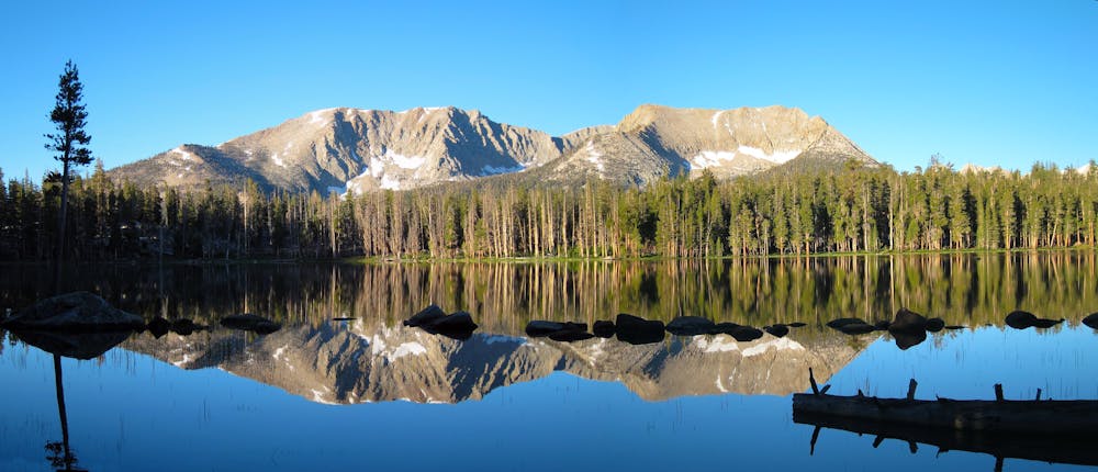
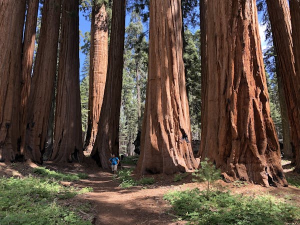
Even on the opposite side of the range from Whitney, the trail wastes no time in getting good. The first mile runs under the lofty canopy of the Giant Forest, then suddenly it emerges at Eagle View to a vista over the canyon of Middle Fork Kaweah River. From there, the traverse of this dramatic gorge and its tributaries continues for about 15 miles into the granite-walled and lake-dotted glacial valley known as Valhalla.
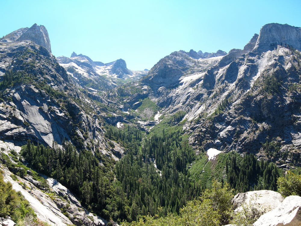
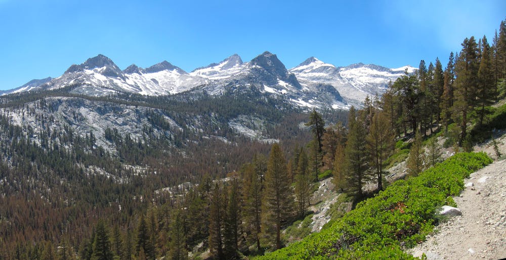
Rest and enjoy the views, because the only way out is 2000 vertical feet of switchbacks and steel-cut cliff traverses. At the top is Kaweah Gap on the Great Western Divide, where the other side of the Sierra awaits beyond. The trail then turns downward, leading into the gentle green valley called Big Arroyo, beneath the impressive chain of Kaweah Peaks.
The trail crosses the valley and heads back up, toward the foot of these peaks, crossing flowing streams and flower-filled meadows. The trail soon turns downhill again, this time via steep switchbacks into the Kern Trench. In the bottom is the Kern River and along it, Kern Hot Springs. Get there early to snag a camp spot.
After a gradual northward ascent along the river, the journey to Whitney really begins. After climbing above the Kern, the HST reaches its junction with the Pacific Crest and John Muir Trails, where you are likely to encounter many more hikers than before. Join them for the march to Mt. Whitney. Along the way are blue alpine lakes where you can camp to acclimatize to the elevation.
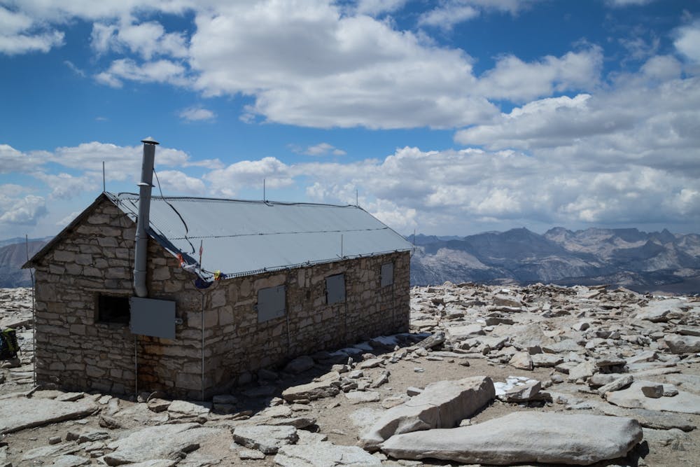
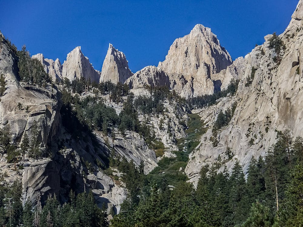
When ready, start the sweeping switchbacks that cut through mountainside talus, leading to Trail Crest, where the main route continues over the pass and the trail to Whitney’s summit turns up the ridgeline. Take this 4.8-mile round trip to stand on the roof of the Sierra Nevada, and the highest point in the Lower 48.
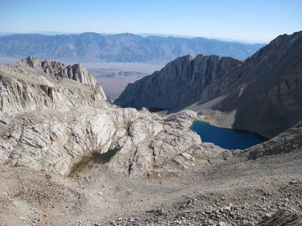
To descend from Whitney and finish the HST, take on the infamous “99 Switchbacks” down the other side. Continue downward through thickening forest and converging streams to return to civilization at Whitney Portal.
Sources: https://www.nps.gov/seki/planyourvisit/high-sierra-trail.htm https://socalhiker.net/overview-of-the-high-sierra-trail/ http://www.highsierratrails.com/highsierratrail/overview.html#here
Difficult
Hiking trails where obstacles such as rocks or roots are prevalent. Some obstacles can require care to step over or around. At times, the trail can be worn and eroded. The grade of the trail is generally quite steep, and can often lead to strenuous hiking.

Some trail sections are extremely exposed where falling will almost certainly result in serious injury or death.

Away from help but easily accessed.
2.4 km away
One of the most popular hikes in Sequoia National Park leads to stunning 360-degree views of the region.
Moderate Hiking
3.3 km away
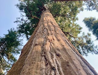
Hike past the largest tree in the world!
Easy Hiking
3.3 km away

This 7-mile hike rolls through groves of the largest trees on planet earth.
Moderate Hiking
4.8 km away
Widely regarded as one of the most incredible day hikes in the USA!
Difficult Hiking
6.1 km away
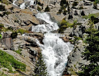
At 1,200 feet tall, Tokopah Falls is the tallest waterfall in Sequoia National Park.
Moderate Hiking

25 routes · Alpine Climbing · Hiking

5 routes · Alpine Climbing · Hiking
7 routes · Alpine Climbing · Hiking

14 routes · Hiking