1.2 km away
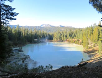
Bumpass Hell
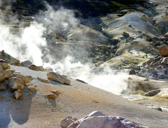
Lassen's largest hydrothermal area, full of heated water and vapors spewing from underground.
Moderate Hiking
- Distance
- 4.5 km
- Ascent
- 145 m
- Descent
- 145 m
The must-do hike to the summit of the park's namesake mountain.
Hiking Difficult

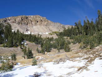
Lassen Peak is California’s most recently active volcano, with a series of eruptions in 1914-17. Hiking to the top of this young mountain, you can see scars that it gouged on the landscape, plus new rock created in the blasts. You may even detect the rotten-egg smell of sulfur exuding from within the mountain. The volcano is still considered active, but no eruption is imminent.
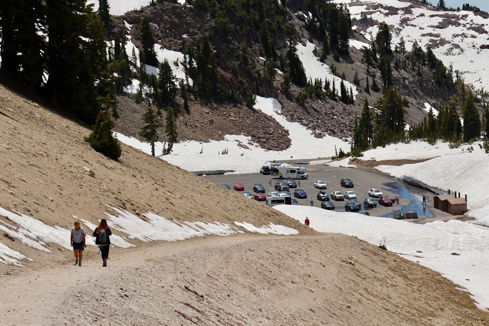
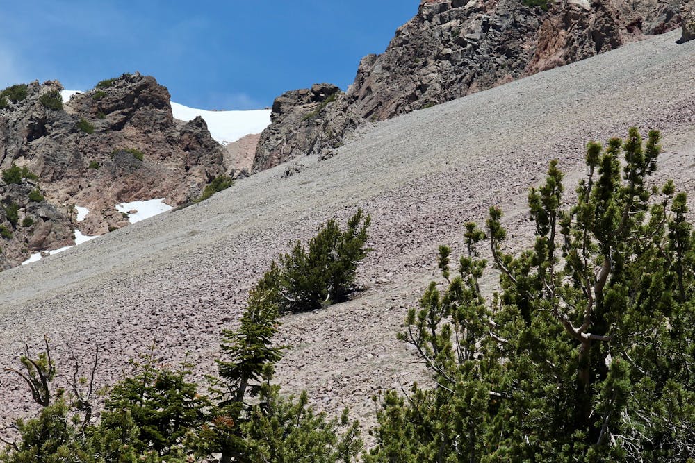
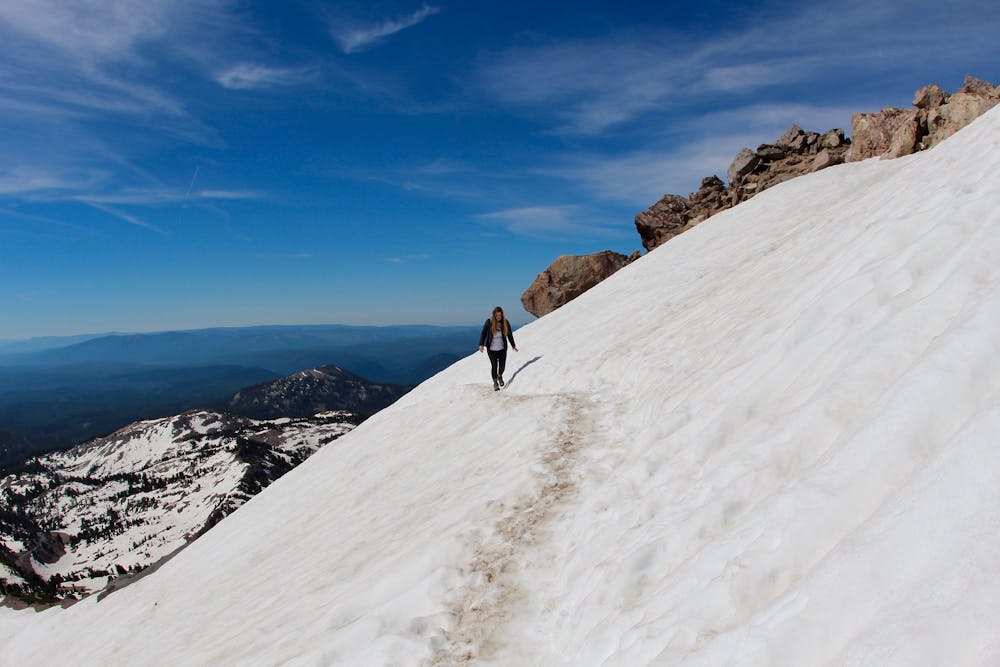
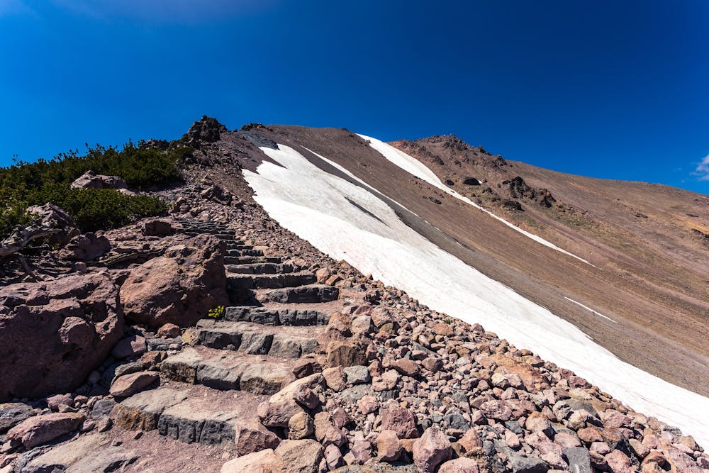
There’s a well-defined and maintained trail all the way to the top, but it’s quite steep with seemingly relentless switchbacks. There may appear to be shortcuts, but you should avoid the temptation to venture off trail. Doing so damages the plants and thin soil that are slowly reclaiming the slopes. At this elevation, snow can linger well into summer, so slipping may be a hazard on the steep slopes. You may need trekking poles and shoe traction to safely complete the trail, depending on conditions.
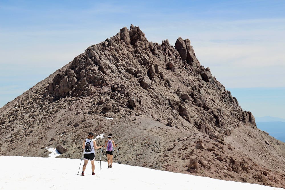
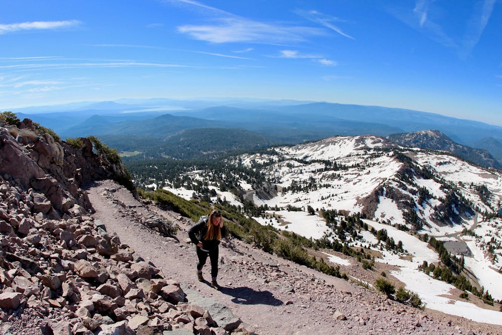
Every step is worth it for the expansive views. As you move up the mountain, the trees become sparser and more diminutive. Eventually, it’s only hardy spruce shrubs that persist. Even those are soon left behind as you climb into the highest and coldest elevations. The top of the mountain is a barren moonscape of exploded rock, granting unobstructed views in all directions.
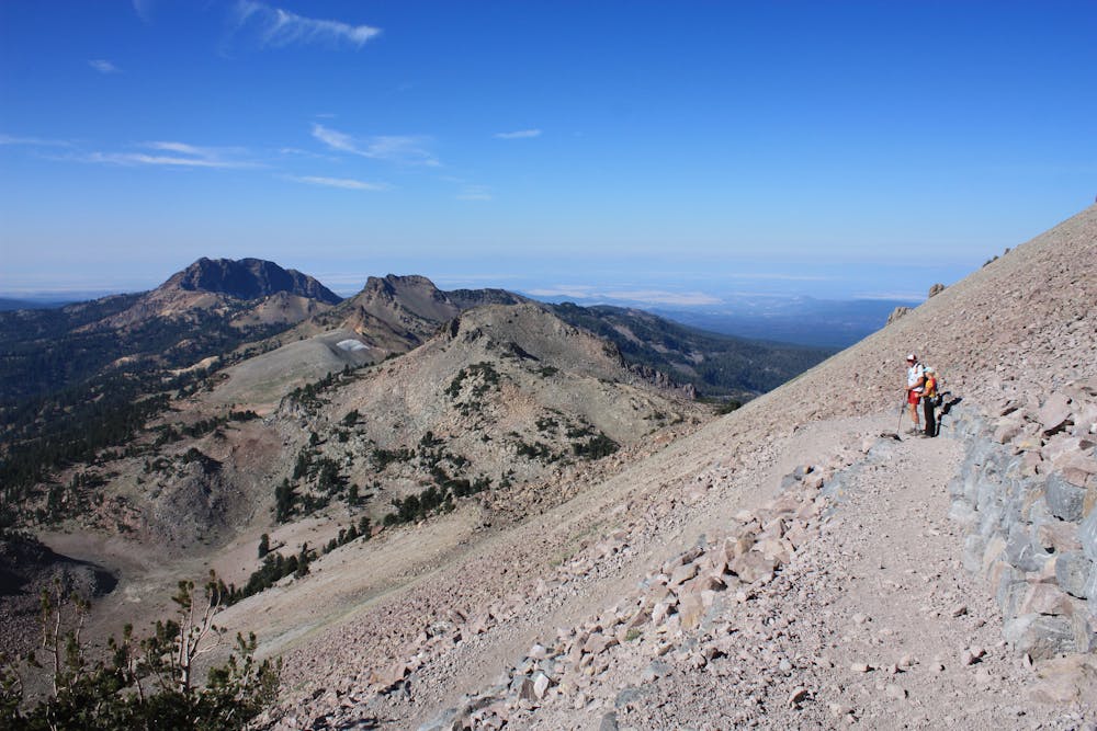
The switchbacks finally let up, and the trail meets a flat spot at the crest of the mountain. There you’ll have a chance to rest, and you can read up on geology and landmarks at a cluster of signs. It’s not the top, but the summit is within sight. Even though the remaining distance is short, it might feel tough at this altitude of more than 10,000 feet. Once on top, you’ll stand on a fin of jagged rock, overlooking the cone of the volcano and the so-called Devastated Area, which was leveled by the last eruption. It’s an excellent vantage over all of Lassen Volcanic National Park.
Source: https://www.nps.gov/lavo/planyourvisit/hikinglassenpeak.htm
Difficult
Hiking trails where obstacles such as rocks or roots are prevalent. Some obstacles can require care to step over or around. At times, the trail can be worn and eroded. The grade of the trail is generally quite steep, and can often lead to strenuous hiking.

Some trail sections have exposed ledges or steep ascents/descents where falling could cause serious injury.

Close to help in case of emergency.
1.2 km away
Lassen's largest hydrothermal area, full of heated water and vapors spewing from underground.
Moderate Hiking
2.2 km away
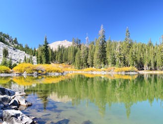
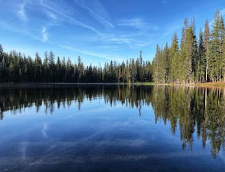
Three exquisite alpine lakes, linked by a path through sunny and colorful woodland.
Moderate Hiking
4.2 km away
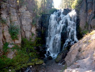
Ultra-popular hike to a cascading creek and waterfall in a verdant gorge.
Difficult Hiking
4.8 km away
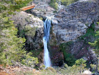
Hilly forest trail to the top of a 75-foot waterfall in a deep gorge.
Moderate Hiking
5.5 km away
Unrelenting ascent on a good trail, to one of the national park's most dramatic peaks.
Difficult Hiking
7.3 km away
An extended stroll through Lassen’s backcountry interior, packed with pristine lakes in subalpine forest.
Moderate Hiking
9.9 km away
Hike along a portion of the Pacific Crest Trail to find a warm creek, a hot lake, and a steaming vent in a lesser-traveled corner of Lassen.
Moderate Hiking
9.9 km away
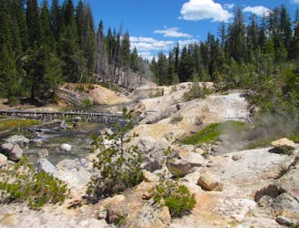
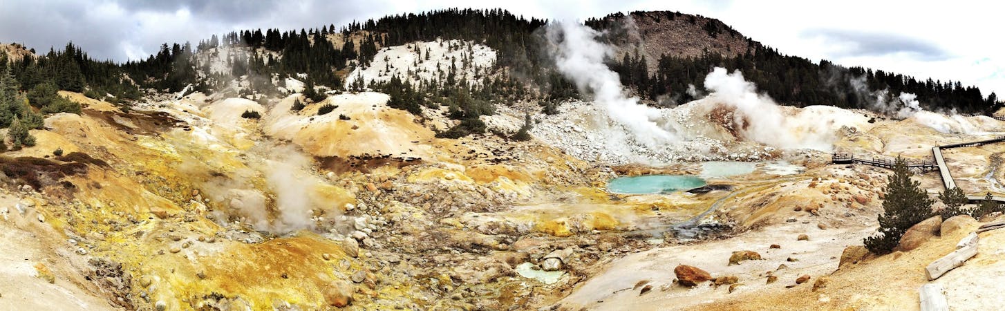
Witness a highly active hydrothermal area in Lassen's peaceful Warner Valley.
Moderate Hiking
11 routes · Hiking

63 routes · Alpine Climbing · Hiking