Lassen Peak Trail
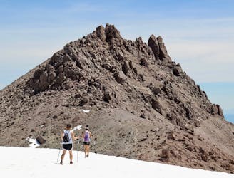
The must-do hike to the summit of the park's namesake mountain.
Difficult Hiking
- Distance
- 7.5 km
- Ascent
- 611 m
- Descent
- 611 m
Hike a volcano that erupted barely a century ago, and walk among steam vents that spew from its molten core.
Hiking Moderate, Difficult
Against its counterparts like Yosemite and Redwood, Lassen Volcanic is often overlooked in California’s repertoire of national parks. It may not have the biggest trees or the tallest rock walls, but Lassen has something the others don’t––an active volcano.
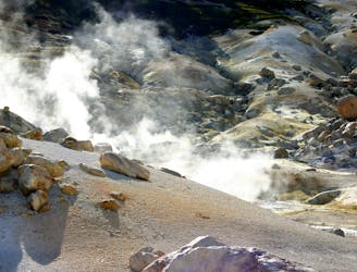
Lassen Peak last erupted in 1917, which is practically yesterday in geologic terms. While there's no eruption imminent today, activity persists beneath the surface. Hot water steams and bubbles from the ground in many places, showing that the volcanic forces which formed this landscape are still smoldering beneath.
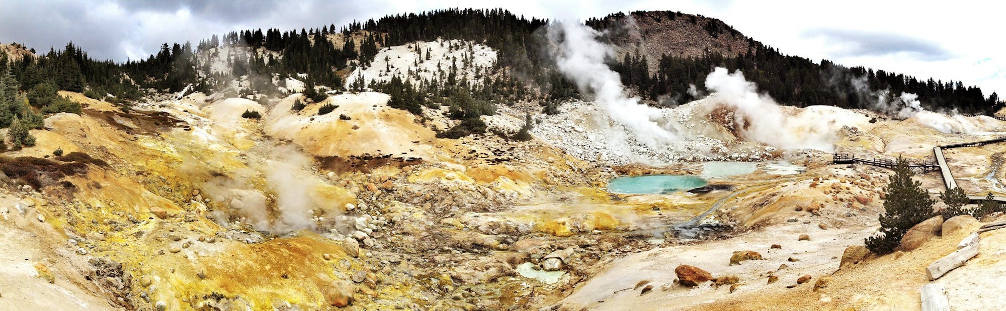
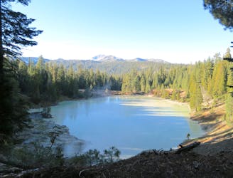
Lassen Volcanic National Park is best known for its hot-water sources, called hydrothermal features. It’s the nation’s second-largest concentration of such wonders, outshone only by Yellowstone. Lassen, unfortunately, has no geysers, but you can see other features like steaming vents, gurgling mud pots, and boiling pools. They are not for soaking in, due to extreme temperatures and acidity, but they are quite the display to observe. On several of the park’s trails, you can walk closely among them, imbibing your senses on their moist heat and earthy odors. The best trails in hydrothermal areas of the park are Bumpass Hell, Devils Kitchen, and Sulphur Works, but there are others as well.
The boiling waters are but one attraction of Lassen’s volcanic landscape. You can also hike to the top of Lassen Peak, which at 10,457 feet is the park’s highest point. From there, you’ll see a host of other mountains, all of which formed from violent eruptions in the past. Don’t miss the opportunity to climb Cinder Cone––a huge mound of cooled ash and lava with an obvious crater in the top. You can also tackle the big hike to Brokeoff Mountain’s summit, and peer into the eroded caldera of an ancient volcano that once dwarfed Lassen Peak.
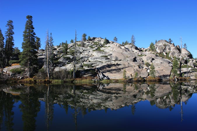
Surrounding these mountains is a hilly plateau, covered mostly by coniferous forest but bearing the blackened scars of volcanism. The Fantastic Lava Beds are the result of molten flows hardening in motion, and the Devastated Area is a swath of forest leveled by the recent eruptions of Lassen Peak. Most of the park remains a thriving montane ecosystem, however, with diverse flora and fauna, flowing rivers, and numerous alpine lakes.
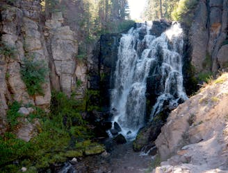
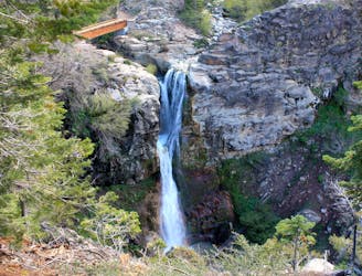
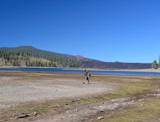
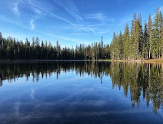
On Lassen’s trails, you can hike through flower-flecked meadows and shady forest to a waterfall, at either Kings Creek Falls or Mill Creek Falls. You can relax on a lakeshore at one of the park’s day-use areas or campgrounds, or hike to more remote lakes like Terrace, Shadow, and Cliff. For greater solitude, you can venture into the backcountry. Much of the park’s terrain is hidden far away from any roads, so a long day hike or backpacking trip can deliver you into true wilderness. Consider an extended outing like Cluster Lakes Loop or Jakey Lake Loop if you want to disappear for a while.
All of these destinations are accessible in summer and fall, when the park’s main road is open. It’s usually closed and snowbound from December through mid or late May. The higher elevations can see as much as 30 feet of accumulation over the winter, and it’s very slow to melt. Some trails may stay snowy well into the summer. The warm and snow-free season in Lassen is quite short, usually just August and early September. Late June through July are best for wildflowers and waterfalls, but during that time, the lakes remain quite cold and mosquitos can be a nuisance, so the late summer window is best for comfortable swimming and camping.
The hikes in this guidebook cover a range of elevation, scenery, and difficulty. They are, of course, not the only adventures in this national park, but they make great places to start. If you visit Lassen any time from late May to November, you’re guaranteed a great hike on one of these trails. Be sure to check current conditions before you go for updates on the trails and road status.
The must-do hike to the summit of the park's namesake mountain.
Difficult Hiking
Ultra-popular hike to a cascading creek and waterfall in a verdant gorge.
Difficult Hiking
Hilly forest trail to the top of a 75-foot waterfall in a deep gorge.
Moderate Hiking
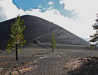
Short but tough hike to the top of a geologically young volcano.
Difficult Hiking
An overnight trip into the most remote reaches of Lassen.
Difficult Hiking
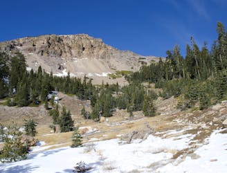
Unrelenting ascent on a good trail, to one of the national park's most dramatic peaks.
Difficult Hiking
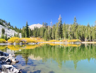
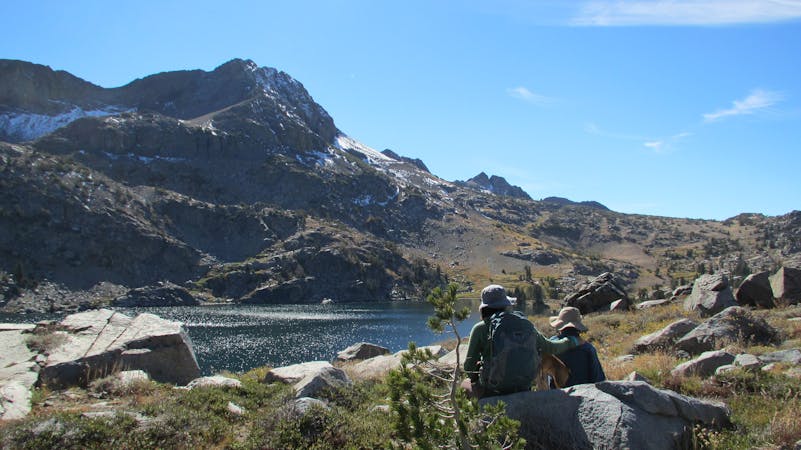
Three exquisite alpine lakes, linked by a path through sunny and colorful woodland.
Moderate Hiking
An extended stroll through Lassen’s backcountry interior, packed with pristine lakes in subalpine forest.
Moderate Hiking
Hike along a portion of the Pacific Crest Trail to find a warm creek, a hot lake, and a steaming vent in a lesser-traveled corner of Lassen.
Moderate Hiking
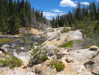
Witness a highly active hydrothermal area in Lassen's peaceful Warner Valley.
Moderate Hiking
Lassen's largest hydrothermal area, full of heated water and vapors spewing from underground.
Moderate Hiking

8 routes · Hiking

12 routes · Hiking
6 routes · Mountain Biking · Hiking
13 routes · Hiking
11 routes · Hiking

17 routes · Hiking
17 routes · Hiking

14 routes · Hiking
4 routes · Hiking
8 routes · Hiking