4.4 km away
Mt. Elwell Loop

Ride your bike over a gnarly mountain peak!
Severe Mountain Biking
- Distance
- 18 km
- Ascent
- 783 m
- Descent
- 783 m
One of the most technical—and most beautiful—trails in the Lost Sierra.
Mountain Biking Extreme

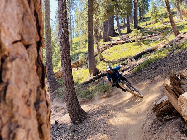
Jamison Creek is regarded by some riders including Kurt Gensheimer as “truly world-class” mountain biking. Hang on to your grips—this trail delivers!
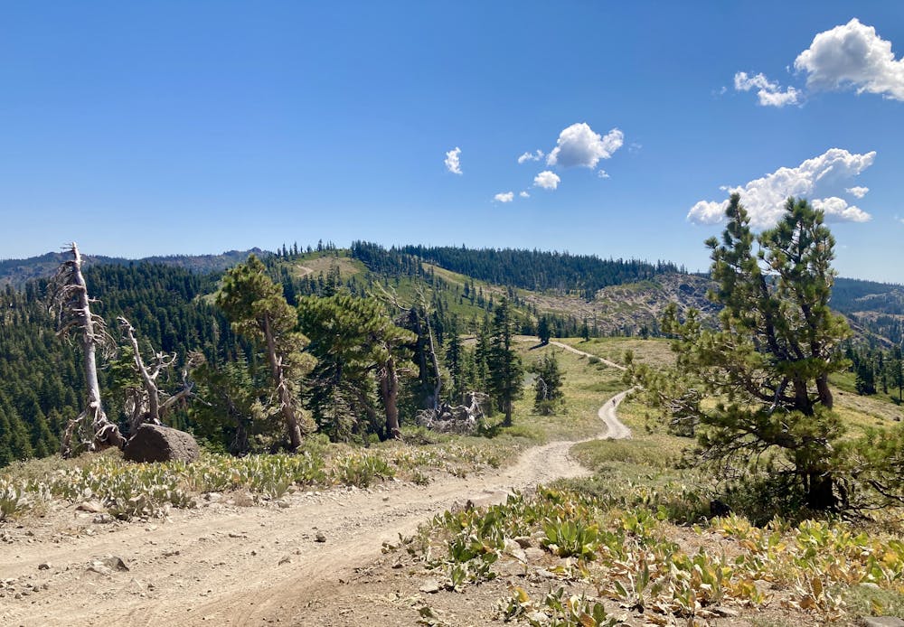

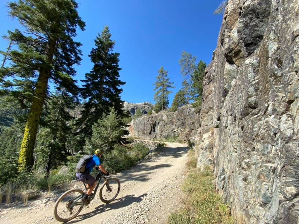
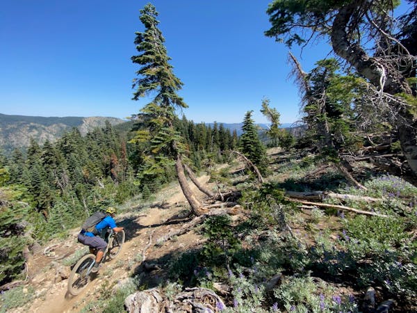
While some riders might consider shuttling Jamison Creek, due to the steep 4x4 road, it’s really only viable as a shuttle with a high clearance vehicle. Instead, I recommend this ride as a loop. Even though the climb is steep in places, even the ascent to the top of the singletrack is a delightful ride. The climbing road ascends through a beautiful, narrow mountain valley, topping out with gorgeous views of the Lakes Basin area from the upper ridge. Then, you drop into Jamison Creek.
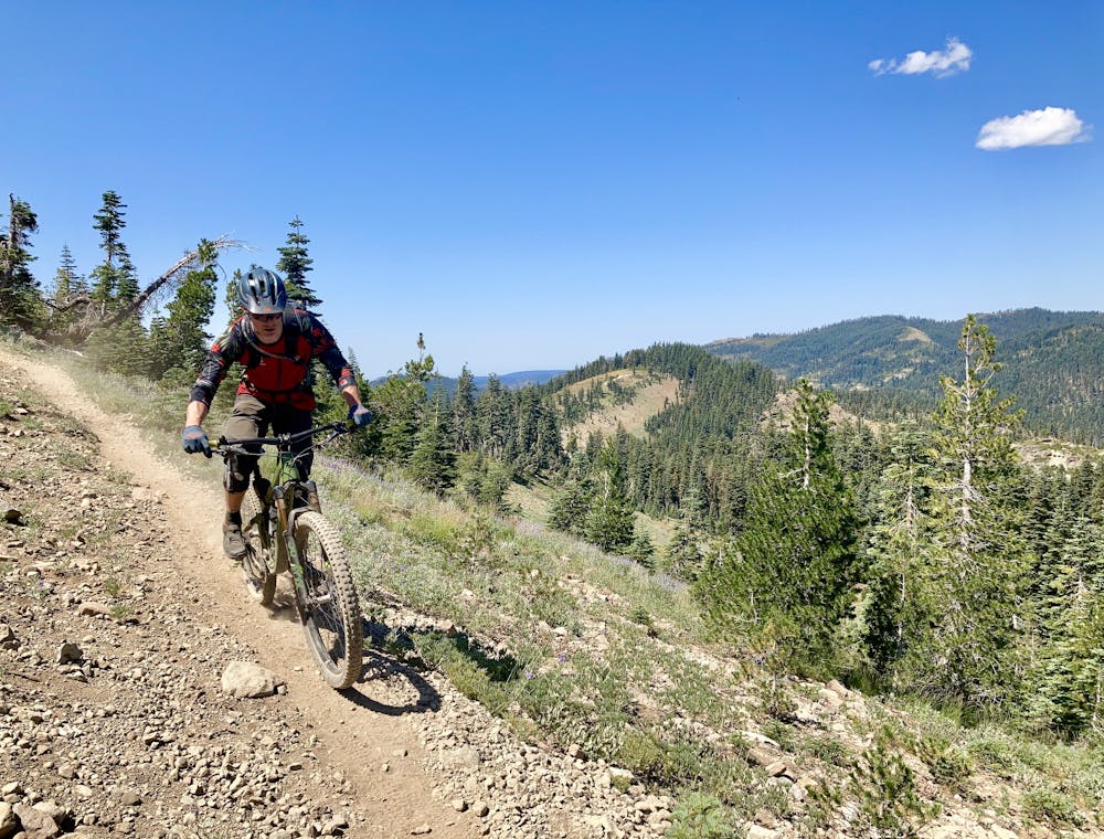
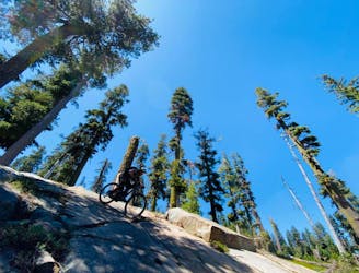
The upper section is fast and wide open with some drops and some beautiful views… and then come the boulders. Jamison creek is bouldery! A local rider labeled Jamison Creek as the most technical mountain bike trail in the Downieville region. So, consider yourself warned: Jamison is no joke.
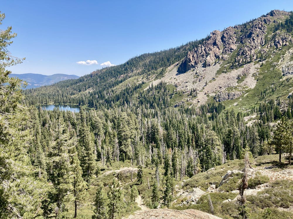
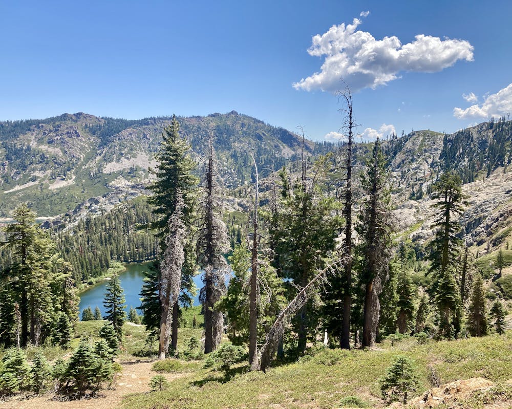
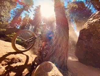
In many places, the trail feels like a dry creek bed. You’ll negotiate some big boulder moves up high, then drop into tight squirrelly sections, finishing with some slightly faster areas down low. Through this middle portion, the trail drops into a stunning, narrow mountain valley with lofty views of pristine mountain lakes hemmed in by vertical rock walls. Finally, lower down, the singletrack drops into lush creek bottoms as it skirts the edge of one of the lakes you spotted up higher.
After the lake, the final section of trail is the most technical. This fall line descent offers up a veritable onslaught of formidable rock boulder steps. Most of the steps are rollable, but one or two have to be dropped. More can be hucked if you’re feeling ambitious. This section is largely responsible for the label as one of the most technical trails in the region, and helps push Jamison Creek over to the “Extreme” FATMAP difficulty rating. If you want to pick nits, perhaps Jamison Creek is on the low end of “Extreme” but any way you slice it, this trail is rough!
Sources: Dirt Rag
Extreme
Very steep, difficult, narrow singletrack with widely variable and unpredictable trail conditions. Unavoidable obstacles could be 15in/38cm tall or greater, and unavoidable obstacles with serious consequences are likely to be present. Obstacles could include big rocks, difficult root sections, drops, jumps, sharp switchbacks, and more. Ideal for expert-level riders.

The trail contains some obstacles such as outcroppings and rock which could cause injury.

Little chance of being seen or helped in case of an accident.
4.4 km away
Ride your bike over a gnarly mountain peak!
Severe Mountain Biking
4.4 km away

Quick shuttle run on the world-class Jamison Creek Trail.
Extreme Mountain Biking
7 km away
Mount Elwell point-to-point shuttle beginning in Lakes Basin.
Severe Mountain Biking
8.4 km away
Epic tech shuttle with gorgeous views.
Severe Mountain Biking
7 routes · Mountain Biking
5 routes · Mountain Biking

20 routes · Mountain Biking