3.1 km away
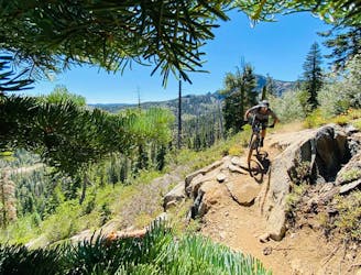
Mills Peak
Epic tech shuttle with gorgeous views.
Severe Mountain Biking
- Distance
- 14 km
- Ascent
- 40 m
- Descent
- 927 m
Mount Elwell point-to-point shuttle beginning in Lakes Basin.
Mountain Biking Severe

While Mt. Elwell is probably best-ridden as a loop, you could also choose to shuttle it, too.
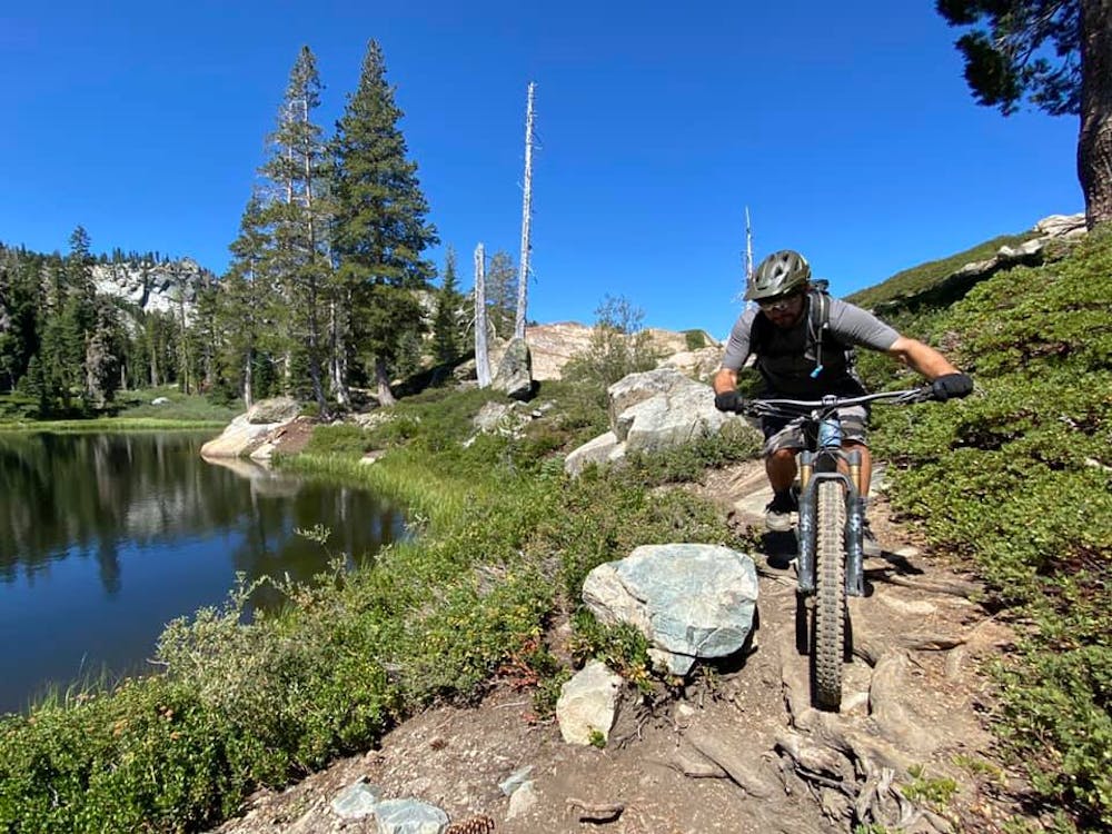
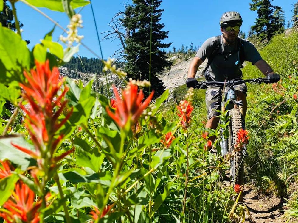
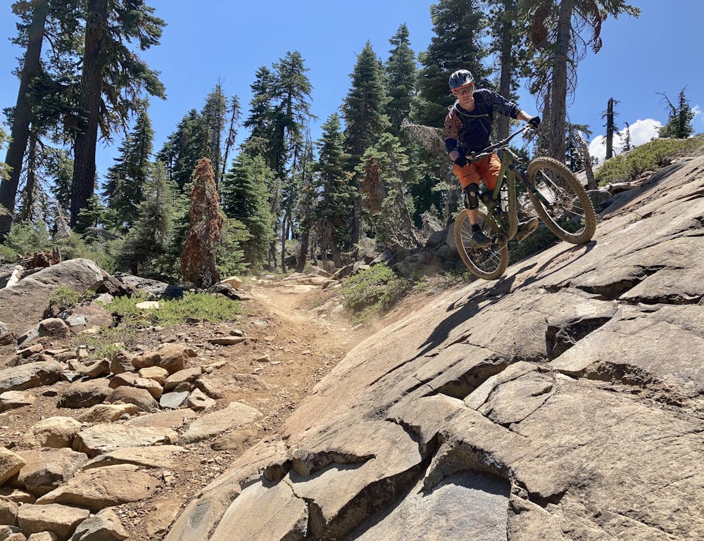
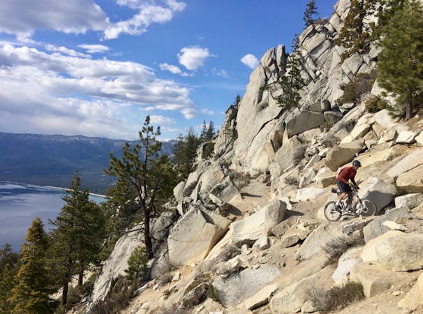
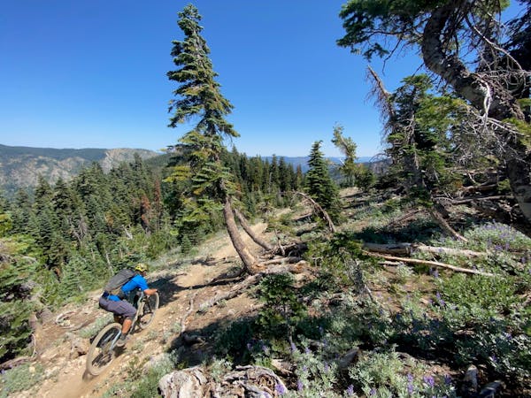
The ride begins in the Lakes Basin area, passing many of the iconic lakes such as Big Bear Lake and Round Lake. The Lakes Basin trails are technical and decidedly not bike-optimized, with challenging boulder moves and rock gardens both up and down the mountain. The technicality is best viewed as a feature and not a bug—the challenging rocks attract riders from across the country looking to test their bike handling mettle.
Even with a shuttle, you’ll still have to schlep your bike up the mountainside. Getting up Elwell is mostly rideable if you are feeling pretty peppy… otherwise, there’s a significant amount of hike-a-bike required to get up the mountain. If you’ve spent any time pushing your bike up mountains in places like Colorado or British Columbia, you won’t find Elwell to be brutally gnarly or overly challenging… it’s just kinda steep. The trail to the top is actually quite well maintained, which could lead to some form of rideability when coupled with good fitness. But if you’ve never pushed your bike to the top of a mountain before… you’re in for a learning experience.
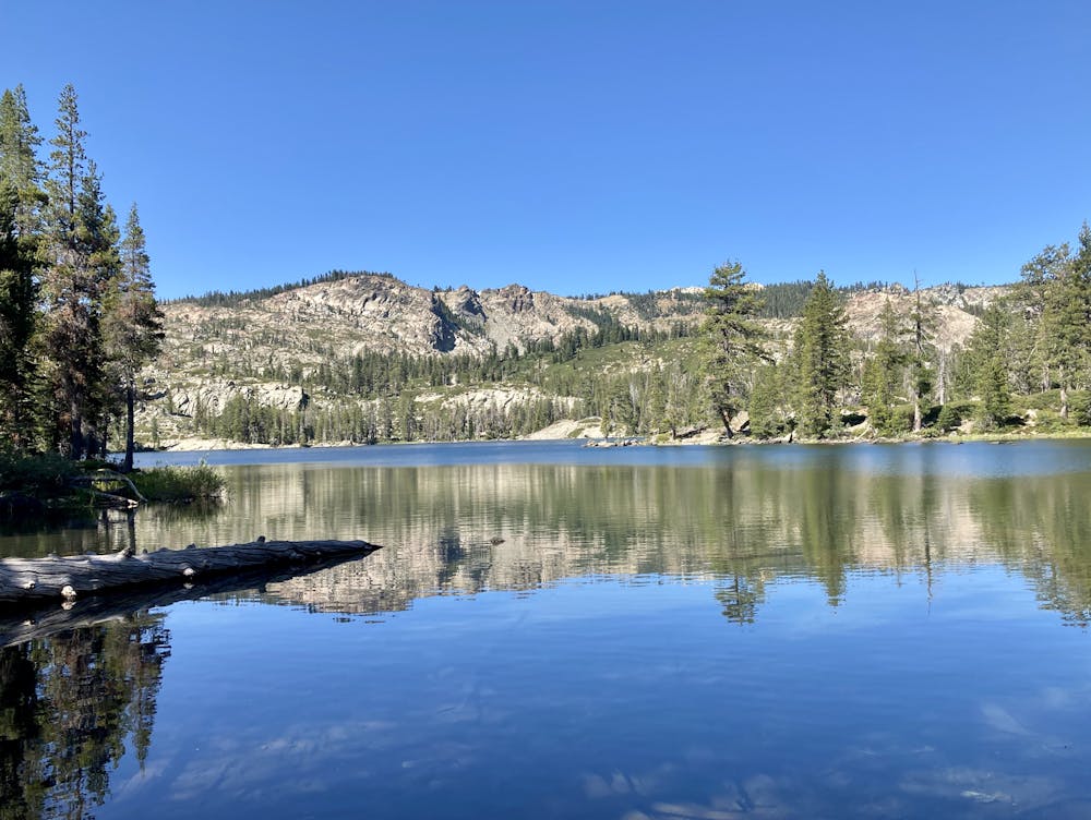
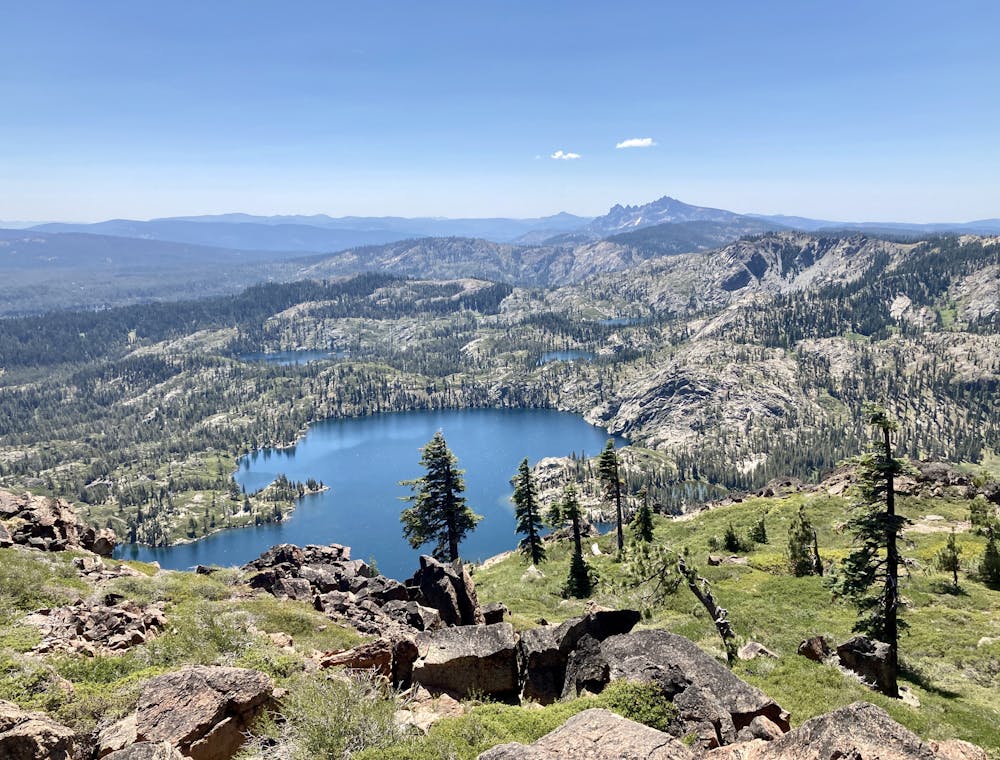
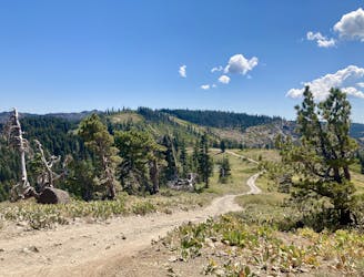
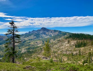
Once on top of the peak, your effort will be rewarded with stupendous views of the Lake Basin and the surrounding Sierras! Be sure to scramble up one of the small rock outcroppings for an even better perspective, and enjoy a snack while you soak in the view.
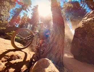
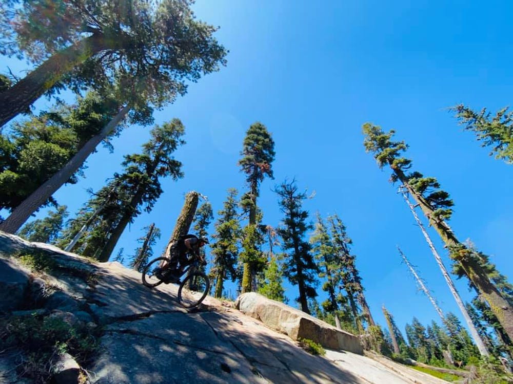
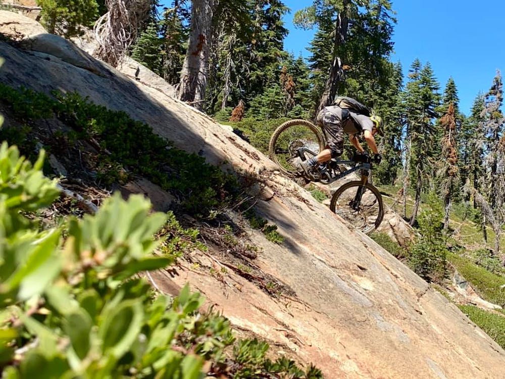
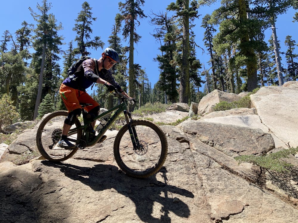
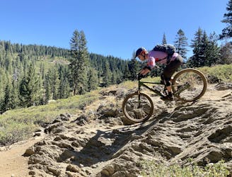
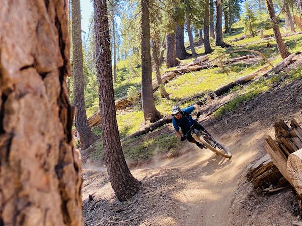
Off the backside of Mount Elwell, the descent is steep, fast, and technical with quite a bit of variety. The trail begins with some tight, challenging rock features and rock gardens up top, but after a couple hundred yards, it opens up and is noticeably less challenging. As you descend, you’ll encounter entertaining slickrock slabs to roll and wallride.
As you continue descending, the trail opens up into some wide-open high-speed straightaways that allow you to absolutely blaze down the mountainside! Keep a keen eye out for hikers as you descend, as trail traffic gets heavier and heavier toward the bottom.
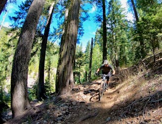
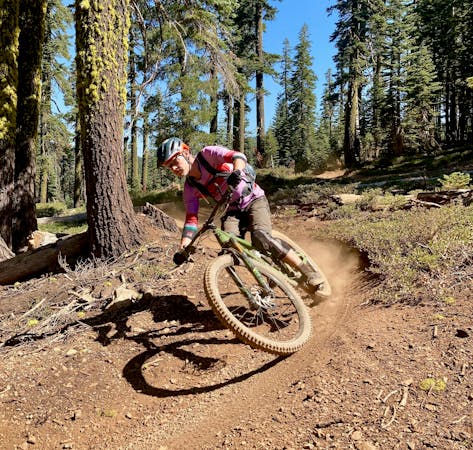
There are a few different ways to connect down to Graeagle—this is just one of the best options. You’ll enjoy a few additional miles of decent singletrack descending, and then after a dirt road connection, you’ll connect to Graeagle’s town trails. These trails are tight, steep, and quirky, but are entertaining and enjoyable with the right mindset.
Before you know it, you’ll be down at the bottom, asking yourself, “how is it over so quickly?"
Severe
Widely variable, narrow trail tread with steeper grades and unavoidable obstacles of 15in/38cm tall or less. Obstacles may include unavoidable bridges 24in/61cm wide or less, large rocks, gravel, difficult root sections, and more. Ideal for advanced-level riders.

The trail contains some obstacles such as outcroppings and rock which could cause injury.

Little chance of being seen or helped in case of an accident.
3.1 km away
Epic tech shuttle with gorgeous views.
Severe Mountain Biking
3.6 km away

Ride your bike over a gnarly mountain peak!
Severe Mountain Biking
7 km away
One of the most technical—and most beautiful—trails in the Lost Sierra.
Extreme Mountain Biking
8 km away

Quick shuttle run on the world-class Jamison Creek Trail.
Extreme Mountain Biking
8.8 km away
A ride combination of lesser-ridden trails to keep you off the beaten path.
Severe Mountain Biking
8.8 km away
A longer, more difficult variant of the Downieville Classic.
Severe Mountain Biking
8.8 km away
An epic shuttle route from Packer Saddle.
Severe Mountain Biking
8.8 km away
A shuttle run of epic proportions, dropping thousands of feet from a mountain top down to a river bottom.
Severe Mountain Biking

25 routes · Mountain Biking

10 routes · Mountain Biking
4 routes · Mountain Biking

10 routes · Mountain Biking
5 routes · Mountain Biking

24 routes · Mountain Biking
7 routes · Mountain Biking
5 routes · Mountain Biking

20 routes · Mountain Biking