3.1 km away
Mt. Elwell Shuttle from Lakes Basin
Mount Elwell point-to-point shuttle beginning in Lakes Basin.
Severe Mountain Biking
- Distance
- 20 km
- Ascent
- 551 m
- Descent
- 1.2 km
Epic tech shuttle with gorgeous views.
Mountain Biking Severe

Mills Peak is one of the newest trails in the Lost Sierra. In total, it’s an eight and a half mile shuttle run with just 130 feet of elevation gain and over 3,000 feet of loss. That’s a climb to descent ratio I can get behind!
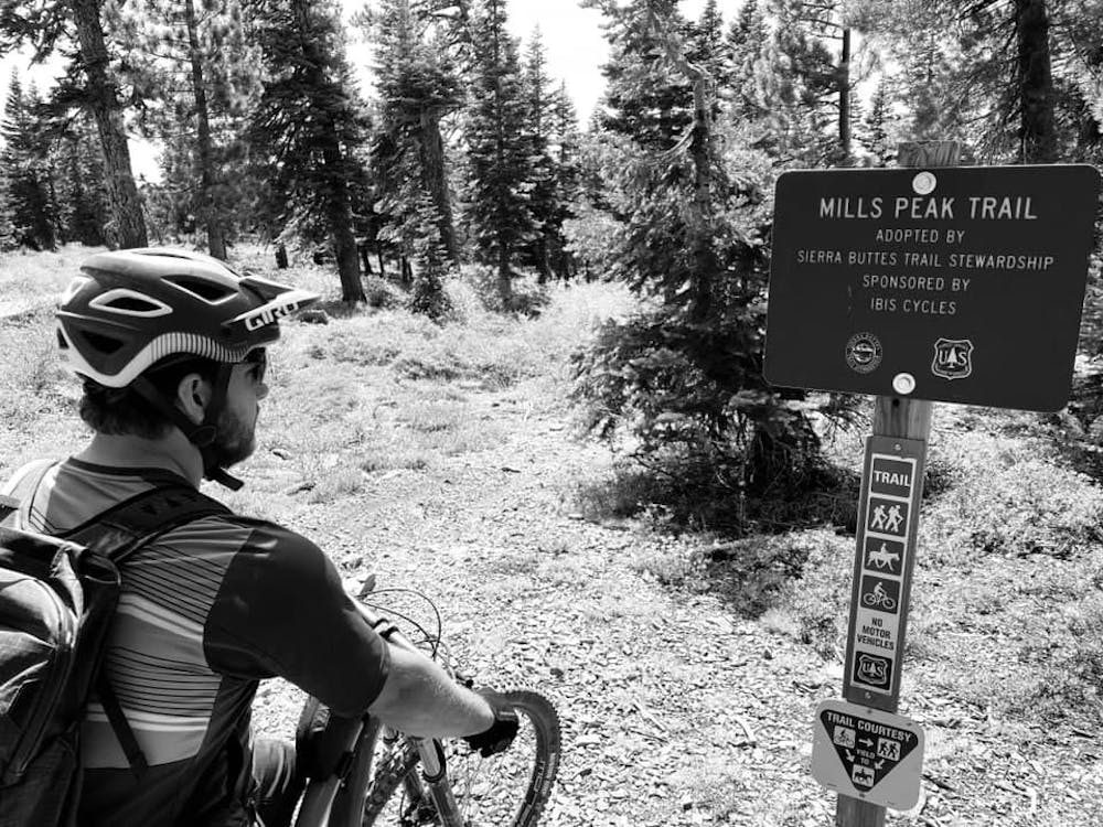
The trail was built by the Sierra Buttes Trail Stewardship over the course of 11 years, and was constructed with mountain bikes in mind. While Mills Peak is bike optimized, it's not a flow trail in any sense of the term. Some corners could actually benefit from the addition of a berm, but the swoop and flow and grade reversals are excellent overall. But more than the flow, the tech riding is the focus on this trail.
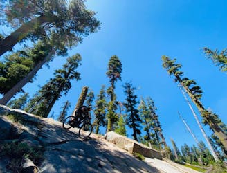
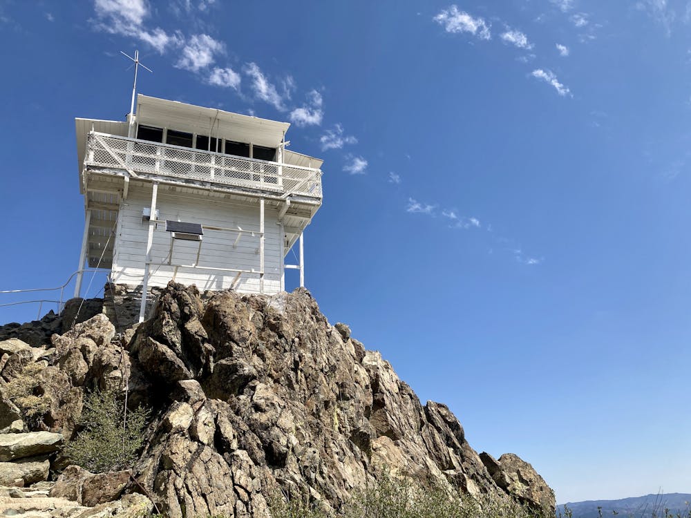
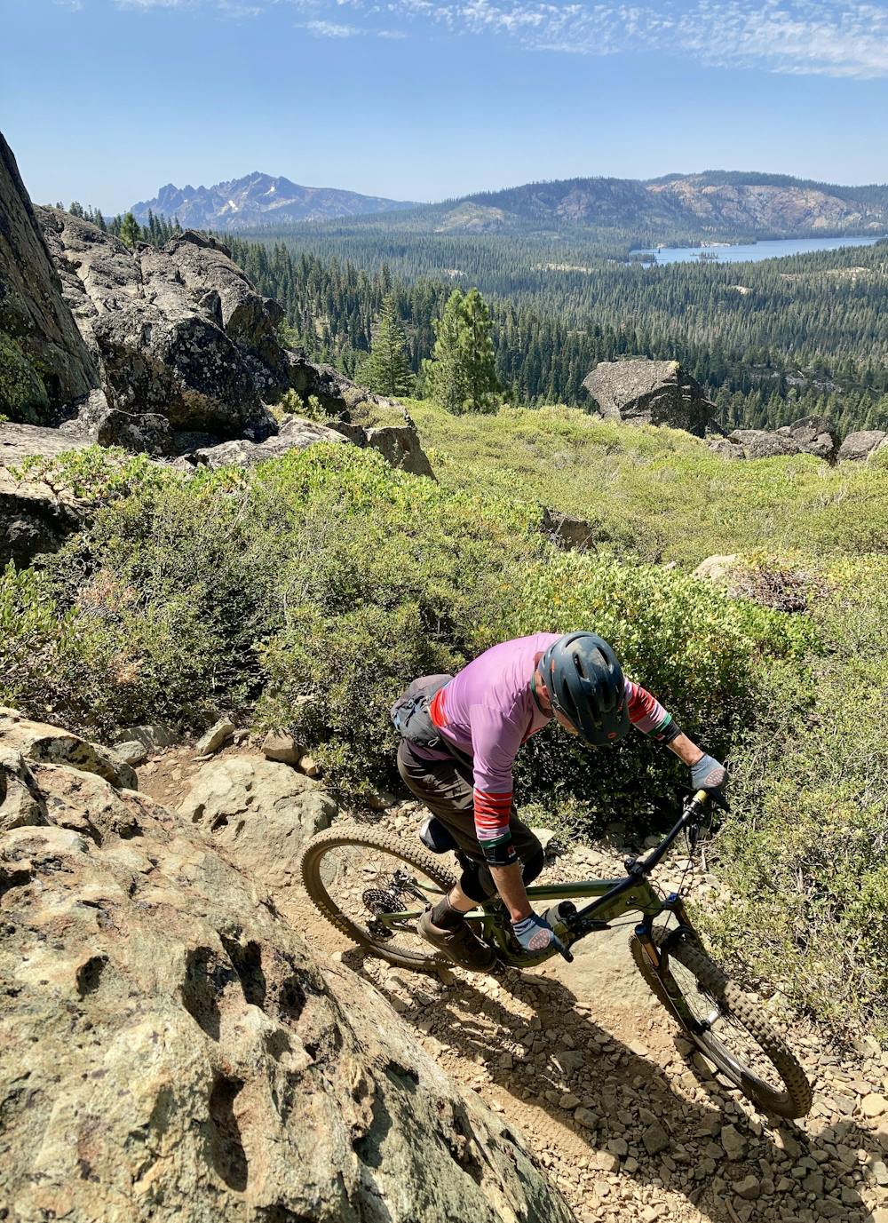
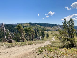
The ride begins from an incredible location—a gorgeous lookout tower on the top of a craggy mountain overlooking Graeagle and the valley below. The ride is almost worth it just for the beautiful view from the top! From the beginning of the singletrack, you begin dropping almost immediately through beautiful, rocky, technical terrain.
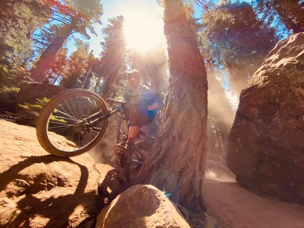
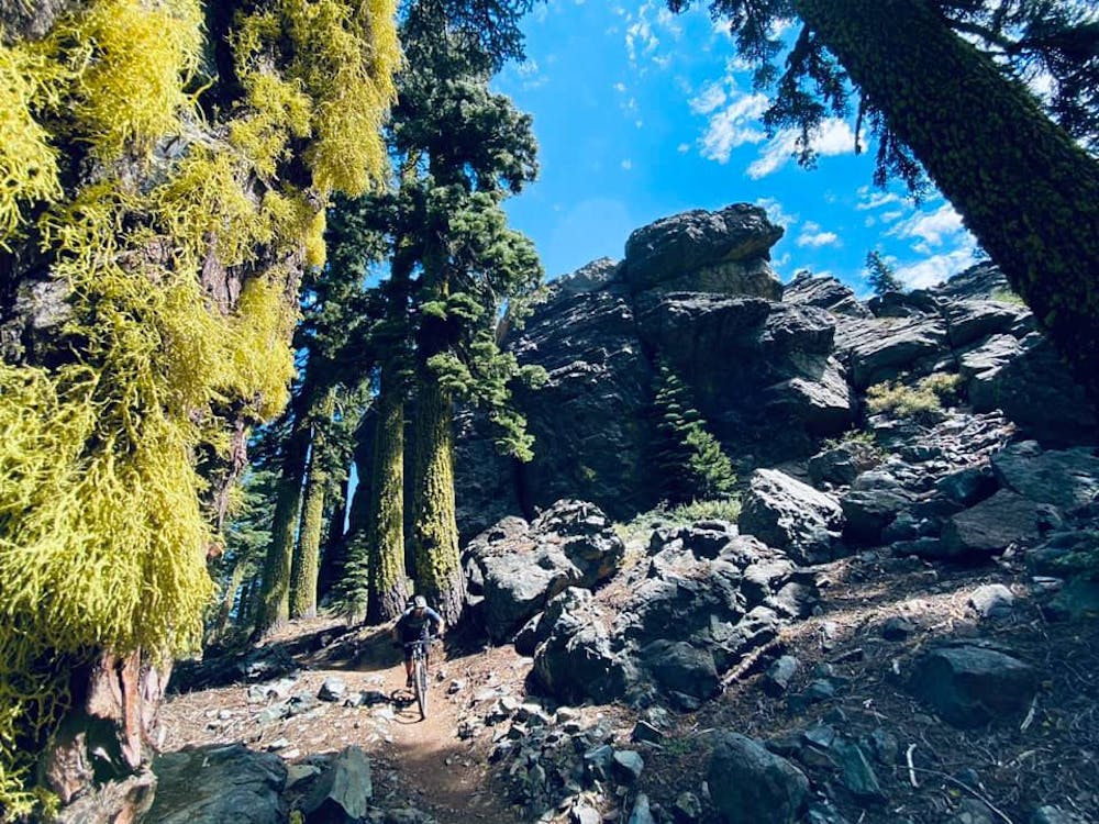
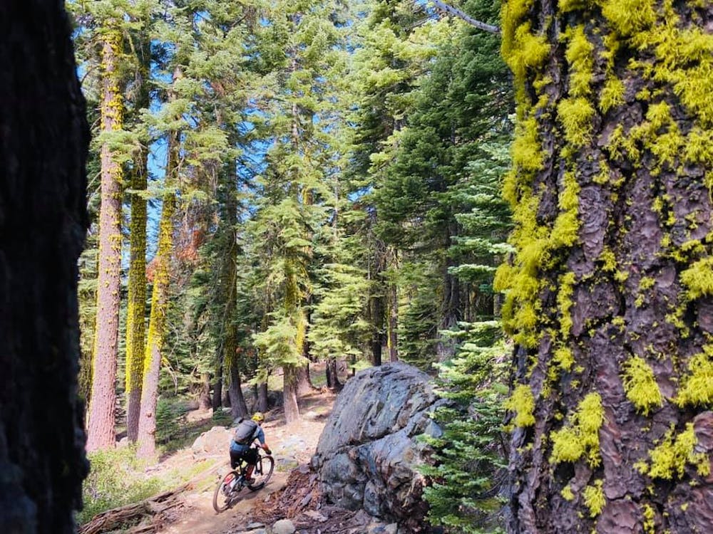
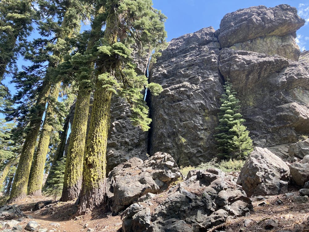
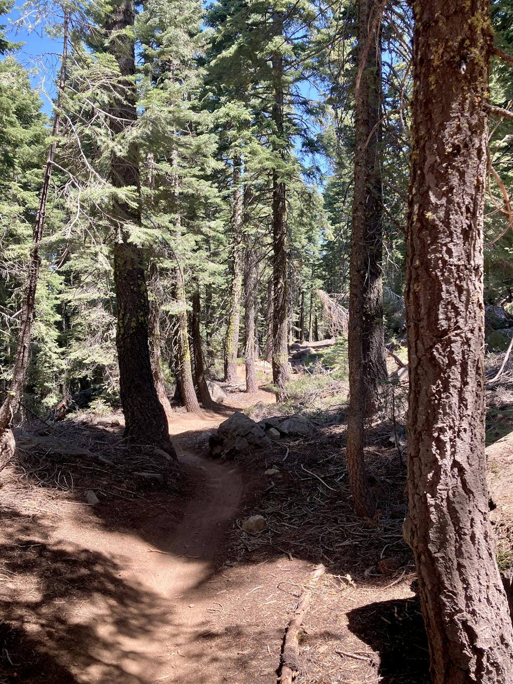
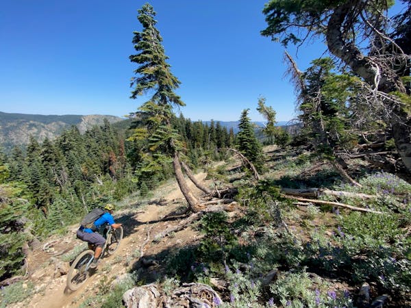
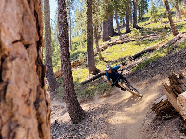
The terrain that they routed this trail through is downright incredible. You’ll roll through beautiful forests with towering pines, some sections of really tight trees, then other sections where the singletrack runs past massive rock cliffs. At some points, you’ll enjoy expansive vistas of the Sierra Buttes and the Lakes Basin. Then it’s back to massive boulder fields and rock gardens, fast, flowy turns, and straight ahead high-speed rock gardens that are guaranteed to numb you to the shoulder. Just when you think you can’t hang on any longer, it’s back into the flow with dark, serpentine singletrack through the forest.
Mills Peak is indeed an extremely varied descent. Despite the stats, parts of it feel a bit too pedally, and there is a short climb or two thrown, but otherwise, it’s a ripping downhill.
The singletrack on this trail rewards the most competent of riders. Skilled bike handlers will be able to make much more speed out of this trail than less experienced riders—straightening out technical lines, pumping turns, airing over tough spots, and throwing in quick pedal strokes will all ratchet up the trail speed substantially.
Sierra Buttes outdid themselves with this epic shuttle run!
Severe
Widely variable, narrow trail tread with steeper grades and unavoidable obstacles of 15in/38cm tall or less. Obstacles may include unavoidable bridges 24in/61cm wide or less, large rocks, gravel, difficult root sections, and more. Ideal for advanced-level riders.

The trail contains some obstacles such as outcroppings and rock which could cause injury.
Away from help but easily accessed.
3.1 km away
Mount Elwell point-to-point shuttle beginning in Lakes Basin.
Severe Mountain Biking
4 km away

Ride your bike over a gnarly mountain peak!
Severe Mountain Biking
8.4 km away
One of the most technical—and most beautiful—trails in the Lost Sierra.
Extreme Mountain Biking
7 routes · Mountain Biking
5 routes · Mountain Biking

20 routes · Mountain Biking