1.8 km away
Over-Hard

Short tree shot down to Mid Vail area.
Moderate Freeride Skiing
- Distance
- 358 m
- Ascent
- 0 m
- Descent
- 88 m
Rarely skied line that doesn't appear on the trail map anymore
Freeride Skiing Difficult

Link to the article about the history of the Mid-Vail Chutes: https://www.vaildaily.com/news/vail-mountain-removes-double-black-diamond-run-the-narrows-from-ski-area/

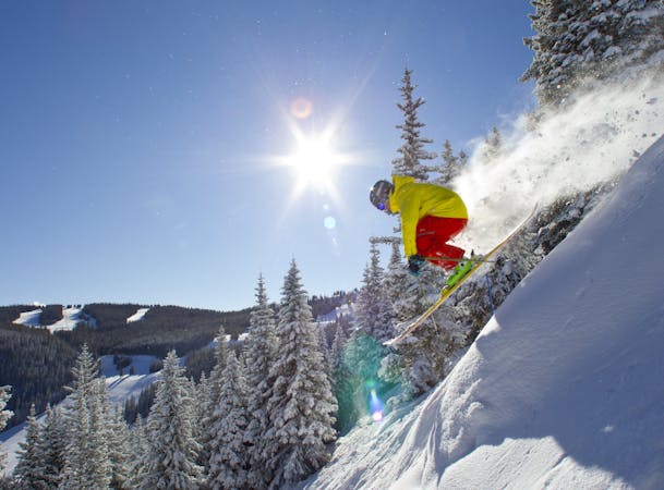
This run appeared on Vail's older trail maps and was a designated single black diamond (therefore being the easiest of the Mid-Vail Chutes) but was eventually taken off the map. Some of the other chutes in this area (including Been There, Done That, and the Narrows) eventually became officially permanently closed zones. This zone remains open but the official run "Bird Baths" has been removed from the trail map. That being said, because it's not advertised on the official trail map anymore, Bird Baths seldom skied. This run is skied even less frequently than Mudslide and Frontside Chutes (some of the most seldom skied runs on the trail map). Still, this is a cool area to check out if you're hesitant to try Mudslide and Frontside Chutes. Difficulty-wise, the pitch is extremely moderate (similar to an entry-level black) but the trees are extremely tight. In addition, because it's extremely low in elevation, the chances of having good snow here is incredibly rare. But on those really good days, this zone will be mostly untouched. Sadly, the closest most people will get to skiing this run will be skiing right by it on Gitalong Road.
Difficult
Serious gradient of 30-38 degrees where a real risk of slipping exists.

As well as the slope itself, there are some obstacles (such as rock outcrops) which could aggravate injury.

Close to help in case of emergency.
1.8 km away
Short tree shot down to Mid Vail area.
Moderate Freeride Skiing
1.8 km away

Short tree run in the Avanti area.
Moderate Freeride Skiing
2 km away

Short tree shot down to Mid Vail area.
Moderate Freeride Skiing
2.2 km away

Great gladed powder run down Mountain Mop.
Moderate Freeride Skiing
2.9 km away

Long gully, epic on powder days.
Moderate Freeride Skiing
3.1 km away

Huge treeline with plenty of options.
Moderate Freeride Skiing
3.2 km away

Long run that can be great on powder days. 1
Moderate Freeride Skiing
3.3 km away

One of the most famous off-piste routes at the resort.
Moderate Freeride Skiing
3.5 km away

Wow Widge
Moderate Freeride Skiing
3.7 km away

Solid treeline that holds snow for weeks after a storm.
Moderate Freeride Skiing

10 routes · Freeride Skiing
16 routes · Freeride Skiing
3 routes · Freeride Skiing · Resort Ski Touring