235 m away
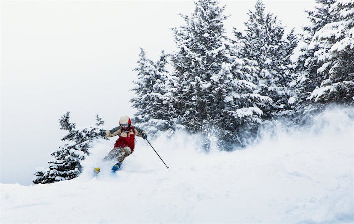
Mid-Vail Trees

Short tree shot down to Mid Vail area.
Moderate Freeride Skiing
- Distance
- 477 m
- Ascent
- 0 m
- Descent
- 126 m
Short tree shot down to Mid Vail area.
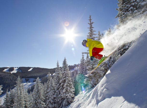
Freeride Skiing Moderate

This is a popular freeride skiing route which is generally considered to be moderate. It's not remote, it features unknown exposure and is typically done in an unknown time of year. From a low point of 3.1 km to the maximum altitude of 3.2 km, the route covers 358 m, 0 vertical metres of ascent and 88 vertical metres of descent.
Short tree shot down to Mid Vail area. There are a number of ways to enter this area, but the easiest way is to look for Over Easy and duck into the trees. This run often gets moguled out at times, as its a very easy tree area to find and ski.
Moderate
Slopes become slightly steeper at around 25-30 degrees.

Close to help in case of emergency.
235 m away
Short tree shot down to Mid Vail area.
Moderate Freeride Skiing
319 m away

Short tree run in the Avanti area.
Moderate Freeride Skiing
1.3 km away

Great gladed powder run down Mountain Mop.
Moderate Freeride Skiing
1.6 km away

One of the most famous off-piste routes at the resort.
Moderate Freeride Skiing
1.7 km away

Huge treeline with plenty of options.
Moderate Freeride Skiing
1.8 km away

Long run that can be great on powder days. 1
Moderate Freeride Skiing
1.9 km away

Wow Widge
Moderate Freeride Skiing
2.4 km away

Epic tree skiing in Sun Down Bowl
Moderate Freeride Skiing
2.6 km away

Solid treeline that holds snow for weeks after a storm.
Moderate Freeride Skiing
2.7 km away

Long gully, epic on powder days.
Moderate Freeride Skiing

10 routes · Freeride Skiing
16 routes · Freeride Skiing
3 routes · Freeride Skiing · Resort Ski Touring