876 m away
Union Meadows GREEN

Far traverse out to the Green line with a short steep couple turns where most don't make it.
Moderate Freeride Skiing
- Distance
- 882 m
- Ascent
- 1 m
- Descent
- 128 m
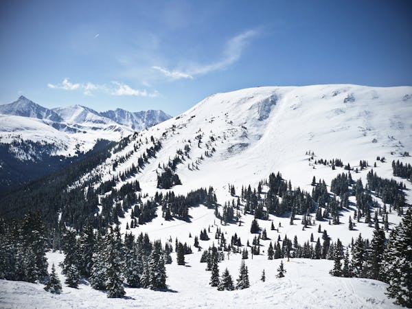
Formidable Cliffs at the bottom section of the Jacque Peak Backcountry Zone
Freeride Skiing Extreme

This is a popular freeride skiing route which is generally considered to be extreme. It's very remote, it features high exposure (e3) and is typically done between January and March. From a low point of 3.4 km to the maximum altitude of 3.5 km, the route covers 500 m, 14 vertical metres of ascent and 78 vertical metres of descent.
This is a scary, but short line you can ski at the bottom of the Jacque Peak zone. It takes a bit of an additional hike to reach but if you want to test out your steep skiing skills on a relatively short run with a crazy pitch, this is the place to do it!
Extreme
Extreme skiing terrain above 45 degrees. These routes are reserved for experienced experts.

In case of a fall, death is highly likely.
Little chance of being seen or helped in case of an accident.
876 m away
Far traverse out to the Green line with a short steep couple turns where most don't make it.
Moderate Freeride Skiing
1.1 km away

Rarely skied gladed trees.
Moderate Freeride Skiing
1.3 km away

Ski into the steepest pitch for a few turns off West Ridge.
Severe Freeride Skiing
1.3 km away

Hidden tree glades with natural wind features.
Moderate Freeride Skiing
1.3 km away

Rarely skied gladed trees in Union Meadows.
Moderate Freeride Skiing
1.3 km away

Quick access to banked tree runs with natural features
Moderate Freeride Skiing
2 km away

The Hollywood Line just above the American Flyer Lift
Difficult Freeride Skiing
2.3 km away

A steep open face to trees, and one of the most aesthetic lines at Copper Mountain.
Difficult Freeride Skiing
7.5 km away

Short Bowl descent off the Southside of Peak 6
Difficult Freeride Skiing
7.6 km away

Steep line with zero shaped rock garden in it
Extreme Freeride Skiing
3 routes · Freeride Skiing