18 m away
Haviland Lake: Wagon - Aspen Loop
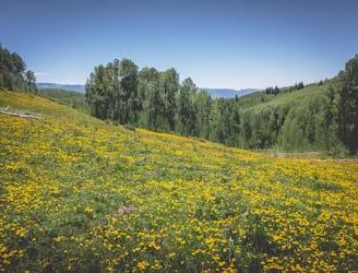
Connect a series of beautiful trails together at Haviland Lake for a fantastic four-mile loop.
Moderate Hiking
- Distance
- 6.7 km
- Ascent
- 156 m
- Descent
- 156 m
This mellow hike to Forebay Lake is a sleeper hit, located just outside of Durango.
Hiking Easy

The hike begins from the trailhead parking lot just outside of the Haviland Lake Campground. Instead of following the singletrack trails into the main Haviland Lake trail system, walk around the gate and follow the gated dirt road to the east.
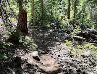
This route follows a mix of rough, abandoned dirt roads and narrow singletrack trails, as well as sections of old road that have narrowed down to singletrack. With less than 500 feet of climbing over this 3.5-mile round-trip hike, it's also potentially one of the flattest lake hikes you'll find in the region! Consequently, the walking is pretty easy the entire time. Yes, there are some boulders in the roadbed, but all of the obstacles are easy to overcome.
There are several unmarked turns out here in the woods, so be sure to download this route for offline navigation.
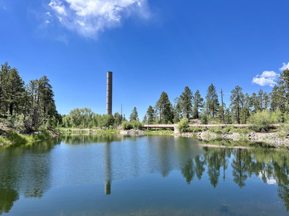
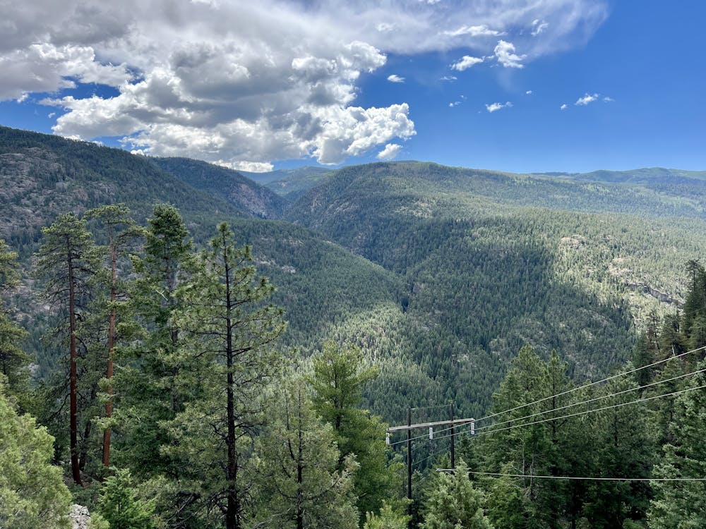
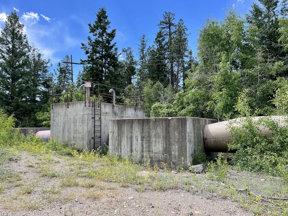
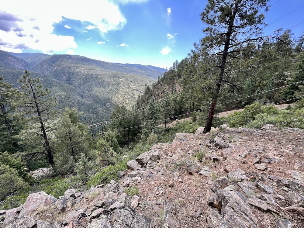
The route shown here visits Forebay Lake, but it ends at an overlook from an old pipeline that drops dramatically into the canyon below. From here, you can enjoy a scenic view of the mountains on the other side of the canyon. With both the old pipeline and the old smokestack visible across Forebay Lake, this hike is a unique mash-up of nature and local history.
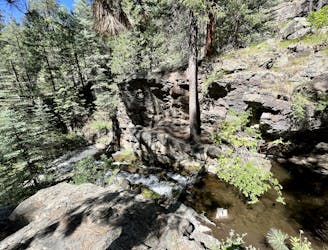
One word of warning: all of the low-lying swampy areas around this hike make it a haven for mosquitoes. Wear your bug spray!
Easy
Walking along a well-kept trail that’s mostly flat. No obstacles are present.

The path is on completely flat land and potential injury is limited to falling over.

Away from help but easily accessed.
18 m away
Connect a series of beautiful trails together at Haviland Lake for a fantastic four-mile loop.
Moderate Hiking
18 m away
Circumnavigate the small but scenic Haviland Lake Trail System.
Difficult Hiking
18 m away
A beautiful loop visiting the Miners Trace Waterfall.
Moderate Hiking
2.7 km away
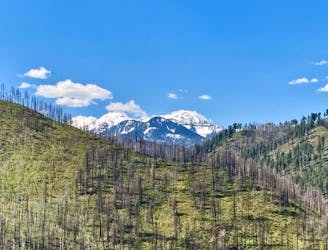
A beautiful fall hike with stunning views from the top of the ridge.
Difficult Hiking
6.8 km away
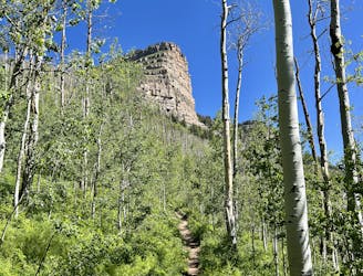
An approachable hike leads to a stunning view point from the top of Castle Rock.
Difficult Hiking
9.8 km away
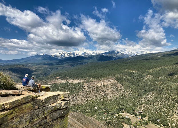
Traverse a stunning, isolated mountain valley.
Moderate Hiking
10 routes · Alpine Climbing · Hiking