4.4 km away
Purgatory Creek Trail Out-and-Back
A scenic hike at any time of the year!
Difficult Hiking
- Distance
- 13 km
- Ascent
- 447 m
- Descent
- 447 m
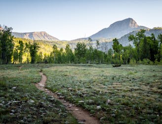
An approachable hike leads to a stunning view point from the top of Castle Rock.
Hiking Difficult

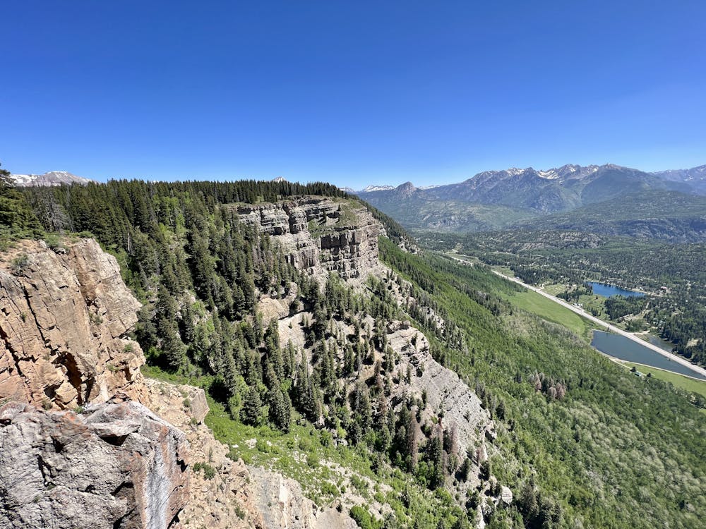
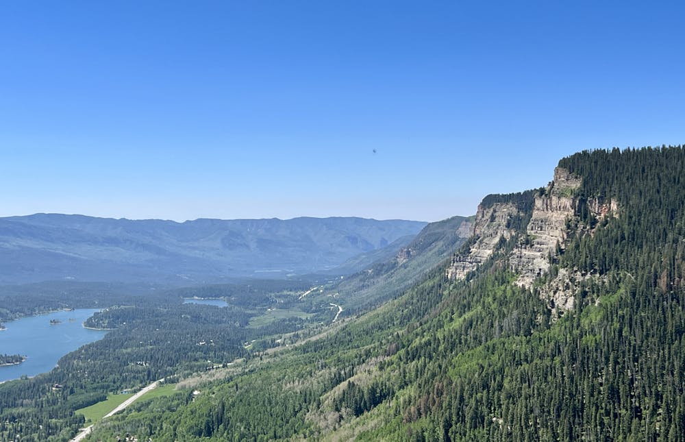
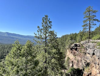
Rising to a modest height of 10,441 feet, Castle Rock is a high point along a ragged cliff band known as the "Hermosa Cliffs," which tower above Highway 550 north of Silverton. The ragged line of cliffs is beautiful from below, and for hikers who ascend to the top of the ridge, it yields even more stunning views from the top.
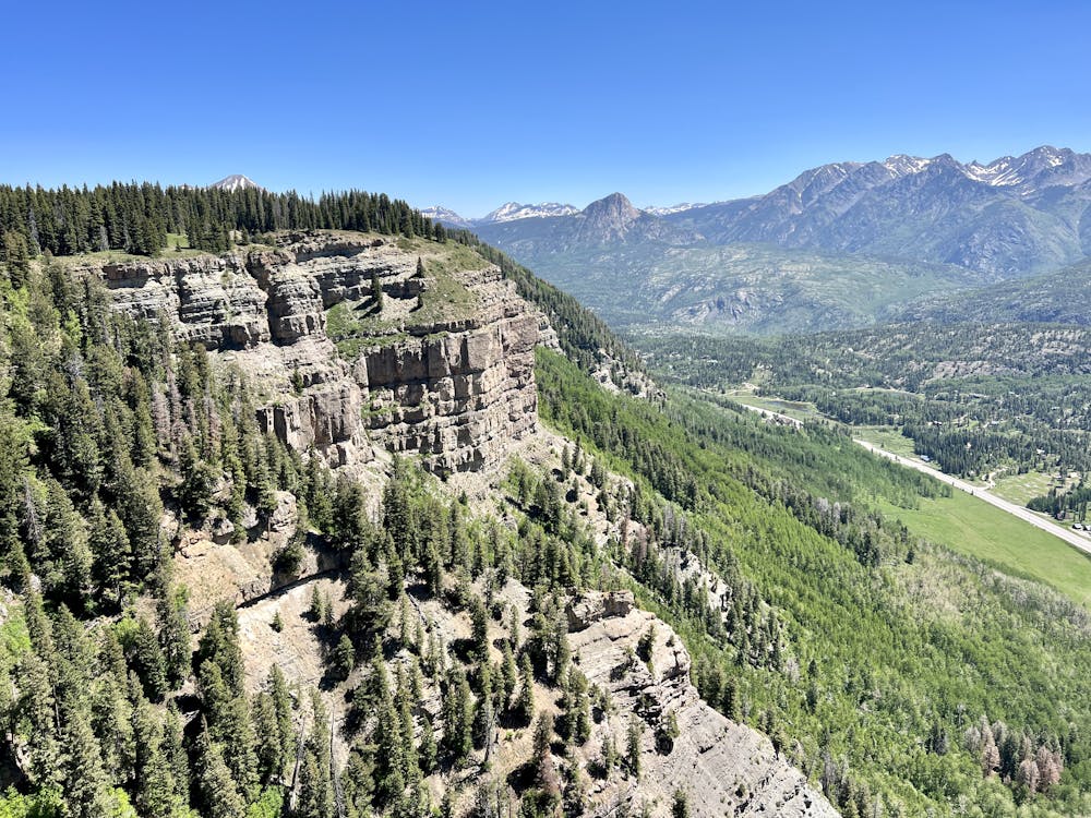
The hike's stats are pretty achievable in the world of peak climbing: just 5.5 miles round-trip with 1,745 feet of elevation gain. As a result, the effort-to-view ratio found on this climb is superb, making it a popular outing.
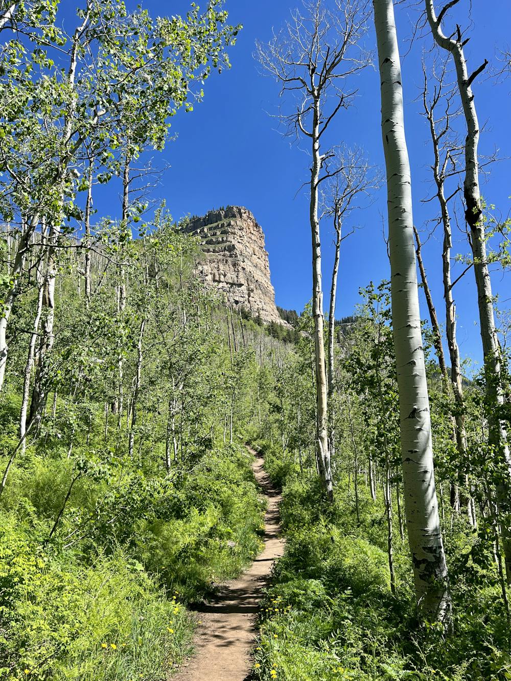
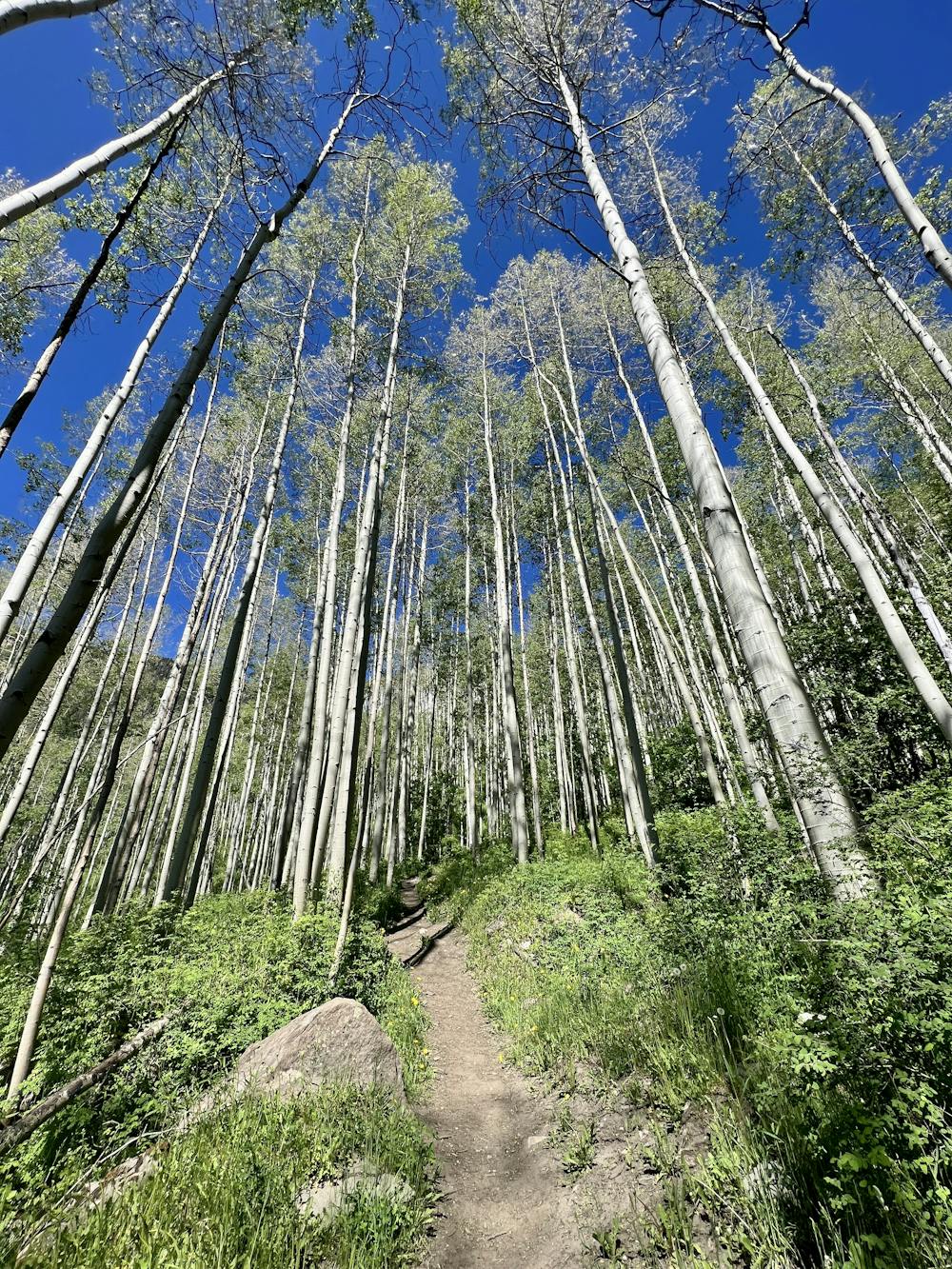
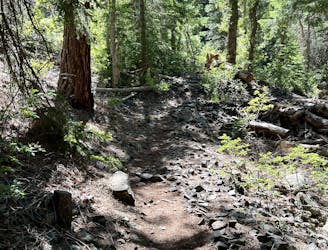
The climb begins from a trailhead directly off the highway, heading up through a towering grove of aspen trees. The trail soon begins to ascend the mountainside, switching back and forth to gain elevation. As you climb, you'll catch glimpses of Castle Rock towering high above you, beckoning you onward in pursuit of your eventual goal.
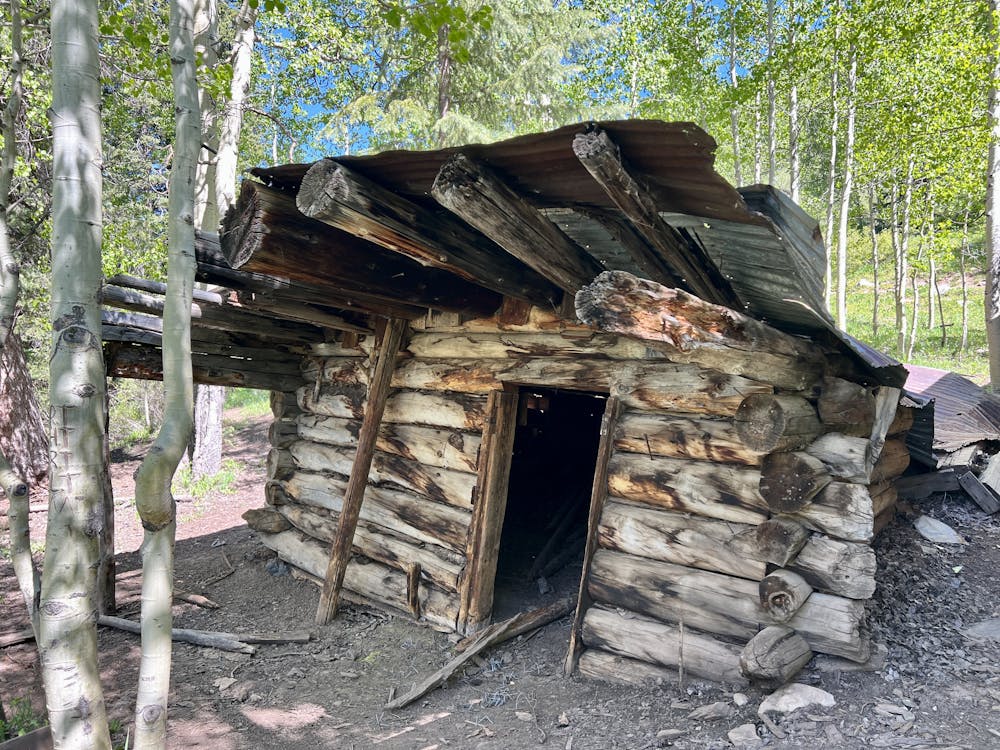
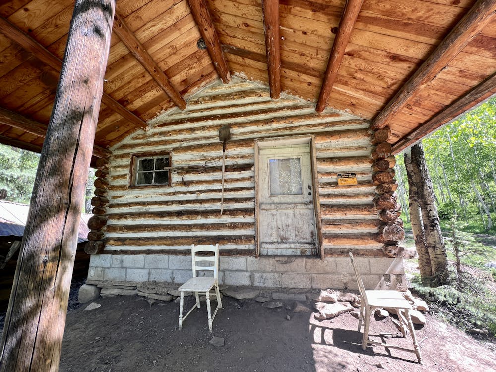
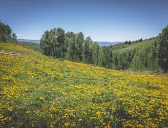
After some steep climbing on the front of the face, the trail mellows out a bit as it climbs to a beautiful meadow. On the edge of the meadow are two historic cabins which aren't open to public access but still provide an intriguing spot to stop, take a breather, and poke around.
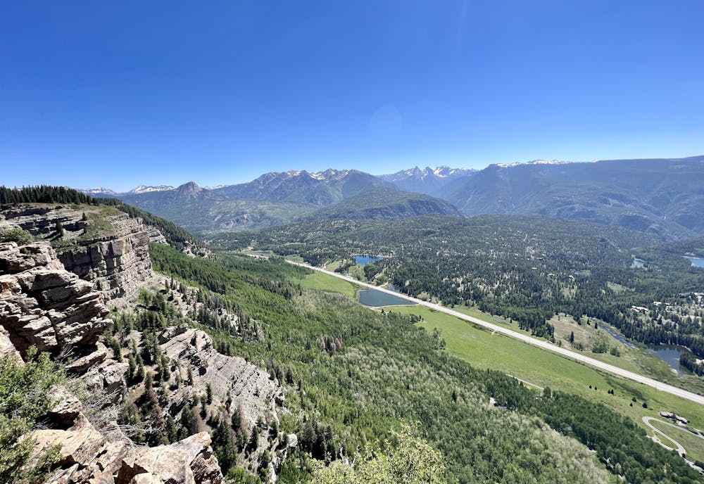
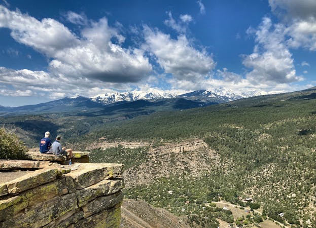
After passing through the meadow, the hike takes a right turn onto an unsigned but heavily-traveled trail toward the top of Castle Rock. From here, the climbing gets dramatically steeper, with a few steep pitches and some loose, sliding dirt. After hiking through some dark timber stands, you'll soon reach the top of the cliff band and enjoy a spectacular view of the valley spread out below you.
You'll notice that the trail continues beyond the outcropping that is Castle Rock. While you can opt to continue along the trail, sources report that it runs for quite a long ways. Trying to create a loop would result in a dramatically longer adventure.
While the hike is a bit steep and loose in places, overall, Castle Rock is a very achievable climb. As such, it attracts many hikers looking to enjoy the views from the top of the mountain. While you'll have to share the trail with some other people, the hike is well worth the effort!
Difficult
Hiking trails where obstacles such as rocks or roots are prevalent. Some obstacles can require care to step over or around. At times, the trail can be worn and eroded. The grade of the trail is generally quite steep, and can often lead to strenuous hiking.

Some trail sections have exposed ledges or steep ascents/descents where falling could cause serious injury.

Away from help but easily accessed.
4.4 km away
A scenic hike at any time of the year!
Difficult Hiking
4.4 km away

An alternative approach to the Needleton trailhead.
Difficult Hiking
6.8 km away
Circumnavigate the small but scenic Haviland Lake Trail System.
Difficult Hiking
6.8 km away
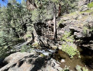
A beautiful loop visiting the Miners Trace Waterfall.
Moderate Hiking
6.8 km away
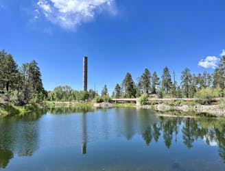
This mellow hike to Forebay Lake is a sleeper hit, located just outside of Durango.
Easy Hiking
6.8 km away
Connect a series of beautiful trails together at Haviland Lake for a fantastic four-mile loop.
Moderate Hiking
8.1 km away
A quick hike offering up stunning views.
Moderate Hiking
9 km away
A beautiful fall hike with stunning views from the top of the ridge.
Difficult Hiking
10 routes · Alpine Climbing · Hiking