125 m away
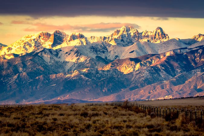
Humboldt Peak
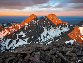
One of the least technical peaks in the Sangres.
Severe Hiking
- Distance
- 20 km
- Ascent
- 1.3 km
- Descent
- 1.3 km
From South Colony Lakes TH. 4,200'/11mi from Upper TH, 5,350'/16.50mi from Lower TH
Hiking Difficult

Imported from 14ers.com. Pictures and route available offline via the 14ers app.
Trailhead:
Take Colorado 69 south from Westcliffe. Drive 4.5 miles and turn right on Colfax Lane. Drive 5.5 miles to the end of Colfax. Turn right and drive 1 mile on a dirt road to a junction. Continue straight up the 120 Road for 0.3 mile to the Lower 2WD Trailhead at 8,800'. To reach the Upper 4WD Trailhead, continue 2.7 miles to parking/camp spots before the first river crossing, near 9,950'. In 2009, the South Colony Lakes road was permanently closed here (gate) and this is the current trailhead. The trail starts next to the trailhead kiosk, in the parking area.
Route:
From the gate closure at 9,950', cross the foot bridge ( 1) and walk 2.5 miles up the old South Colony Lakes (Approach) road to reach a junction - 2. Turn right, leave the road and continue west through the forest - 3 and 4. After 0.6 mile on the trail, cross a rocky area - 5. Near 11,600', the trail passes some camping spots off to the left - 6. After nearly a mile on this trail, exit the trees and continue through willows to the north of the creek and Lower South Colony Lake - 7.
Taken from Crestone Needle, 8 is a look at the remaining route. Follow the trail northwest up the hillside and locate a trail junction above the upper lake - 9. Turn right and continue toward a slope below the west ridge - 10. 11 is another broad look at the route from Crestone Needle. Switchback north toward the saddle between Unnamed Point 13,290' and Humboldt. After about 700 feet of gain, reach the 12,850-foot saddle - 12 and 13.
From the saddle, Humboldt's west ridge is to the east - 14. Walk up the ridge a bit to reach some small rock outcroppings - 15. Follow the trail along or slightly left of the ridge crest. Above 13,700', there are some areas where it's easy to lose this trail so stay near the ridge ( 16) and look for small cairns and trail segments. Keep hiking until you reach a bit more difficult terrain below a false summit. This is the crux of the route. Climb around the right side of this area ( 17) and hop up through the rocks to reach the west end of the summit ridge. Once on the false summit (and you don't have to go to the top of it), the summit is visible across a flat grassy area - 18. Walk 0.25 mile east and climb 20 feet of easy rock ( 19) to the summit - 20 and 21.
Notes:
Humboldt is much easier than climbing the other 14ers in the area (Crestone Needle, Crestone Peak, Kit Carson Peak and Challenger Point) but it's not a Class 1 walk-up. IMPORTANT: This route enters the Sangre De Cristo Wilderness area. Wilderness areas have special regulations and restrictions for party size, dispersed camping, campfires, etc. Also, dog owners should read the wilderness information carefully because some wilderness areas prohibit dogs to be off-leash and/or limit how close dogs can be to lakes and streams. If you have questions about the wilderness area, please contact a U.S. Forest Service office for the National Forest(s) listed above.
Difficult
Hiking trails where obstacles such as rocks or roots are prevalent. Some obstacles can require care to step over or around. At times, the trail can be worn and eroded. The grade of the trail is generally quite steep, and can often lead to strenuous hiking.

The trail contains some obstacles such as outcroppings and rock which could cause injury.
Away from help but easily accessed.
125 m away
One of the least technical peaks in the Sangres.
Severe Hiking
6 km away
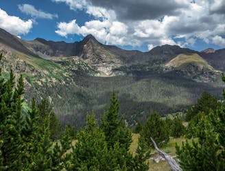
Two seldom-seen alpine lakes, high in the Sangre de Cristo Wilderness.
Difficult Hiking
6 km away
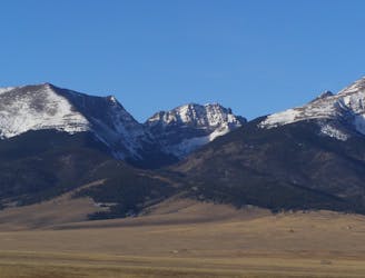
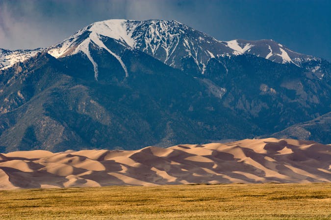
Alpine hike to a Sangre de Cristo 13er, within Great Sand Dunes National Park and Preserve.
Extreme Hiking
10 routes · Alpine Climbing · Hiking

46 routes · Alpine Climbing · Hiking
7 routes · Alpine Climbing · Hiking