4.2 km away
Medano Lake
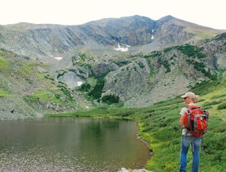
Hike from the Medano Pass 4WD road to a secluded lake in an alpine cirque.
Moderate Hiking
- Distance
- 10 km
- Ascent
- 597 m
- Descent
- 597 m
Alpine hike to a 13er summit, with an absolutely epic view over the Great Sand Dunes.
Hiking Extreme

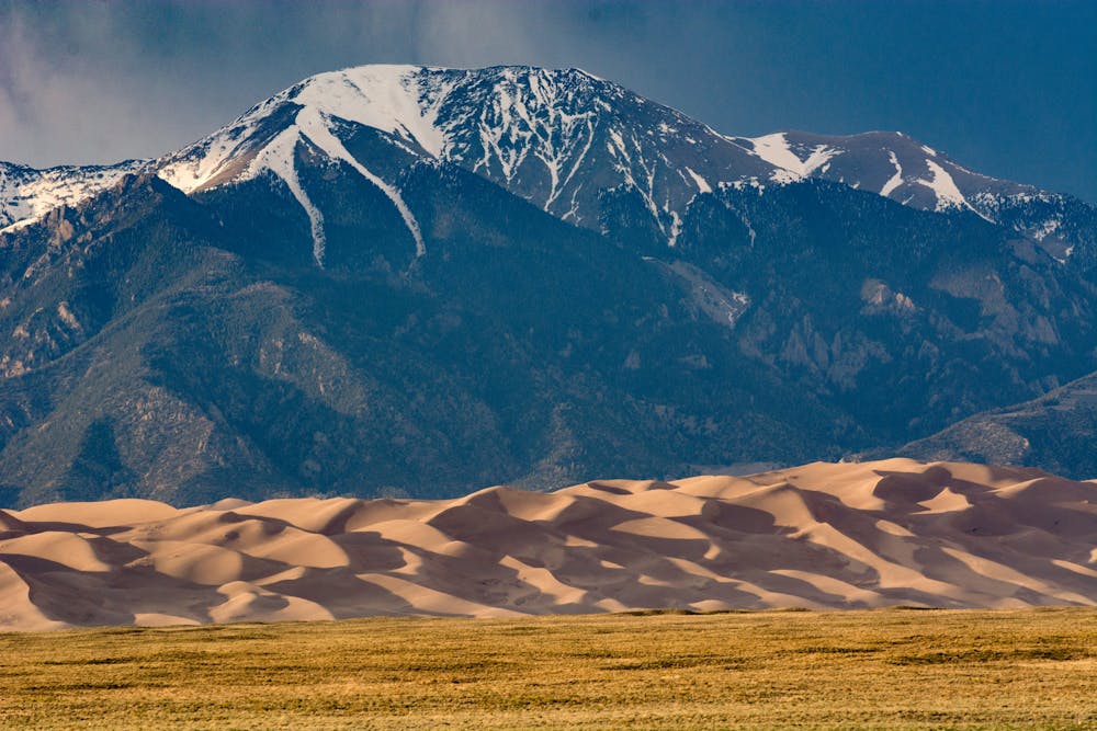
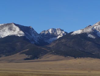
Mount Herard (13,297 feet) is the summit that stands sentinel over the Great Sand Dunes. Thousands of visitors admire its snowy slopes from far below, but few ever think to venture there. Reaching the summit is, in fact, quite the journey. It requires driving the Medano Pass 4WD road from the national park, then hiking the trail to Medano Lake Most parties choose to camp near the lake and get an early start on the peak.
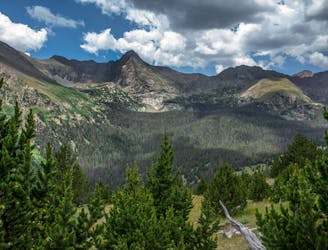
The route is not a designated trail, but it’s done frequently enough that a path is visible for much of the way. Look for a faint trail through the grass to the north of the lake. This goes steeply up the meadowy slopes, finding a natural ramp to bypass the cliffs and enter an upper bowl. From there, find the path of least resistance over the talus to gain the north ridge. It’s a straightforward hike up the tundra, but becomes quite steep near the top.
After completing the upper portion of the north ridge, you’ll be standing on a false summit, staring down a huge couloir with Medano Lake looking tiny at the bottom. From there, continue along a gentler upper ridge to gain the summit.
The top of Mount Herard is broad and grassy. Walk just beyond the summit cairn for the ultimate panorama. From there, looking over the dunes and the San Luis Valley is like the view from an airplane. Also visible to the north are the jagged peaks of the Crestones. When you’ve taken it all in, simply reverse the route to return.
Sources: https://www.nps.gov/grsa/planyourvisit/hiking.htm https://www.summitpost.org/medano-lake-trailhead/165806
Extreme
Scrambling up mountains and along technical trails with moderate fall exposure. Handholds are necessary to navigate the trail in its entirety, although they are not necessary at all times. Some obstacles can be very large and difficult to navigate, and the grades can often be near-vertical. The challenge of the trail and the steepness of the grade results in very strenuous hiking. Hikes of this difficulty blur the lines between "hiking" and "climbing".

Some trail sections have exposed ledges or steep ascents/descents where falling could cause serious injury.
Little chance of being seen or helped in case of an accident.
4.2 km away
Hike from the Medano Pass 4WD road to a secluded lake in an alpine cirque.
Moderate Hiking
7.4 km away
Alpine hike to a Sangre de Cristo 13er, within Great Sand Dunes National Park and Preserve.
Extreme Hiking
7.4 km away
Two seldom-seen alpine lakes, high in the Sangre de Cristo Wilderness.
Difficult Hiking

7 routes · Alpine Climbing · Hiking