124 m away
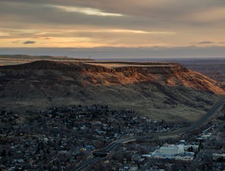
North Table Mountain: Outer Loop
What this popular trail network lacks in quality it makes up for in accessibility.
Moderate Mountain Biking
- Distance
- 12 km
- Ascent
- 315 m
- Descent
- 315 m
What this popular trail network lacks in quality it makes up for in accessibility.
Mountain Biking Difficult

Mountain bikers are moving to the Colorado Front Range by the thousands thanks to the great trail access and the burgeoning economy. With the population explosion comes throngs of riders swarming the trails, and North Table Mountain is one of the key after work hot spots for residents in and around Golden.
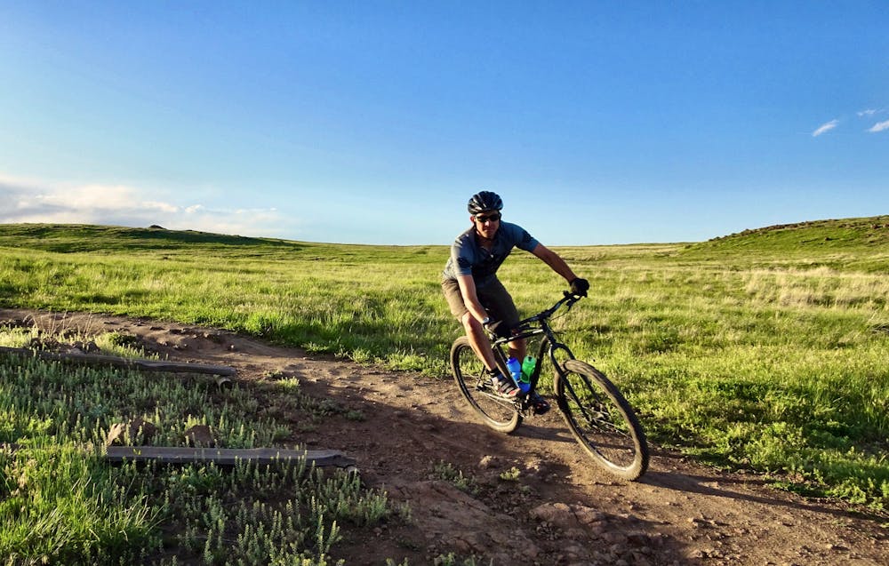
Easily accessible off of Highway 93 or from a variety of trailheads in Golden, North Table Mountain not only sees mountain bikers, but hikers, dog walkers, trail runners, and equestrians as well. The singletrack shows the signs of this wear, with rutted sections and a lot of trail braiding.
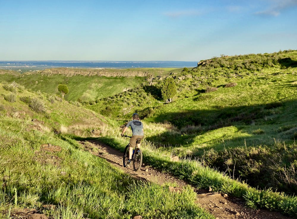
While some sections of trail are very worn, others have seen more recent maintenance and exhibit the classic characteristics of Front Range singletrack: steep, switchbacked climbs, technical rock challenges, and fast—but short—descents.
This trail network is worth riding if only for the views from the tops of the cliffs ringing North Table Mountain, providing beautiful vistas of the greater Denver area, and the mountains rising up from the plains.
Some sections of this network are much more difficult than others, so beginner riders can choose to stick to the easier trails and advanced riders can seek out the more technical descents.
The Rim Rock Trail, which is included in this route, is closed for raptor nesting from February 1-July 31, but it can be easily skipped over by using the Mesa Top Trail.
While definitely not the best singletrack trail in the area, if you're looking for a quit hit of dirt after you clock out for the day, North Table Mountain just might be the perfect fix.
Difficult
Mostly stable trail tread with some variability featuring larger and more unavoidable obstacles that may include, but not be limited to: bigger stones, roots, steps, and narrow curves. Compared to lower intermediate, technical difficulty is more advanced and grades of slopes are steeper. Ideal for upper intermediate riders.

The trail contains some obstacles such as outcroppings and rock which could cause injury.

Close to help in case of emergency.
124 m away
What this popular trail network lacks in quality it makes up for in accessibility.
Moderate Mountain Biking
7.6 km away
A scenic climb to an action-packed downhill in the foothills just outside of Golden.
Severe Mountain Biking

6 routes · Mountain Biking