1.4 km away
Royal Gorge Park
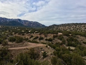
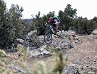
New school machine-built trails coupled with stunning views of the Royal Gorge make for a winning combination.
Moderate Mountain Biking
- Distance
- 18 km
- Ascent
- 353 m
- Descent
- 353 m
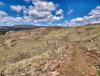
A formidable trail dropping from the Royal Gorge Park to Canon City far below.
Mountain Biking Difficult

The Royal Cascade is a formidable mountain bike trail connecting the Royal Gorge park to the town of Canon City. The community celebrated the opening of what's sure to be an iconic trail in March of 2022. Since then, it's slowly created a buzz amongst the Colorado mountain bike community, drawing riders from across the state.
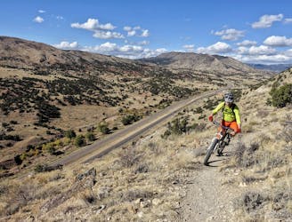
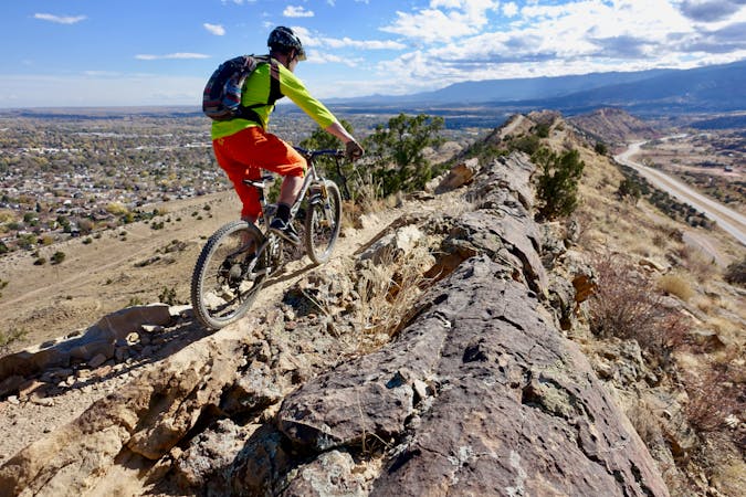
This steep trail is best ridden as a shuttle ride from the Royal Gorge Park, descending to the town of Canon City below. Currently, there are no commercial companies routinely running shuttles on this trail, so you'll have to coordinate your own. Even as a shuttle run, this ride gains 866 vertical feet—yet it descends 2,310 feet over its length. The route, as shown, is 7.7 miles long, which is quite an achievable distance. For riders looking for a longer mountain bike ride, the best option is to pedal a few loops on the fantastic trails at the Royal Gorge Park and then finish the day by descending back to town.
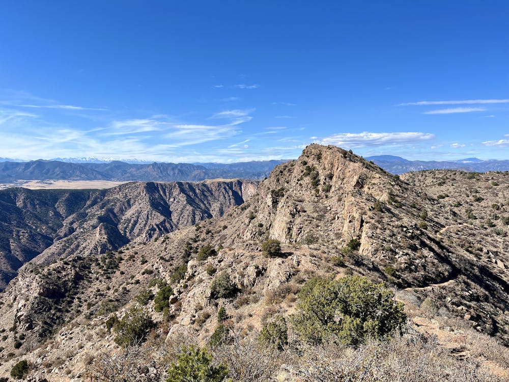
After finishing your ride at the Royal Gorge Park, you'll pedal across the ridge toward the gorge itself, but before you descend, you'll punch straight up a steep mountainside to a high point on top of the ridge. This switchbacked climb is a tad too steep for most riders to pedal up, although undoubtedly, a few very strong riders will clean it. Expect to do a bit of hike-a-biking if you're a mere mortal and not riding an electric bike.
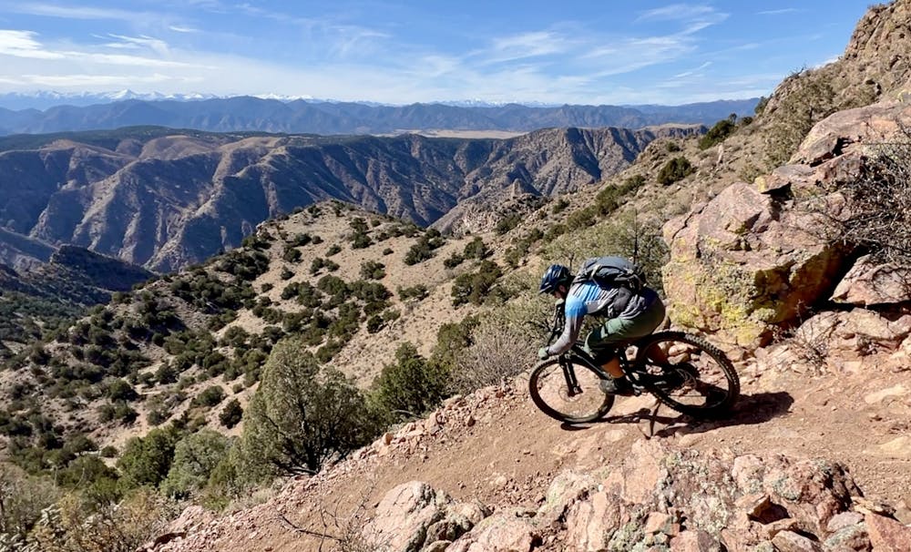
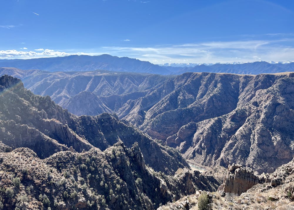
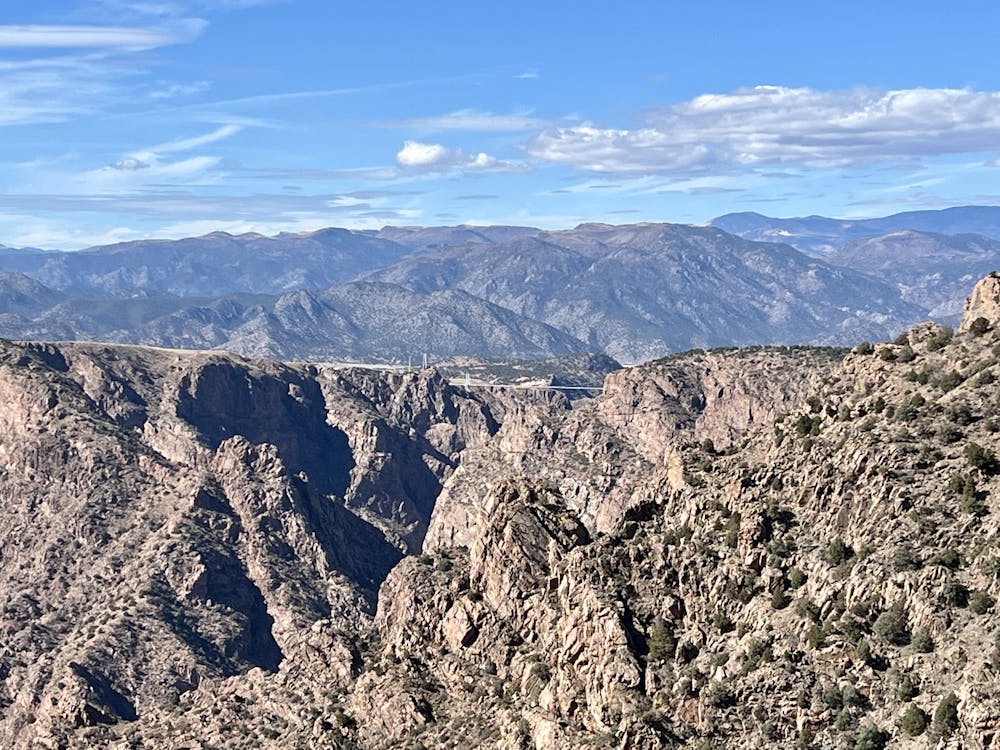
Once on top of the mountain, take some time to absorb the stupendous view of the region. The Royal Gorge is spread out below you, and you can glimpse the famous Royal Gorge Bridge in the distance. In the other direction, Canon City is in the foreground, and Pikes Peak forms the distant skyline. Enjoy this incredible location, then pull up your pads, and get ready to descend!
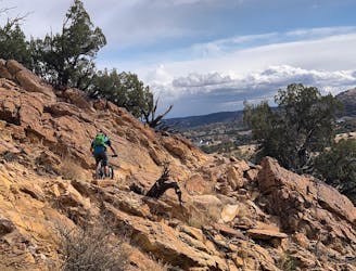
Building the Royal Cascade Trail was undoubtedly an arduous endeavor. The terrain it traverses from the top of the mountain to the bottom of the canyon is uber steep, rocky, and filled with cliff bands. Simply building a trail through this terrain is an incredible feat, and the builders deserve many kudos.
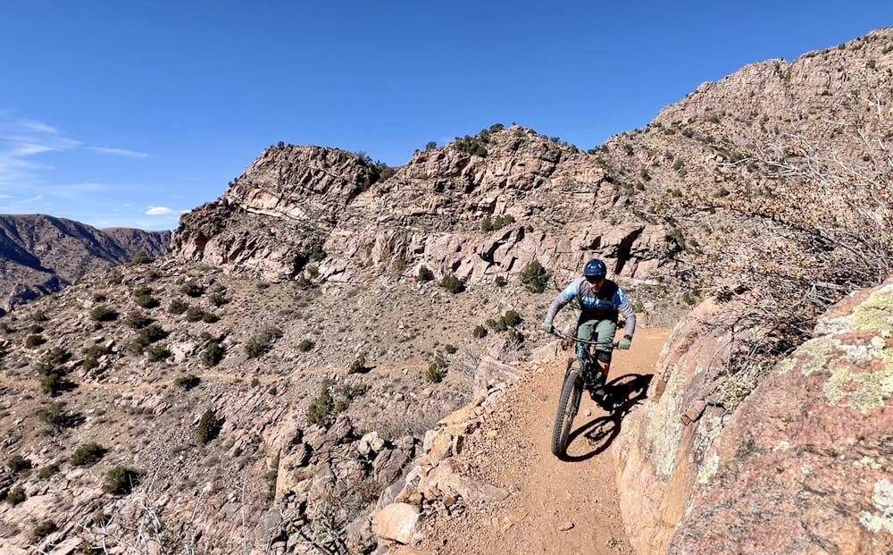
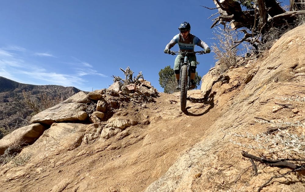
However, the finished project is a bit of a head-scratcher. The trail signs warn that the Royal Cascade is a double black diamond trail and that it's for experts only, but in reality, the vast majority of the trail is a flowy machine-built intermediate trail. There are only a few short, steep, rocky sections where the difficulty is elevated.
In these sections, it appears that the builders were rolling along, and then in a few spots, they suddenly got cliffed out and had to incorporate some unsustainably steep descents to skirt around a cliff band and get down to the next section of benchcut. So as you ride, you'll be flowing along a mellow trail, only to be confronted with an exposed, harrowing chute or rock slab ride, before returning to the easy singletrack.
It's always difficult from the outside to know the reason for what seem like strange trail alignment issues. Was there really no other option? Did somebody with little experience lay out the trail, forcing the builder into a corner? Are there archeological artifacts or sensitive ecological locations that had to be avoided? Ultimately, even during a project of this length, many of the key players might not even know all the reasons. According to JoinFar.org, the Royal Cascade was "first identified as a potential route over 25 years ago," so some of the history of this trail design is already lost to the mists of time.
Regardless, there are a few problems with how the trail ended up. First, several of these steep sections were already eroding significantly in the fall of 2022, just six months after the trail was open. This indicates that some sections are very unsustainable and will only get much worse over the years.
Second, a well-built trail generally retains a consistent trail character all the way down. By sticking to a consistent building style and character, the trail then provides a particular riding experience that will appeal to a certain type of rider. As it stands, many riders will come away from their time on the Royal Cascade disappointed. Intermediate riders will scare themselves on the exposed, rocky sections and won't be able to ride some of them. Advanced riders will wish that there were many more rocks and technical moves on the way down. And so, in the end, few people will be pleased.
Ultimately, the technical difficulty of this trail as of 2022 is nowhere near a double black diamond rating. It's not even close to the most difficult trail in Canon City, much less the ranking amongst the gnarliest trails in Colorado. It is possible that erosive forces may turn this into a double black diamond trail over the years, but that remains to be seen. Currently, this descent only warrants a FATMAP "Difficult" rating, which is about a blue/black on a global scale.
None of this is to say that you shouldn't ride this trail—you definitely should! Just approach the ride with a reasonable expectation of what you'll encounter. With these thoughts in mind, you'll be prepared to enjoy the Royal Cascade for what it is—a beautiful mountain bike ride through an incredibly rugged landscape!
Note: The Royal Cascade is subject to extensive and somewhat unusual seasonal closures to protect bighorn sheep. The trail is closed for the entire months of June and July, and in September and October, the trail is only open from 9:00am to 5:00pm. As long as you plan around these dates and times, you can easily still have a fantastic ride on the Royal Cascade!
Difficult
Mostly stable trail tread with some variability featuring larger and more unavoidable obstacles that may include, but not be limited to: bigger stones, roots, steps, and narrow curves. Compared to lower intermediate, technical difficulty is more advanced and grades of slopes are steeper. Ideal for upper intermediate riders.

Some trail sections have exposed ledges or steep ascents/descents where falling could cause serious injury.

Away from help but easily accessed.
1.4 km away
New school machine-built trails coupled with stunning views of the Royal Gorge make for a winning combination.
Moderate Mountain Biking
1.4 km away
The freshest singletrack at Canon City's ever-expanding Royal Gorge Trail System.
Moderate Mountain Biking
4.5 km away
The Hogbacks trails can be accessed easily from downtown Canon City, providing both easy beginner trails and gnarly black-diamond descents.
Extreme Mountain Biking
5.1 km away
A diverse network with trails for all riders from beginner to advanced, the easy accessibility from town to such a big trail network is astonishing!
Difficult Mountain Biking
5.1 km away
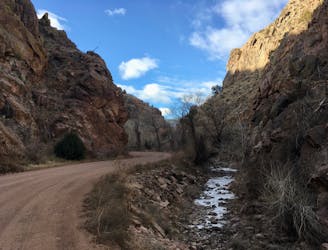
A rough, remote gravel road passing through beautiful rolling mountains.
Easy Mountain Biking
5.4 km away
World-class gravel riding in Canon City!
Easy Mountain Biking
9.4 km away
The newest addition to the epic Oil Well Flats trail system climbs—both a great climb and descent.
Difficult Mountain Biking
6 routes · Mountain Biking
11 routes · Mountain Biking