1.3 km away
Phantom Canyon -> Shelf Road Loop
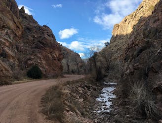
World-class gravel riding in Canon City!
Easy Mountain Biking
- Distance
- 113 km
- Ascent
- 2.1 km
- Descent
- 2.1 km
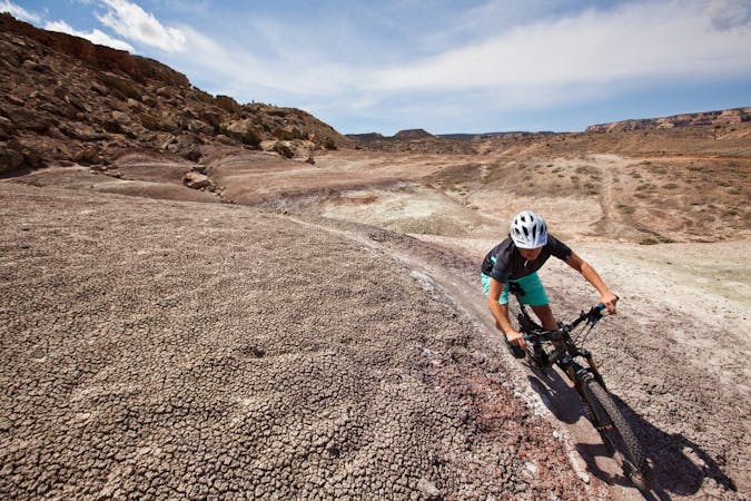
The Hogbacks trails can be accessed easily from downtown Canon City, providing both easy beginner trails and gnarly black-diamond descents.
Mountain Biking Extreme

The singletrack in the Hogbacks area is easily accessible from the west side of Canon City, making these trails popular for after work rides. Consequently, dog walkers, hikers, and runners also frequent these trails, although the nearby gravel trail takes much of the foot traffic.
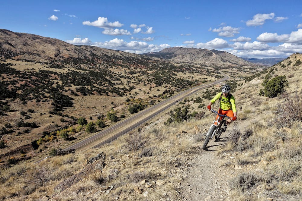
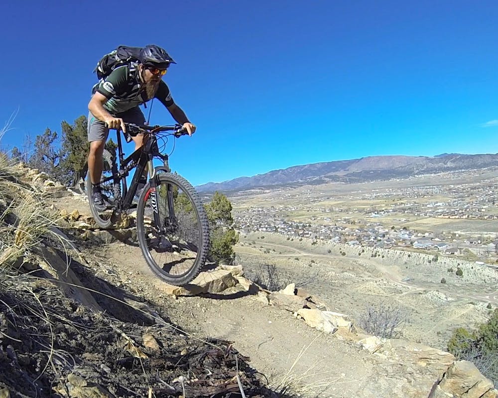
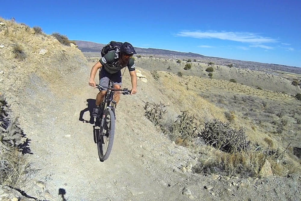
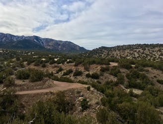
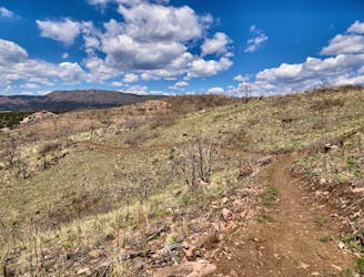
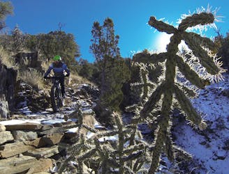
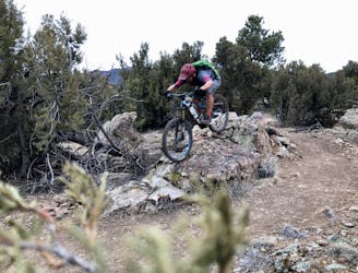
One of the most interesting things about this network is the radical diversity of the trails. The lower Graneros trail is very flowy, mellow, non-technical, and beginner-friendly. But as you climb up the ridge to access the higher trails, the singletrack quickly switches to black diamond difficulty, with some sections exceeding.
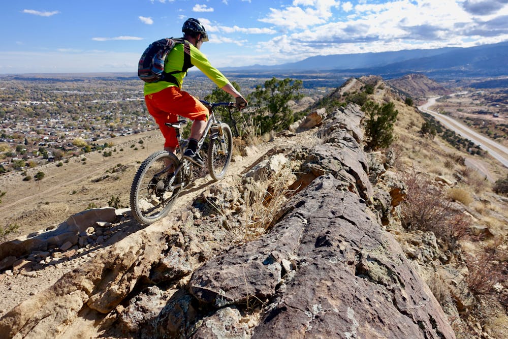
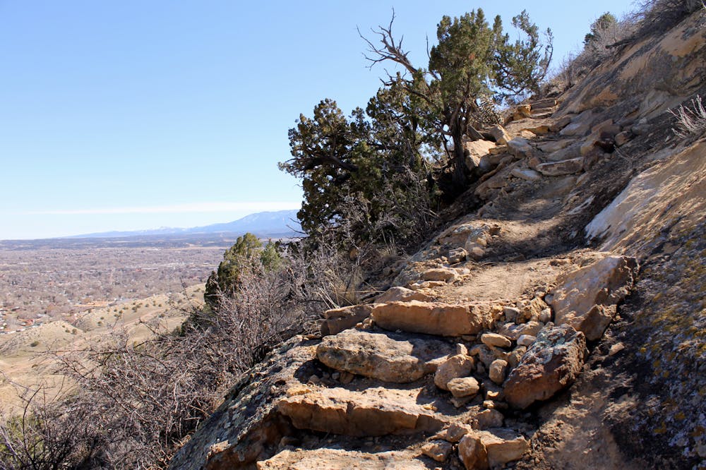
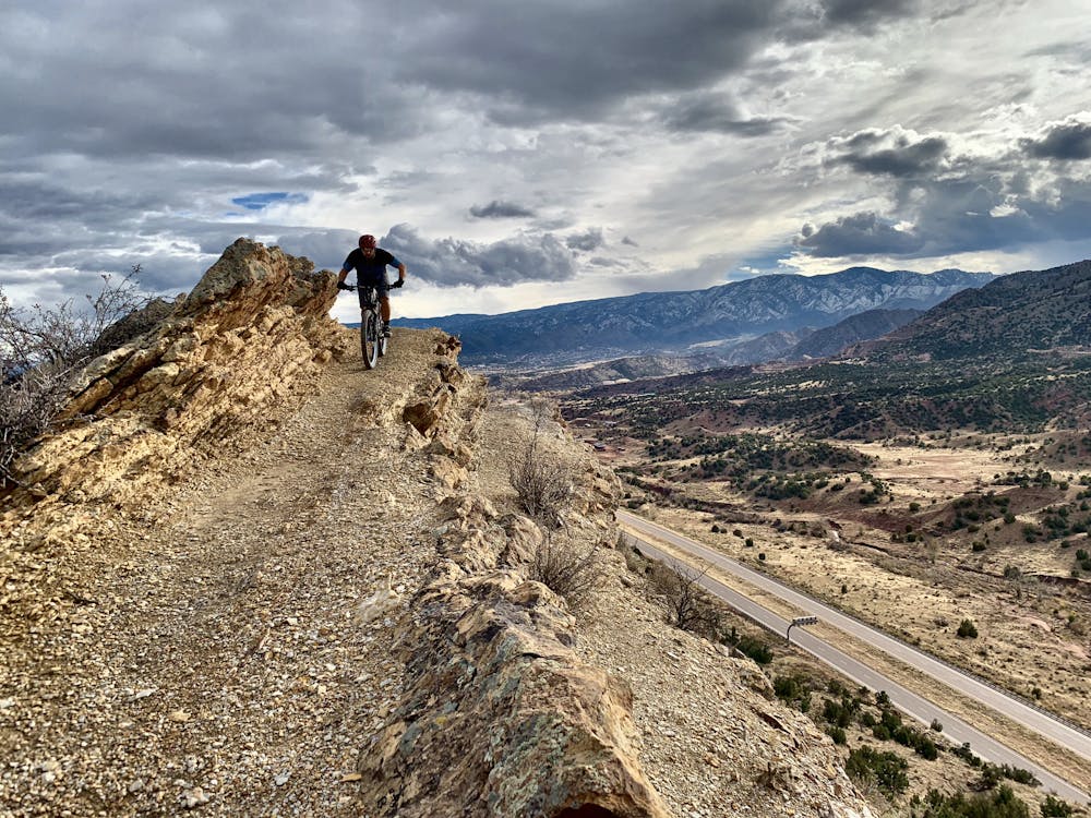
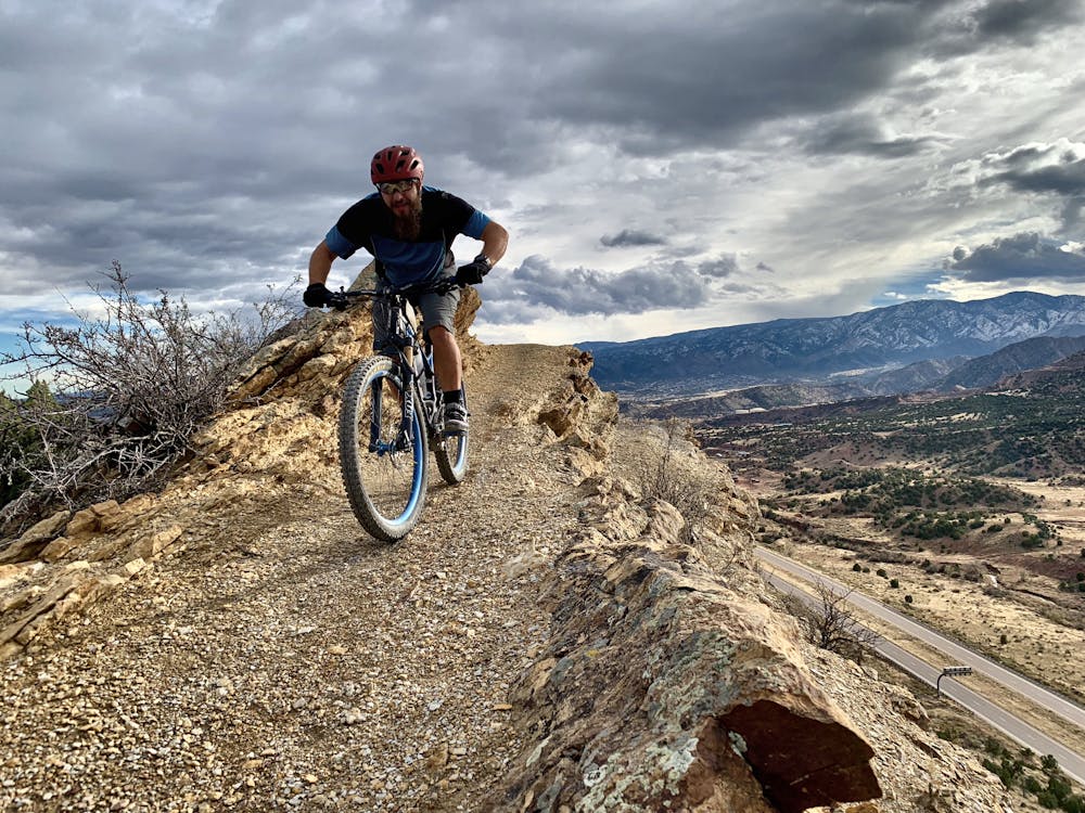
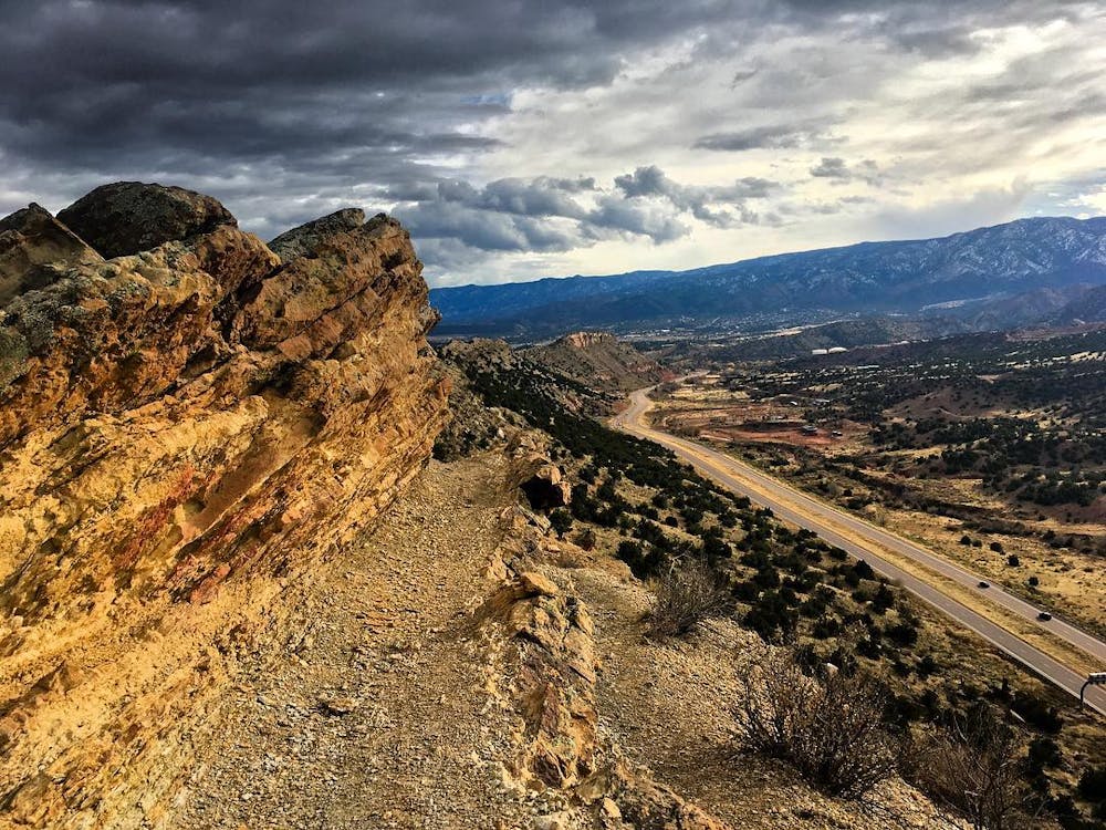
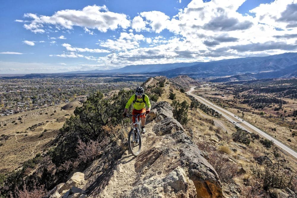
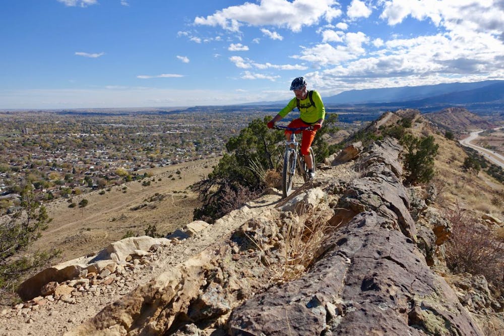
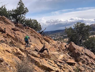
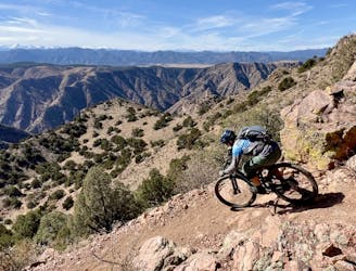
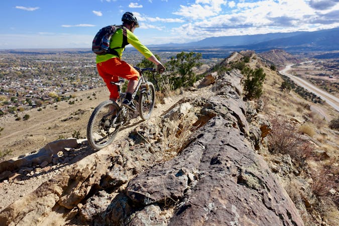
The upper Dakota Ridge trail along the hogback spine is a must-ride, but some sections will force even the best riders to dismount due to awkward stair sections. But the views make up for this awkwardness. As you ride a knife-edge ridge, the views in every direction are simply stunning!
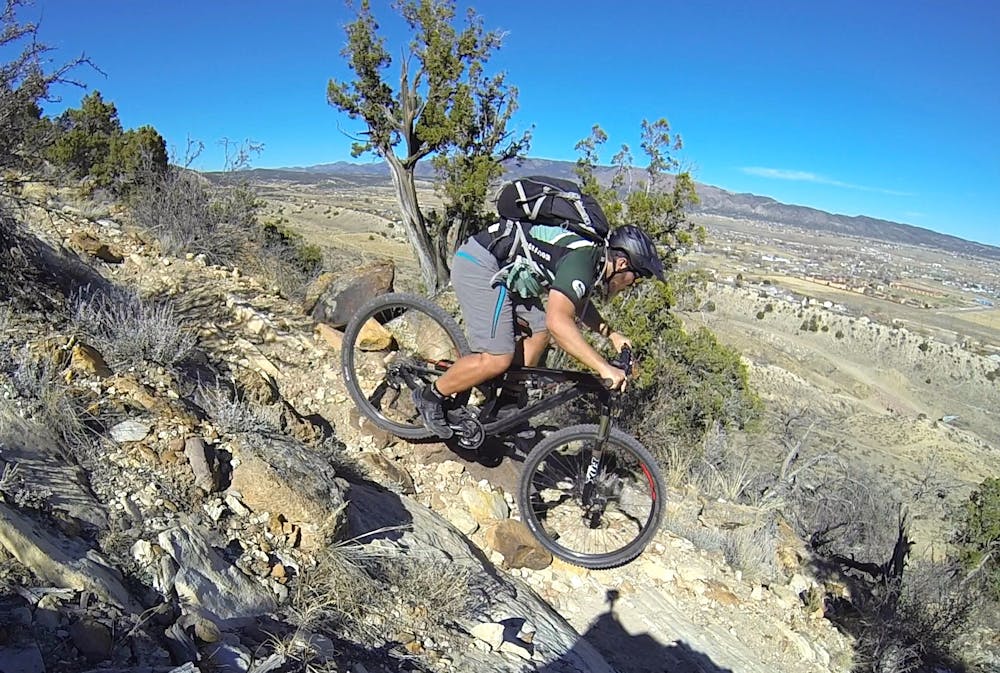
When Dakota Ridge turns down, the singletrack switches to 100% gnar, with full-commitment rock rolls plunging into hard turns with lots of exposure. While all rideable by advanced riders, trust in your bike and your bike handling skills is an absolute must.
Once back on Graneros, it's tempting to simply coast back to the trailhead, but pedaling halfway back up the ridge to access the short Stone Quarry trail is well-worth the effort. In addition to running past an old stone quarry, more technical ledge-filled descending awaits you.
While these trails are short and steep, Hogbacks is well-worth adding to your Canon City schedule as an afternoon quickie.
Extreme
Very steep, difficult, narrow singletrack with widely variable and unpredictable trail conditions. Unavoidable obstacles could be 15in/38cm tall or greater, and unavoidable obstacles with serious consequences are likely to be present. Obstacles could include big rocks, difficult root sections, drops, jumps, sharp switchbacks, and more. Ideal for expert-level riders.

Some trail sections are extremely exposed where falling will almost certainly result in serious injury or death.

Close to help in case of emergency.
1.3 km away
World-class gravel riding in Canon City!
Easy Mountain Biking
1.9 km away
A diverse network with trails for all riders from beginner to advanced, the easy accessibility from town to such a big trail network is astonishing!
Difficult Mountain Biking
1.9 km away
A rough, remote gravel road passing through beautiful rolling mountains.
Easy Mountain Biking
4.5 km away
A formidable trail dropping from the Royal Gorge Park to Canon City far below.
Difficult Mountain Biking
5.8 km away
New school machine-built trails coupled with stunning views of the Royal Gorge make for a winning combination.
Moderate Mountain Biking
5.8 km away
The freshest singletrack at Canon City's ever-expanding Royal Gorge Trail System.
Moderate Mountain Biking
6.8 km away
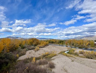
An easy but incredibly scenic gravel path through Canon City and into the Royal Gorge.
Easy Mountain Biking
8.5 km away
The newest addition to the epic Oil Well Flats trail system climbs—both a great climb and descent.
Difficult Mountain Biking
6 routes · Mountain Biking
11 routes · Mountain Biking