6.7 km away
Arkansas Riverwalk to Tunnel Drive
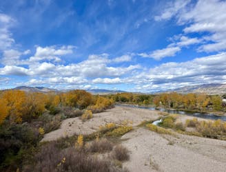
An easy but incredibly scenic gravel path through Canon City and into the Royal Gorge.
Easy Mountain Biking
- Distance
- 25 km
- Ascent
- 283 m
- Descent
- 283 m
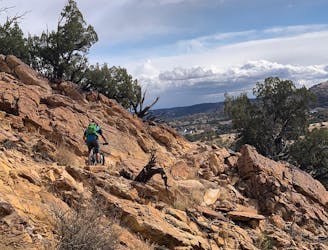
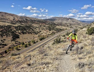
Pedal to the top of a 9,340-foot peak near Canon City.
Mountain Biking Severe

Tanner Peak rises outside the town of Canon City to a height of 9,340 feet above sea level. This is one of the most prominent close-to-town peaks and is easily accessible from multiple aspects. The route shown here is one of the most popular, beginning at a convenient trailhead on County Road 143.
From the craggy summit of the mountain, you'll enjoy spectacular views of Pikes Peak to the north and the Sange de Cristo range forming the western horizon. Being able to ride your bike to the top of such a tall peak is an attractive adventure. However, don't expect to find pristine singletrack. Rather, this entire trail is ATV legal and sees substantial traffic, especially on weekends during peak season.
Severe
Widely variable, narrow trail tread with steeper grades and unavoidable obstacles of 15in/38cm tall or less. Obstacles may include unavoidable bridges 24in/61cm wide or less, large rocks, gravel, difficult root sections, and more. Ideal for advanced-level riders.

The path is on completely flat land and potential injury is limited to falling over.

Away from help but easily accessed.
6.7 km away
An easy but incredibly scenic gravel path through Canon City and into the Royal Gorge.
Easy Mountain Biking
6.8 km away
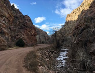
A rough, remote gravel road passing through beautiful rolling mountains.
Easy Mountain Biking
6.8 km away
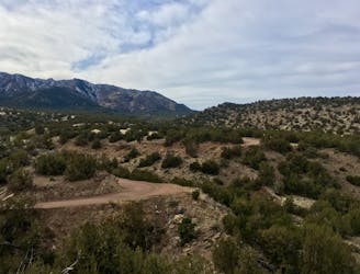
A diverse network with trails for all riders from beginner to advanced, the easy accessibility from town to such a big trail network is astonishing!
Difficult Mountain Biking
7.2 km away
World-class gravel riding in Canon City!
Easy Mountain Biking
8.4 km away
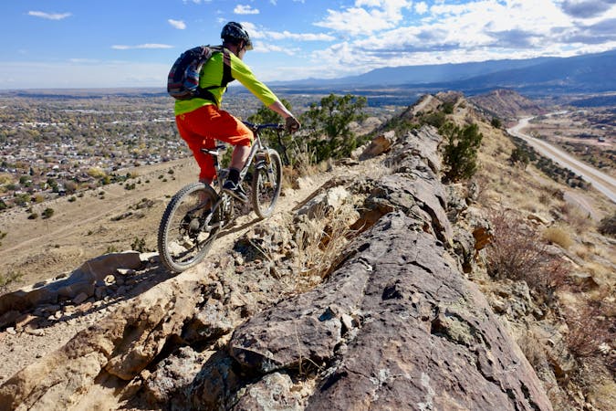
The Hogbacks trails can be accessed easily from downtown Canon City, providing both easy beginner trails and gnarly black-diamond descents.
Extreme Mountain Biking
6 routes · Mountain Biking
11 routes · Mountain Biking