3.3 km away
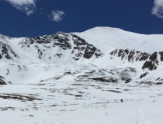
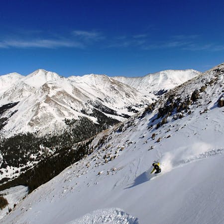
Torreys Peak: Emperor Couloir
Ski a spectacular 3,000-foot line off the summit of one of Colorado's most popular 14ers.
Severe Ski Touring
- Distance
- 3.7 km
- Ascent
- 999 m
- Descent
- 999 m
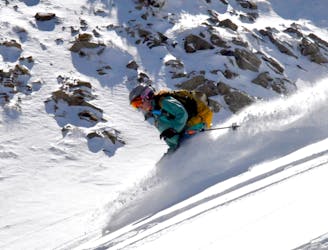
Short steep chutes off the Lenawee Mountain Ridge
Ski Touring Severe

You can access these chutes via the Lenawee Mountain Hike. This zone usually does not ski well until late season because it gets so much sun exposure. However, the terrain is some of the easiest access backcountry terrain off Loveland Pass. You can follow the route up the ridge and drop in many different locations. It is preferred to drop skier's left the first time and ski out to the bottom to scout the rest of the chutes. There are many options here and due to the SW exposure, you must ski these lines early in the day. If you decide to ski these lines multiple times, you should be able to set a skin track between The Fleas and Shit for Brains in the gully. These lines would combine well with Shit for Brains and the No Name chutes. When you decide to ski out, follow the mapped route and make your way through the trees. You can also access the ski area as well if you would like.
Severe
Steep skiing at 38-45 degrees. This requires very good technique and the risk of falling has serious consequences.

As well as the slope itself, there are some obstacles (such as rock outcrops) which could aggravate injury.
Away from help but easily accessed.
3.3 km away
Ski a spectacular 3,000-foot line off the summit of one of Colorado's most popular 14ers.
Severe Ski Touring
5.6 km away
If avalanche conditions are safe this is a good powder stash near Keystone.
Moderate Ski Touring
6.6 km away
Great route for beginner mountaineers—climb an easy 14er, ski a short couloir, and cruise through a fun gulley back to the trailhead.
Difficult Ski Touring
12 routes · Freeride Skiing · Ski Touring
7 routes · Ski Touring