Snowslide and Sawtooth Peaks

Combo of the two 8000+ foot peaks above Snowslide Lake.
Extreme Hiking
- Distance
- 12 km
- Ascent
- 1.1 km
- Descent
- 1.1 km
Steep jaunt up to a lake with opportunities for fishing, camping, and further hikes into the mountains.
Hiking Moderate

Snowslide is a scenic lake with decent fishing, reached by a steep but quick ascent from Lick Creek Road. To get there, park at the signed Snowslide Trailhead. Find a way across the creek, then follow the obvious trail that heads uphill. It gets steep and rocky almost right away, ascending through forest and one broad avalanche clearing on its way to the lake. You'll enjoy views to peaks across the valley, and up to Snowslide Peak ahead.
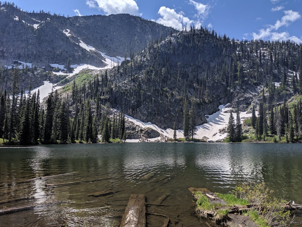
Once at the lake, you'll come upon one small campsite where the trail meets the shore. The path continues around the east side, where an even better campsite is found. Camping is allowed with no special permit, and sites are first-come-first served. You can bushwack along the lakeshore to find more spots for fishing, swimming, or lounging by the water.
The trail extends past the lake up to Snowslide Summit, which is the pass between Snowslide and Sawtooth Peaks. From there you might continue over and down on the trail to Maki Lake, or scramble off-trail to tag one of the peaks.
Moderate
Hiking along trails with some uneven terrain and small hills. Small rocks and roots may be present.

The trail contains some obstacles such as outcroppings and rock which could cause injury.

Little chance of being seen or helped in case of an accident.
Combo of the two 8000+ foot peaks above Snowslide Lake.
Extreme Hiking
1.2 km away

A steep trail crossing bouldery meadows and mountain creeks, leading to a large lake hidden high in the mountains.
Difficult Hiking