3.2 km away
Mount Katahdin via the Abol Trail
The shortest, most direct route to Mount Katahdin.
Extreme Hiking
- Distance
- 12 km
- Ascent
- 1.2 km
- Descent
- 1.2 km
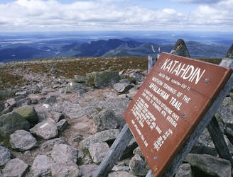
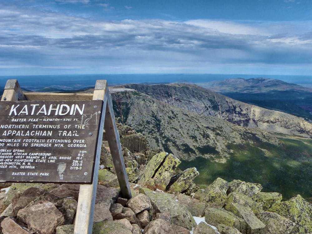
The northern terminus of the Appalachian Trail on the top of Mount Katahdin.
Hiking Severe

This final segment of the 2,200-mile Appalachian Trail summits Mount Katahdin via the Hunt Trail. The centerpiece of Maine's Baxter State Park, Katahdin serves as the highest mountain in the state and even translates as "The Greatest Mountain" in the native Penobscot Indian language.
Along with the Abol Trail, this trailhead serves as one of the most common starting points to attempt a summit hike. There are a couple of options to approach the summit from the east, but they are significantly more challenging and often reserved for the more adventurous.
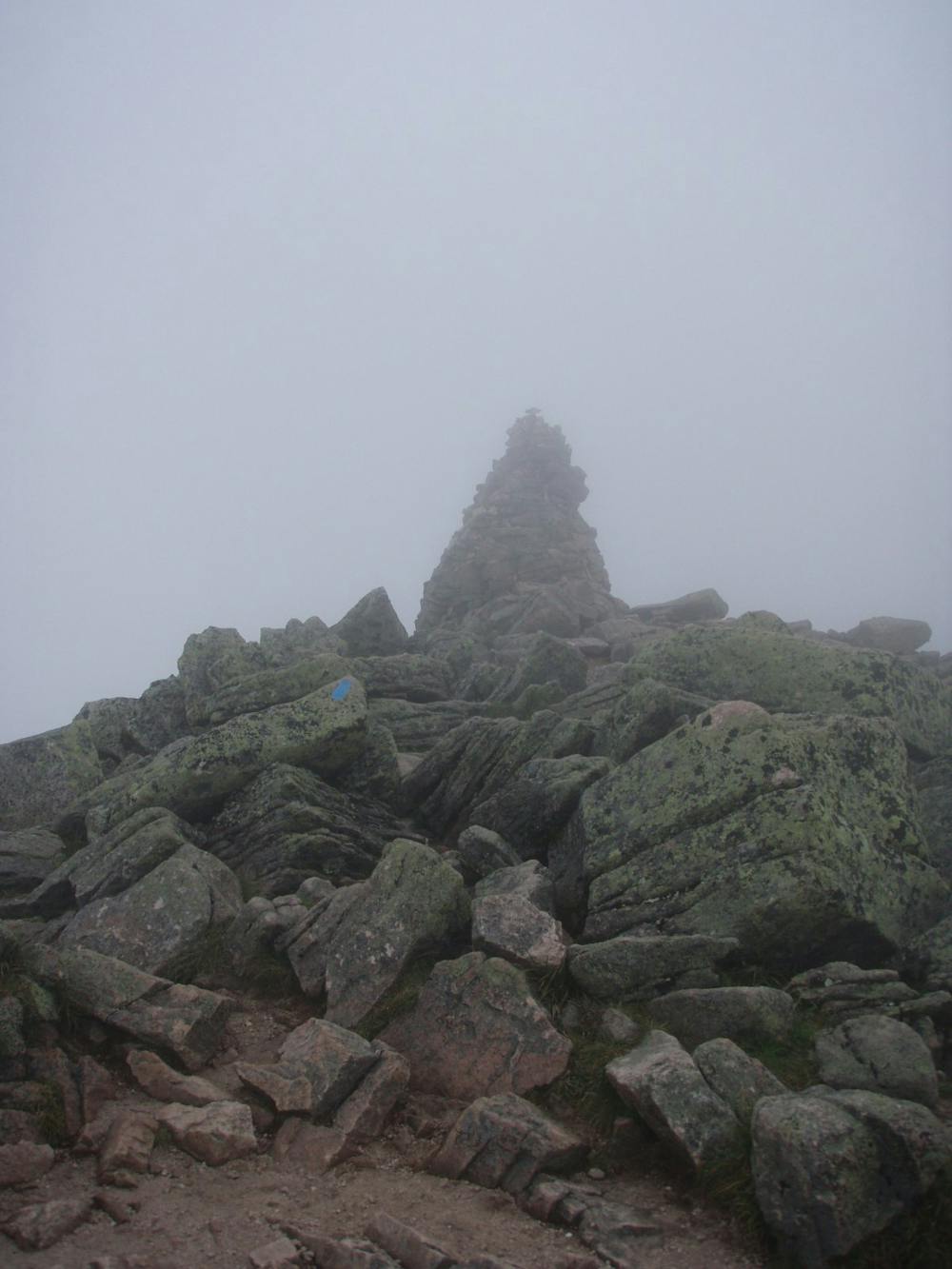
To avoid the crowds, be sure to get an early start. As with many of New England's high exposed peaks, the weather can be quite harsh at times, with a high possibility of afternoon thunderstorms.
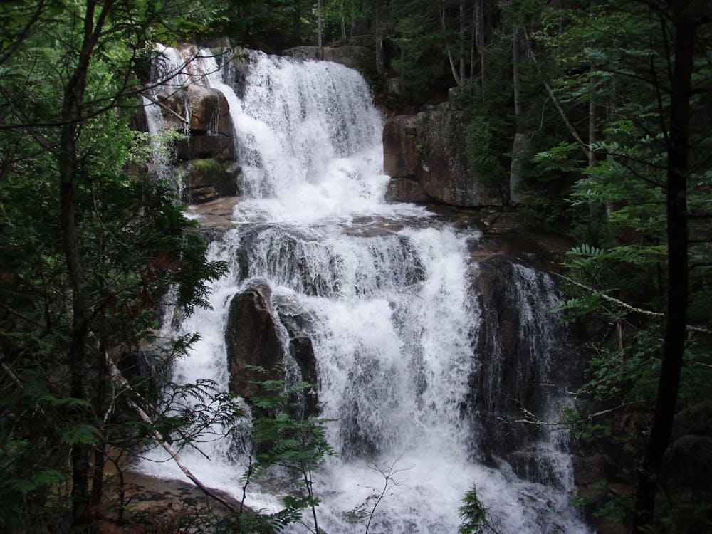
The trail climbs gradually from the campground to the first landmark, Katahdin Stream Falls. Here, you'll find a picturesque wooden bridge and beautiful 50-foot waterfall. This is also the last source of water along the AT heading north.
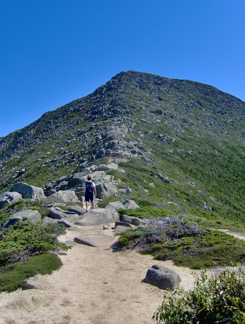
Following the falls, the trail steepens as the untamed forest begins to give way to a boulder scramble. As you get closer to the summit, you'll be welcomed with phenomenal, epic views. A dried spring and trail junction lie one mile from the summit.
Atop Mount Katahdin (synonymous with Baxter Peak), enjoy the breathtaking views from 5,267 feet. A large placard lies atop the summit and denotes the 2,189.1 miles separating this summit from Springer Mountain in Georgia. Whether day hiking or thru-hiking, enjoy the views from the summit—an excellent reward for your accomplishment!
Descend back down the AT to the Katahdin Stream Campground to round out the hike.
Sources: https://www.northeasthikes.com/hunt-trail-katahdin-baxter-state-park-maine/ https://en.wikipedia.org/wiki/MountKatahdin
Severe
Hiking challenging trails where simple scrambling, with the occasional use of the hands, is a distinct possibility. The trails are often filled with all manner of obstacles both small and large, and the hills are very steep. Obstacles and challenges are often unexpected and can be unpredictable.

Some trail sections have exposed ledges or steep ascents/descents where falling could cause serious injury.

Away from help but easily accessed.
3.2 km away
The shortest, most direct route to Mount Katahdin.
Extreme Hiking

58 routes · Hiking