3.2 km away
Appalachian Trail: Katahdin Stream Campground to Mount Katahdin
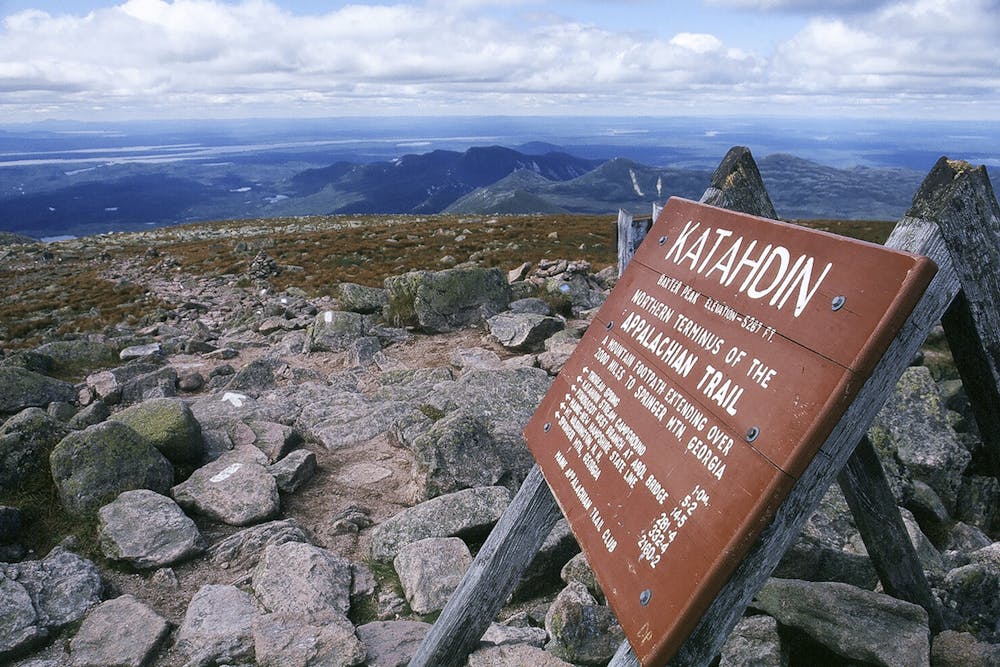
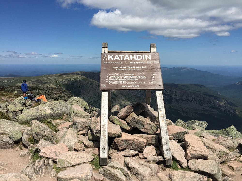
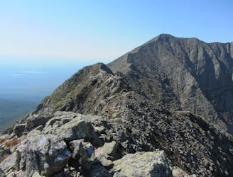
The northern terminus of the Appalachian Trail on the top of Mount Katahdin.
Severe Hiking
- Distance
- 15 km
- Ascent
- 1.3 km
- Descent
- 1.3 km
The shortest, most direct route to Mount Katahdin.
Hiking Extreme

Though short, this route to the summit of Mount Katahdin should not be taken lightly. The trail still gains nearly 4,000 feet in its short 3.5-mile ascent. Though the strongest of trail runners have done the climb in under two hours, most would suggest allocating 3-5 hours to reach the summit.
Typical of the high peaks in New England, afternoon storms can be likely in the warmer months. Start your hike early and ensure you have the appropriate gear for any situation.
Begin your hike from the Abol Campground. You will find the official trailhead between two lean-to shelters. Sign your name on the registry and make your way up the trail. Though the path is wide at the trailhead, it quickly narrows as it begins climbing.
The first mile or so ascends gradually as the trail makes its way through a dense forest. For a short day hike, take the spur trail to Little Abol Falls. To reach Katahdin, continue up Abol Trail.
Around mile 1.5, the route follows a new portion of trail that was opened in 2016. Originally, the trail ascended straight up a rock slide, but landslides and constant erosion led to its ultimate demise. The trail now switchbacks its way up thanks to the Maine Conservation Corps.
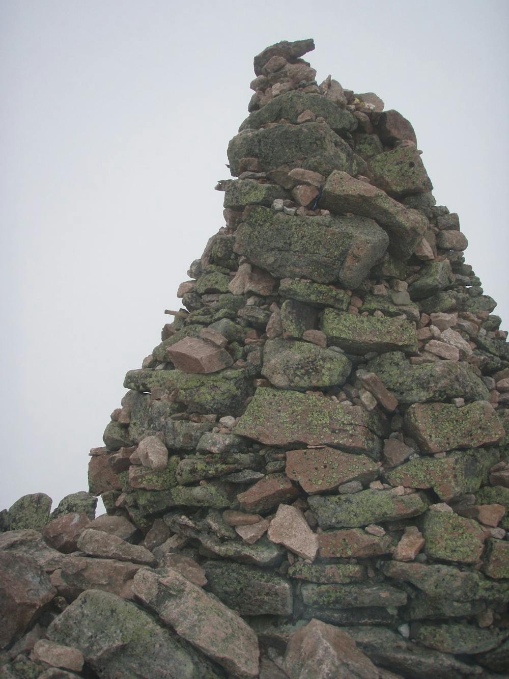
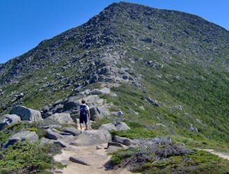
Ascending into the treeless alpine terrain, the switchbacks give way to large fields of boulders as the trail makes its way to Thoreau Spring. Three points of contact will be necessary at many points. Despite the name, the spring is nothing more than a small puddle and should not be relied upon for water.
From here, take the Hunt Trail to the Summit of Mount Katahdin, referred to as Baxter Peak on the trail sign. Less intense than the previous bit, the trail still has a climb ahead to reach the peak.
Enjoy the phenomenal backdrop of the surrounding mountains within Baxter State Park at 5,627 feet. As Maine's highest peak and the northern terminus for the 2,200-mile-long Appalachian Trail, it rewards you with unending views. The summit also provides an excellent vantage point to view the infamous and dangerous Knife Edge Trail, an extremely narrow path connecting Katahdin to Chimney Peak.
To complete the hike, retrace your steps to the trailhead, now 4,000 feet below.
Sources: https://www.northeasthikes.com/the-katahdin-abol-trail-hike/
Extreme
Scrambling up mountains and along technical trails with moderate fall exposure. Handholds are necessary to navigate the trail in its entirety, although they are not necessary at all times. Some obstacles can be very large and difficult to navigate, and the grades can often be near-vertical. The challenge of the trail and the steepness of the grade results in very strenuous hiking. Hikes of this difficulty blur the lines between "hiking" and "climbing".

Some trail sections have exposed ledges or steep ascents/descents where falling could cause serious injury.

Away from help but easily accessed.
3.2 km away
The northern terminus of the Appalachian Trail on the top of Mount Katahdin.
Severe Hiking
9.7 km away
An incredibly challenging and dangerous loop reserved only for the adventurous..
Severe Hiking

58 routes · Hiking

10 routes · Hiking