9.7 km away
Mount Katahdin via the Abol Trail
The shortest, most direct route to Mount Katahdin.
Extreme Hiking
- Distance
- 12 km
- Ascent
- 1.2 km
- Descent
- 1.2 km
An incredibly challenging and dangerous loop reserved only for the adventurous..
Hiking Severe
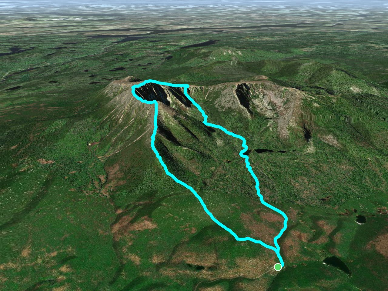
This epic route connects the Roaring Brook Campground to Mount Katahdin via the infamous Knife Edge Trail. This hike could be completed as a full day hike, or an overnight trip utilizing the Chimney Pond Campground.
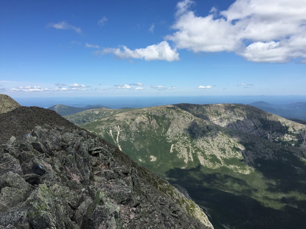
Beginning at the Roaring Brook Campground, follow the blue blazes up Helon Taylor Trail west towards Pamola Peak. Named after the Native American storm god Pamola, the approach to the 4,900-foot summit is no easy feat—just over 3 miles with almost 3,500 feet of climbing. At this elevation, the exposure can become extremely dangerous. Know that afternoon thunderstorms are not out of the questions.
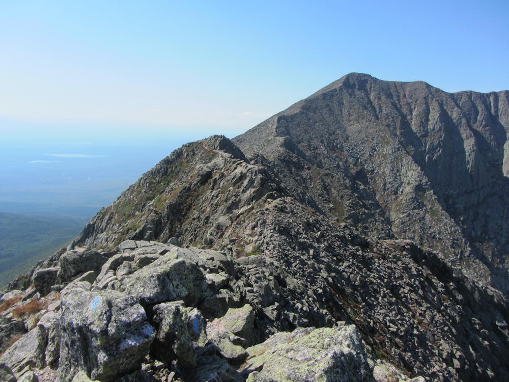
Separating Pamola from Maine's highest peak, Mount Katahdin (Baxter Peak) is the infamous 1.1-mile-long Knife Edge Trail. At times, this rocky, boulder-ridden ridgeline traverse is less than 4 feet wide, and steep slopes on each side of the ridge lead 2,000 feet below. Over time, this trail has claimed a handful of lives and incurred countless injuries—some of which were due to leaving marked trails. Watch your footing, bring appropriate gear, and don't be afraid to postpone the hike due to inclement weather.
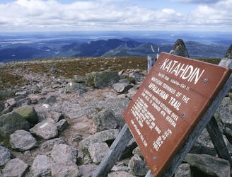
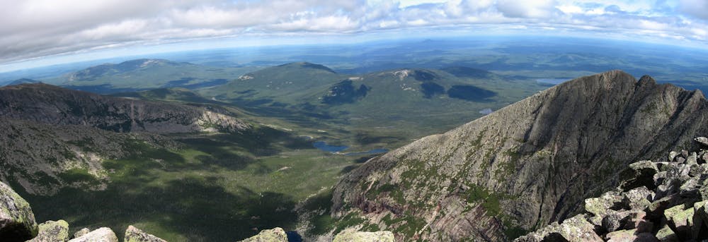
Along the ridge and atop Katahdin you'll be rewarded with incredible, unparalleled views from the highest point in Maine. Take a few minutes and savor your accomplishment at the northern terminus of the 2,200-mile-long Appalachian Trail. From here, most thru-hikers retrace their steps back down the white-blazed AT to Katahdin Stream Campground, but an occasional one or two choose to make their way across the daring Knife Edge heading to Roaring Brook.
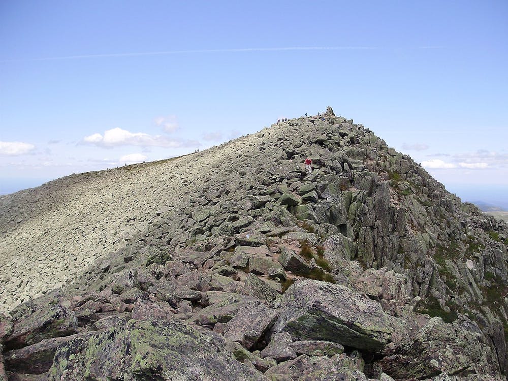
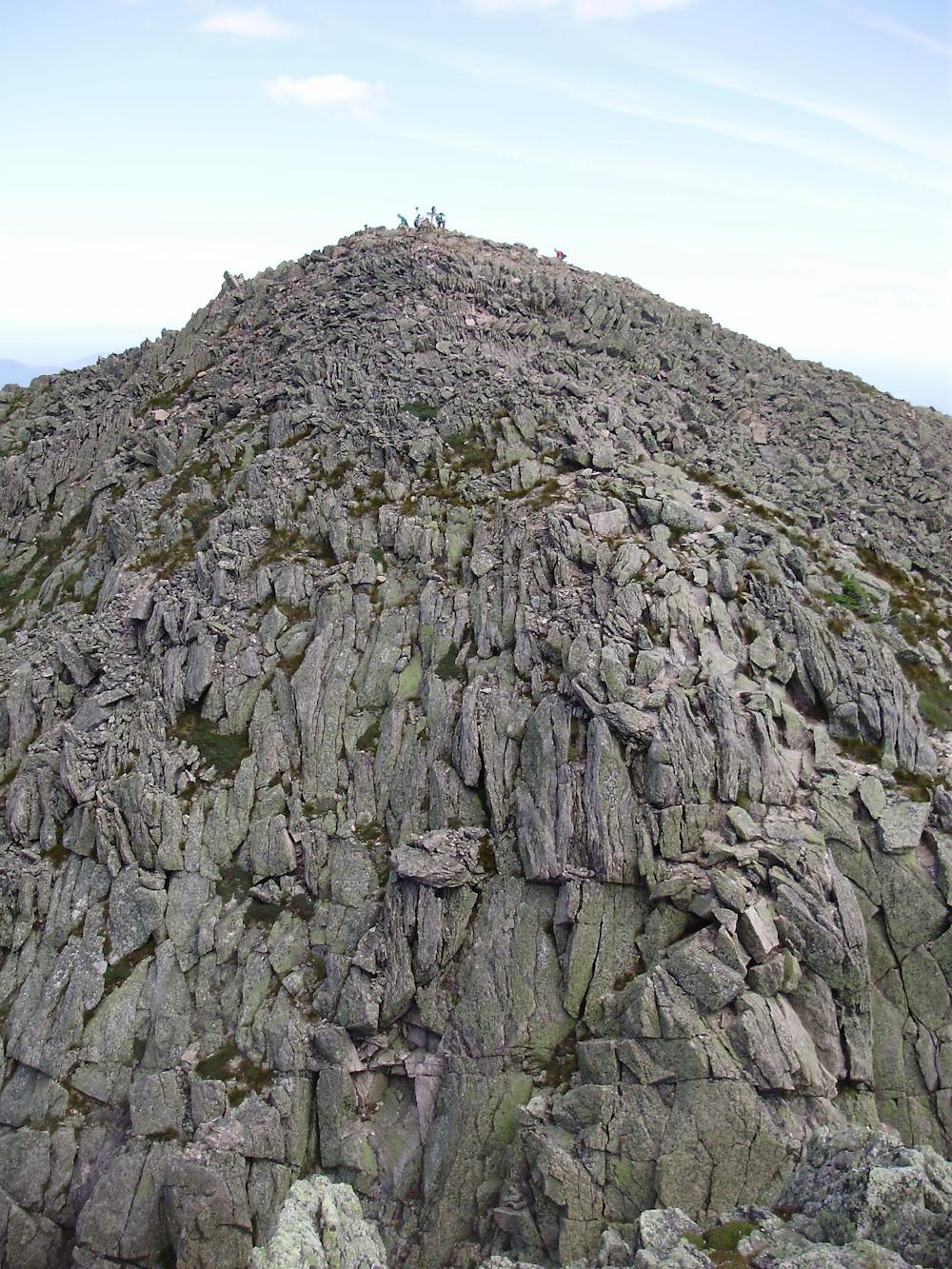
From here, you have the option to take the Cathedral Trail or Saddle Trail (shown here) down to Chimney Pond. If you are planning an overnight trip, this is where you'd need to make arrangements.
To round out the loop, follow the Chimney Pond Trail as it gradually makes its way downhill towards the trailhead.
Sources: https://en.wikipedia.org/wiki/MountKatahdin https://newengland.com/today/travel/maine/hiking-mount-katahdin-and-the-infamous-knife-edge-trail-in-maine/
Severe
Hiking challenging trails where simple scrambling, with the occasional use of the hands, is a distinct possibility. The trails are often filled with all manner of obstacles both small and large, and the hills are very steep. Obstacles and challenges are often unexpected and can be unpredictable.

Some trail sections are extremely exposed where falling will almost certainly result in serious injury or death.

Away from help but easily accessed.
9.7 km away
The shortest, most direct route to Mount Katahdin.
Extreme Hiking

58 routes · Hiking

10 routes · Hiking