5 m away
Chain of Lakes

Hiking and canoeing route deep in the Voyageurs backcountry, with lakeside campsites that guarantee solitude.
Moderate Hiking
- Distance
- 21 km
- Ascent
- 234 m
- Descent
- 234 m
Paddle or motor across Kabetogama Lake, then find this remote trail leading to a smaller lake hidden in the forest.
Hiking Moderate

This is a remote trail on the far side of the lake from Kabetogama Visitor Center, only accessible by boat. The visitor center is a common starting point, but a closer public boat launch is at Woodenfrog Campground. Navigate carefully among the lake’s many small islands to reach the trailhead in a broad cove.
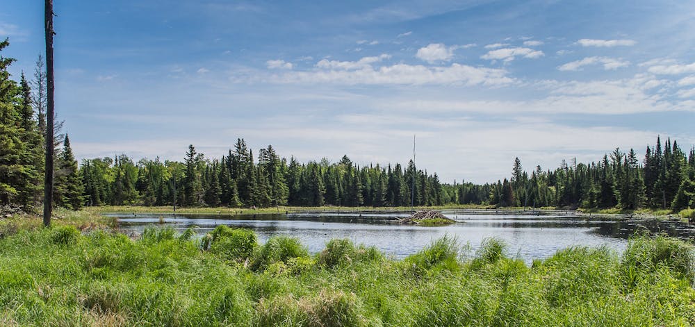
There you’ll find a small dock and a separate area to land canoes and kayaks. At the start of the trail, there is a pit toilet, then the narrow path leads off into the forest. It covers a variety of terrain, from deep woods to clearings and marshes, and brief bouldery sections with steep ups and downs. Look for beavers and their dams, and if you’re really lucky, you might spot a moose. The trail ends at the wonderfully secluded Locator Lake, among rock ledges and thick forest along the shore.
To get the most out of this hike, stop into the Kabetogama Visitor Center ahead of time and reserve a canoe on Locator Lake. They’ll loan you a key to a boat stashed at the end of the trail, then you can paddle around the deserted lake once you reach it.
Source: https://www.nps.gov/voya/planyourvisit/hiking-trails.htm
Moderate
Hiking along trails with some uneven terrain and small hills. Small rocks and roots may be present.

The trail contains some obstacles such as outcroppings and rock which could cause injury.

Little chance of being seen or helped in case of an accident.
5 m away
Hiking and canoeing route deep in the Voyageurs backcountry, with lakeside campsites that guarantee solitude.
Moderate Hiking

5 routes · Hiking