3 km away
Appalachian Trail: Crawford Notch to Pinkham Notch
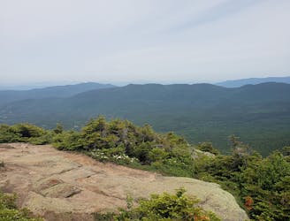
Summit the highest peak in the northeast, Mount Washington.
Severe Hiking
- Distance
- 37 km
- Ascent
- 2.6 km
- Descent
- 2.4 km
Beautiful hike to Arethusa Falls
Hiking Moderate

This is a popular hiking route which is generally considered to be moderate. It's very remote, it features medium exposure and is typically done all year round. From a low point of 357 m to the maximum altitude of 630 m, the route covers 5.1 km, 295 vertical metres of ascent and 294 vertical metres of descent.
Heavily Trafficked out and back trail located near Bartlett, NH to Arethusa Falls. The trail is primarily used for hiking and snowshoeing. Dogs are allowed but must be kept on leash.
Moderate
Hiking along trails with some uneven terrain and small hills. Small rocks and roots may be present.

The trail contains some obstacles such as outcroppings and rock which could cause injury.

Little chance of being seen or helped in case of an accident.
3 km away
Summit the highest peak in the northeast, Mount Washington.
Severe Hiking

58 routes · Hiking