1.4 km away
Bear Mountain Loop via Major Welch Trail and Appalachian Trail
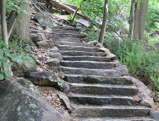
A picturesque and challenging, albeit short, hike to the the summit of Bear Mountain.
Difficult Hiking
- Distance
- 6.2 km
- Ascent
- 358 m
- Descent
- 358 m
This section passes Anthony's Nose, Canopus Lake, Nuclear Lake, and Cat Rocks ending at the Appalachian Trail Station .
Hiking Difficult
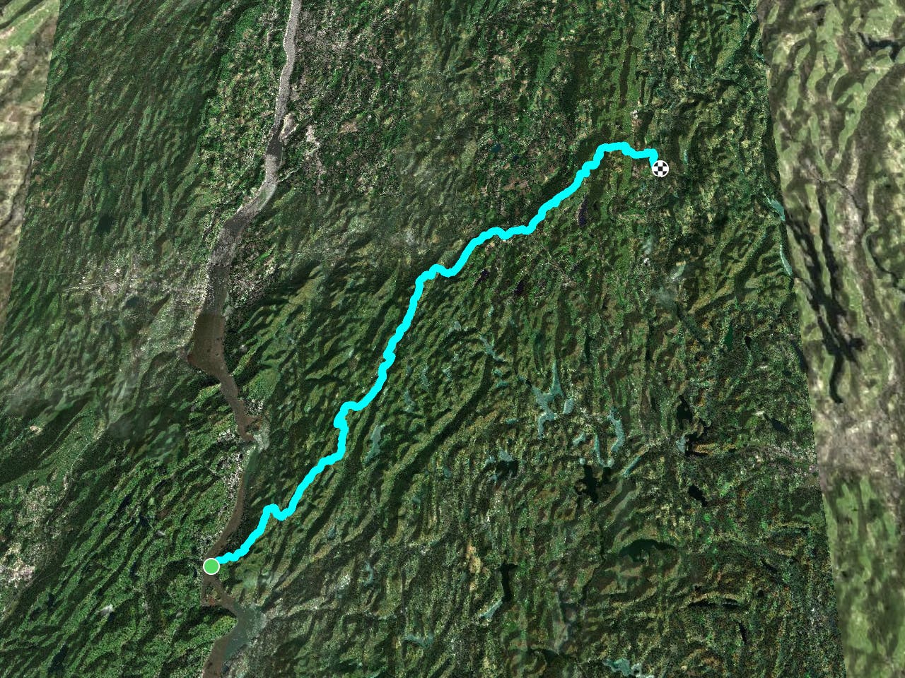
With a train station at both the southern and northern terminus, this segment creates an opportunity for a car-free point-to-point hike. Though service is limited to both stations, day hikers often utilize it over the weekends to access popular landmarks like Anthony's Nose from the south, or Cat Rocks from the north.
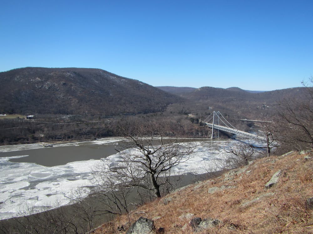
If beginning at Bear Mountain Bridge, there is typically roadside parking available, though it can become quite busy on the weekends. The AT enters the forest a few hundred feet up the road heading northeast, but an alternate access trail leads straight to Anthony's Nose, a popular overlook with an excellent vantage point to Hudson River.
Before the first road crossing, you'll reach the first campsite along the stretch. A few miles north, you'll reach US-9. A small gas station and market sit at the intersection and are often used for resupply.
Continuing north, the trail crosses several roads and meanders its way through small communities. Clarence Fahnestock State Park lies ahead and welcomes you with a few small lakes, and ultimately Canopus Lake. The trail parallels the west shore of the lake then continues north where it crosses the Taconic State Parkway. No parking area or services exist here or where the trail crosses I-84. Ahead, the trail passes another shelter, then Depot Hill before crossing NY-55.
The final portion of this segment holds two final landmarks. Several stories surround Nuclear Lake, as it was once home to a private nuclear research facility. The lake was also the site of a plutonium spill prior to its purchase by the NPS. Though picturesque and littered with wildlife, no swimming is allowed.
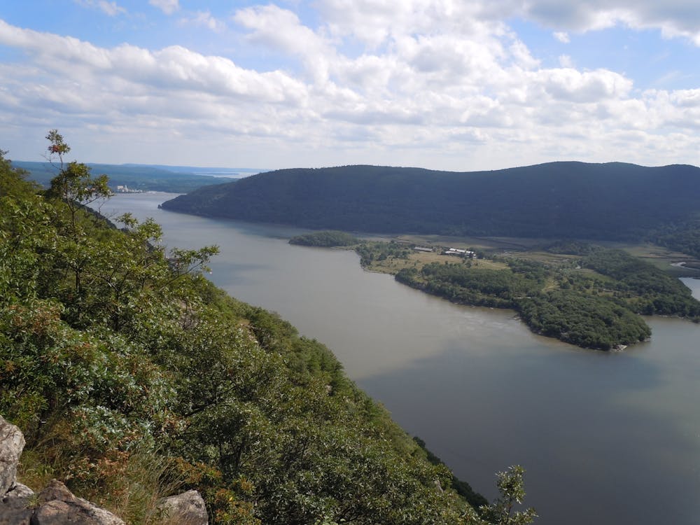
Atop West Mountain, the trail reaches the final overlook of this segment, commonly known as Cat Rocks. Its picturesque vantage point makes it a perfect opportunity for a day hike.
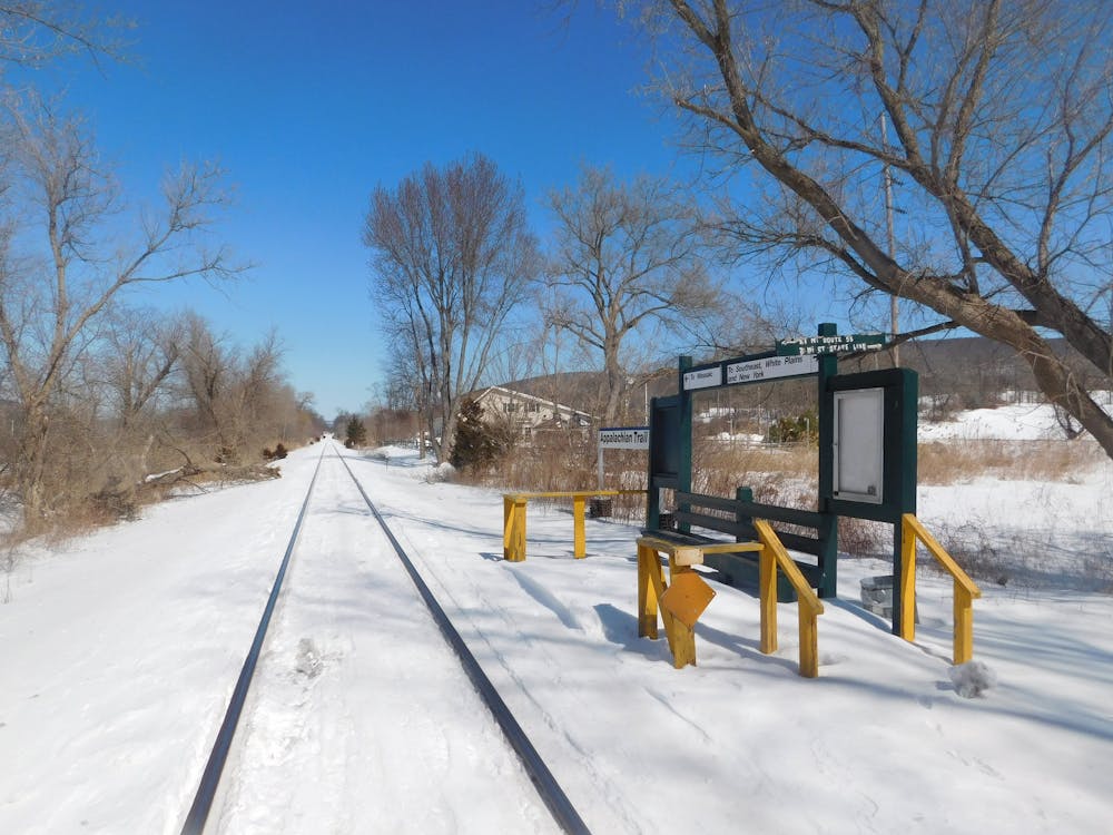
At NY-22, you'll reach the Appalachian Trail Station and a parking area just north on the road.
Sources: http://articles.latimes.com/1986-07-20/news/mn-170961appalachian-trail
Difficult
Hiking trails where obstacles such as rocks or roots are prevalent. Some obstacles can require care to step over or around. At times, the trail can be worn and eroded. The grade of the trail is generally quite steep, and can often lead to strenuous hiking.

The trail contains some obstacles such as outcroppings and rock which could cause injury.
Away from help but easily accessed.
1.4 km away
A picturesque and challenging, albeit short, hike to the the summit of Bear Mountain.
Difficult Hiking
4.6 km away
A historic loop connecting some of Bear Mountain's finest views.
Difficult Hiking
7.4 km away

A relaxing hike connecting moss-covered ponds to two defined summits.
Moderate Hiking

8 routes · Hiking

58 routes · Hiking