1.4 km away
Appalachian Trail: Bear Mountain Bridge to NY-22
This section passes Anthony's Nose, Canopus Lake, Nuclear Lake, and Cat Rocks ending at the Appalachian Trail Station .
Difficult Hiking
- Distance
- 68 km
- Ascent
- 2.6 km
- Descent
- 2.5 km
A picturesque and challenging, albeit short, hike to the the summit of Bear Mountain.
Hiking Difficult

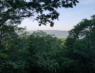
This loop pairs the Major Welch Trail with the Appalachian Trail to reach the summit of Bear Mountain, a popular destination. Rich with history, the summit provides beautiful panoramic views and is also accessible by car.
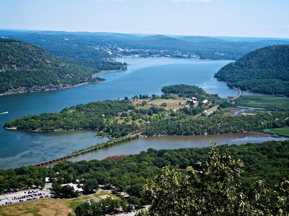
To begin this hike, park at one of the lots near Hessian Lake. There are plenty of options, but know that most require a small fee. The loop begins along the south side of the lake, just north of the ice rink. Follow the Hessian Lake Loop Trail north around the west side of the lake. Look for the Major Welch Trailhead and follow the trail up. Traversing up the north face of Bear Mountain, the trail climbs over 1,000 feet to the summit.
Despite the parking lot, the views from the summit are quite incredible and arguably some of the best in the Hudson Valley. From the Perkins Memorial Tower, you get an excellent vantage point to view surrounding states, as well as the Manhattan skyline. In the winter, the mountain provides stunning views without the crowd.
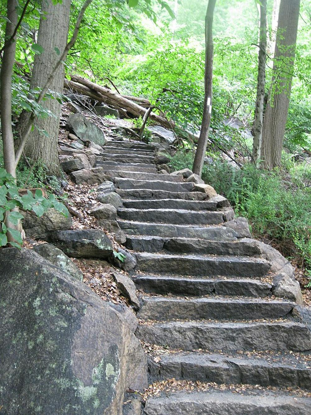
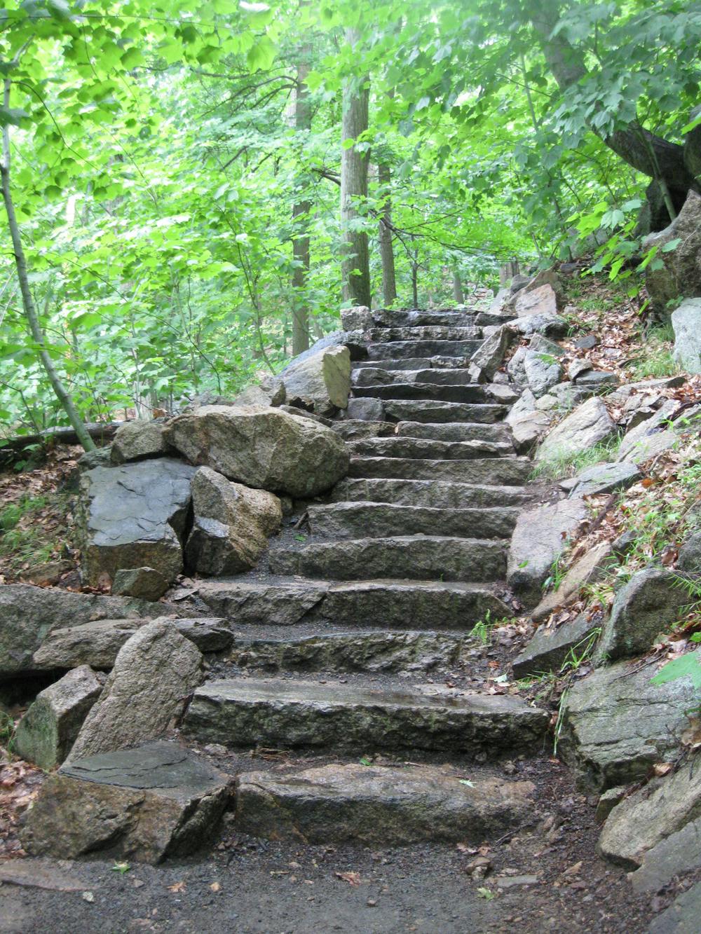
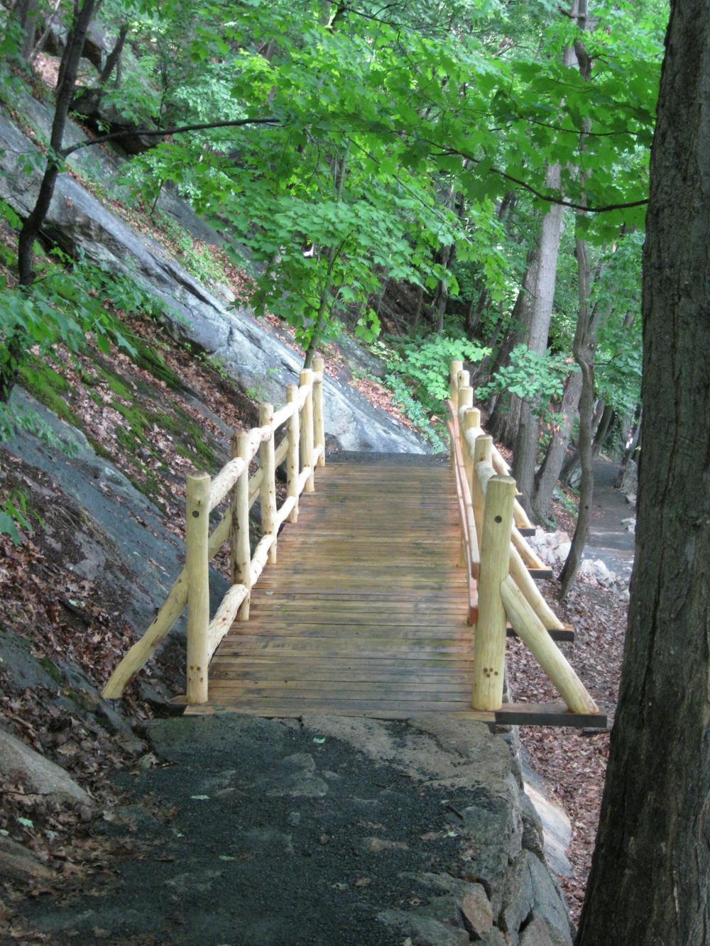
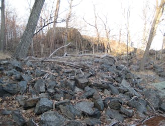
Continuing along this loop, look for the white 2x6" white blazes, the official marker of the Appalachian Trail. This section of the AT was the first stretch completed of the 2,200-mile-long trail and connects Bear Mountain south to the Deleware Water Gap. In the summer, expect to see thru-hikers making their way north to Mount Katahdin in Maine. Follow the trail north with them as it descends a series of well-built stairs and bridges. Enjoy the beautiful rock formations that make up the mountain as you head back towards Hessian Lake.
To round out the hike, retrace your steps from the lake back to where you began. For a bonus, follow the Appalachian Trail north as it heads along the east side of the lake and to the Trailside Museums and Zoo. This is the official lowest elevation on the entire AT, with its highest point located south in the Great Smoky Mountains National Park atop Clingman Dome at 6,600 feet.
Sources: https://en.wikipedia.org/wiki/BearMountainStatePark https://hikethehudsonvalley.com/hikes/bear-mountain-state-park/
Difficult
Hiking trails where obstacles such as rocks or roots are prevalent. Some obstacles can require care to step over or around. At times, the trail can be worn and eroded. The grade of the trail is generally quite steep, and can often lead to strenuous hiking.

The trail contains some obstacles such as outcroppings and rock which could cause injury.

Close to help in case of emergency.
1.4 km away
This section passes Anthony's Nose, Canopus Lake, Nuclear Lake, and Cat Rocks ending at the Appalachian Trail Station .
Difficult Hiking
4.1 km away
A historic loop connecting some of Bear Mountain's finest views.
Difficult Hiking
7.4 km away
A relaxing hike connecting moss-covered ponds to two defined summits.
Moderate Hiking

8 routes · Hiking

58 routes · Hiking