3 km away
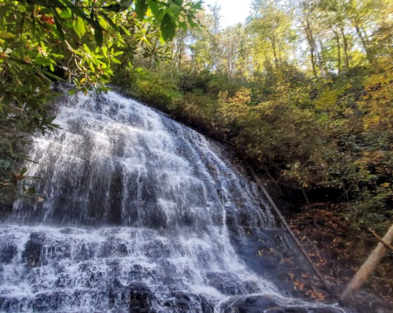
Rufus Morgan Falls
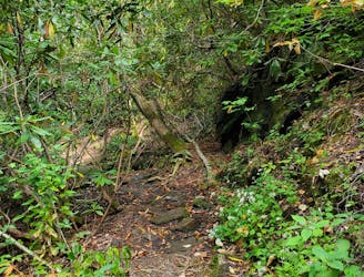
A short day hike west of Franklin to a quiet 70' waterfall.
Moderate Hiking
- Distance
- 1.5 km
- Ascent
- 80 m
- Descent
- 80 m
A beautiful trek across Wayah and Wesser Balds.
Hiking Difficult

This segment serves as an excellent point-to-point shuttle for those looking for a multi-day trip. On average a hiker will require 2 or 3 days to traverse this 28-mile stretch of the Appalachian Trail.
This particular region is an outdoor adventurer's paradise, and several different companies offer shuttles to and from these trailheads.
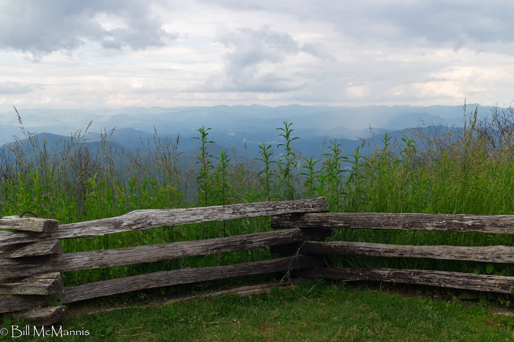
Beginning at Winding Stair Gap, the trail climbs nearly 1,500' over four miles to the summit of Siler Bald. A quick spur to the clearing is worth the panoramic views of the Nantahala National Forest.
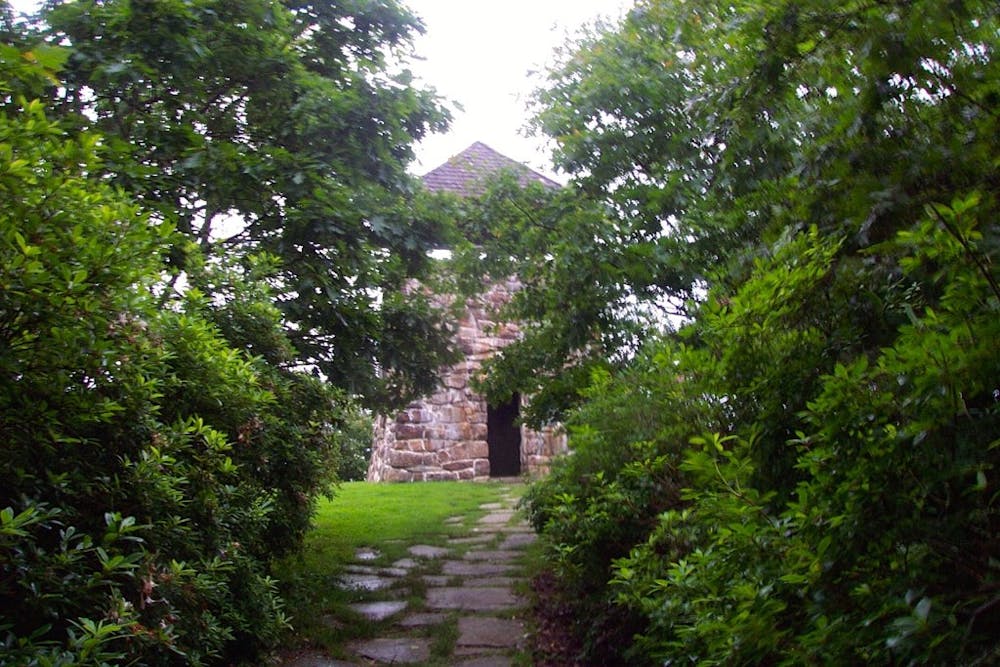
The most prominent peak of the segment is Wayah Bald, about 11 miles in. The name of this peak was believed to be a derivative of the Cherokee word "Waya" meaning "wolf". Red Wolves once inhabited this area, and ancient weapons found nearby imply that the indigenous people frequently hunted in this area.
In 1937, the CCC erected a stone observation tower to overlook the surrounding area—your reward for reaching the nearly 5,400' summit. The blooming rhododendrons and azaleas in the spring, in addition to the changing colors of the fall, make this a popular destination for hikers.
For the less adventurous, a parking area lies adjacent to the summit leaving only a short hike to the tower.
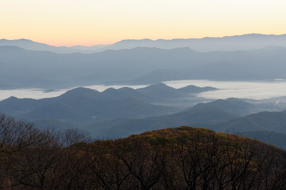
Cold Spring Shelter and Tellico Gap lie north on the trail, leaving one final landmark before the Nantahala Outdoor Center: Wesser Bald. Just 5.5 miles from the NOC, this summit serves as an excellent destination for a day hiker or trail runner.
The unimpeded 360° view from the observation tower makes it a great place to stop to enjoy some lunch. Its location relative to its surroundings offers a vantage point of the upcoming Smokies—a rugged, yet rewarding piece of land encompassing the highest points in the Southeast.
The NOC provides numerous options for accommodations, food, and an outdoor outfitter should you find yourself needing any supplies.
Sources: https://en.wikipedia.org/wiki/WesserBald https://en.wikipedia.org/wiki/WayahBald https://outonthetrail.wordpress.com/2015/04/21/appalachian-trail-winding-stair-gap-franklin-nc-to-nantahala-outdoor-center-bryson-city-nc/
Difficult
Hiking trails where obstacles such as rocks or roots are prevalent. Some obstacles can require care to step over or around. At times, the trail can be worn and eroded. The grade of the trail is generally quite steep, and can often lead to strenuous hiking.

The trail contains some obstacles such as outcroppings and rock which could cause injury.
Away from help but easily accessed.
3 km away
A short day hike west of Franklin to a quiet 70' waterfall.
Moderate Hiking

58 routes · Hiking
10 routes · Hiking