902 m away
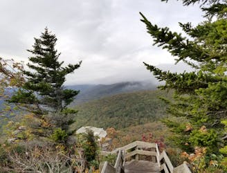
Stack Rock
A short hike to a unique rock formation, and a great opportunity to stretch your legs after a drive.
Moderate Hiking
- Distance
- 698 m
- Ascent
- 18 m
- Descent
- 18 m
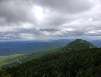
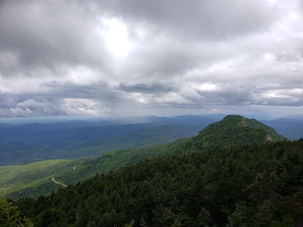
A short hike beneath Grandfather Mountain with spectacular views of the surrounding Blue Ridge.
Hiking Moderate

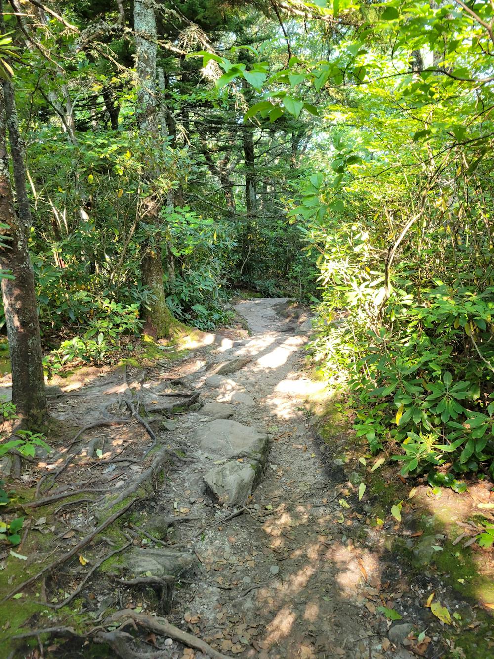
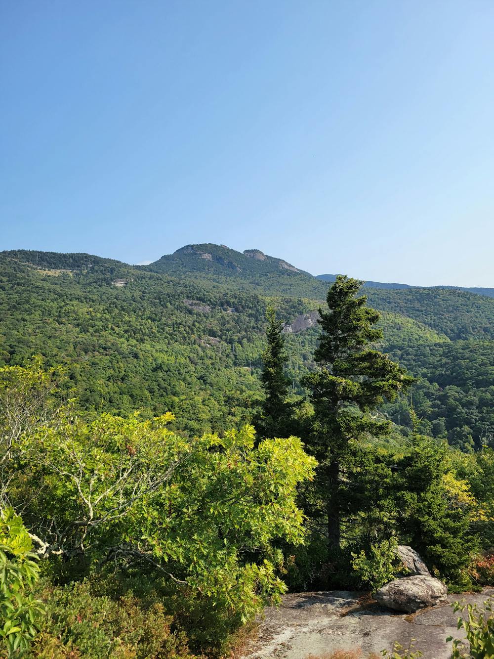
Nestled beneath the mighty Grandfather Mountain, Beacon Heights is a beautiful short hike with seemingly endless views from an exposed rock face. From the parking lot, you'll begin with a view looking up towards Raven Rocks. Then the trail leads to two defined overlooks with long, sweeping views looking off onto the horizon. The nearby Grandmother Mountain can also be seen to the southwest, noted by the large broadcasting tower erected on its summit.
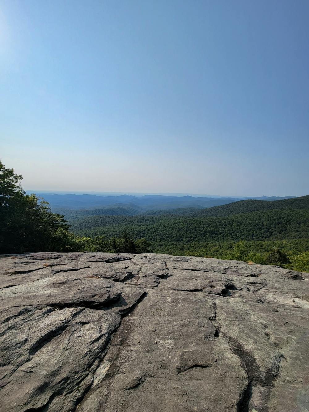
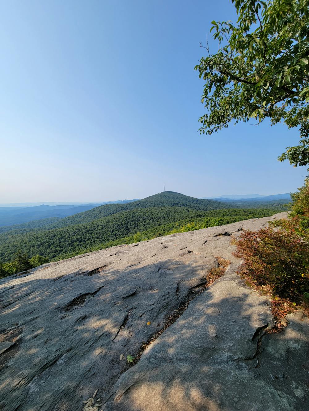
If you're driving the Blue Ridge Parkway, Beacon Heights is the perfect way to stretch your legs and a great place to enjoy lunch with a view. It's less than 20 minutes from Blowing Rock and less than 2 hours for those traveling from Asheville. Whether you're spending the day in the area or just passing through, this beautiful overlook hike shouldn't be passed up.
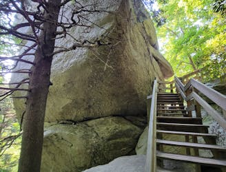
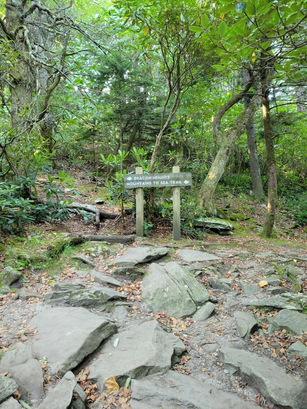
Moments down the road, Stack Rock is another short hike that pairs well with Beacon Heights. Though it offers no views along the trail, a wooden staircase circles around a massive rock formation, and the dark forest floor hosts beautiful wildflowers and fungi, depending on the time of year. The hikes are also connected via the Tanawha Trail, which is part of the larger Mountains to Sea Trail.
To enjoy this hike, hit the BRP or take US-221 to where it meets the parkway. The lot can hold up to 10 vehicles, with more options nearby if it's full. There are no restrooms or facilities at the pull-off, but there is plenty of cell reception. This hike can also be enjoyed year-round, though parts of the BRP close for ice and snow during the winter. US-221, however, is treated and plowed as needed.
Moderate
Hiking along trails with some uneven terrain and small hills. Small rocks and roots may be present.

The trail contains some obstacles such as outcroppings and rock which could cause injury.
Away from help but easily accessed.
902 m away
A short hike to a unique rock formation, and a great opportunity to stretch your legs after a drive.
Moderate Hiking
1.2 km away
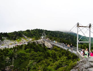
An out-and-back with stunning views from the Mile High Swinging Bridge in Grandfather Mountain SP.
Moderate Hiking
3.4 km away
A scenic short hike to a rocky overlook with sweeping views.
Moderate Hiking
3.9 km away

A difficult and steep path connecting NC-105 to the highest point on Grandfather Mountain, Calloway Peak.
Difficult Hiking
5.9 km away
A classic - yet difficult - hike to Calloway Peak in Grandfather Mountain State Park.
Difficult Hiking

10 routes · Hiking

16 routes · Hiking
6 routes · Hiking