2.5 km away
Stack Rock
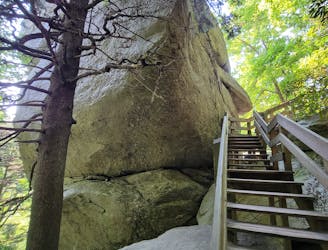
A short hike to a unique rock formation, and a great opportunity to stretch your legs after a drive.
Moderate Hiking
- Distance
- 698 m
- Ascent
- 18 m
- Descent
- 18 m
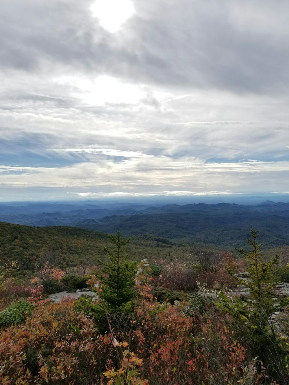
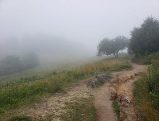
A scenic short hike to a rocky overlook with sweeping views.
Hiking Moderate

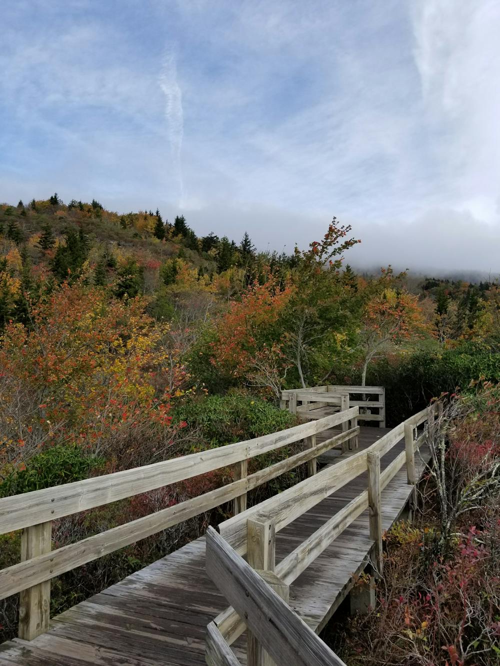
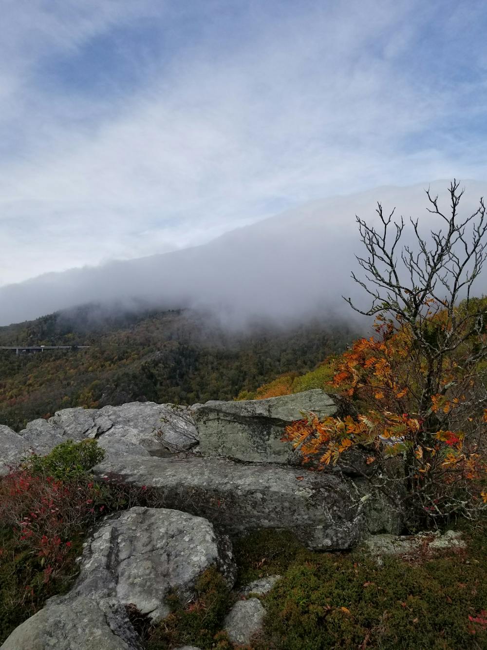
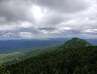
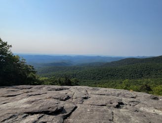
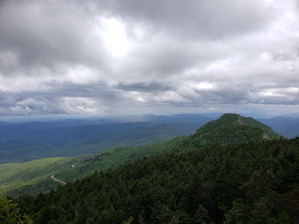
Rough Ridge is a short hike from the Blue Ridge Parkway with something for everyone. Just .3-miles from the trailhead, a boardwalk passes over fragile vegetation and offers incredible views to the south. Another .5-miles up, you'll reach the high point of Rough Ridge, a boulder-strewn summit perfect for a picnic. However you hike it, this is an overlook that you won't want to pass up.
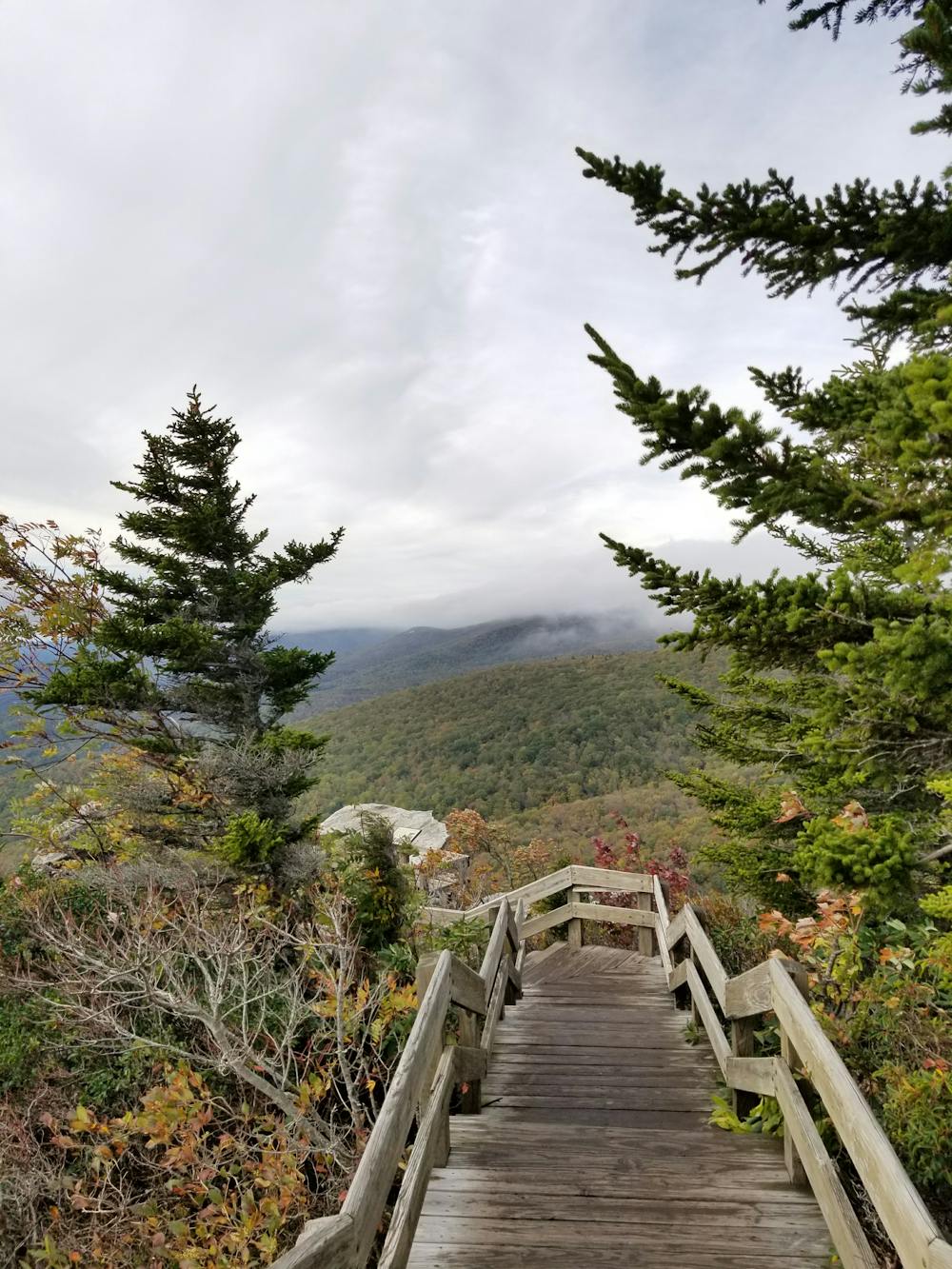
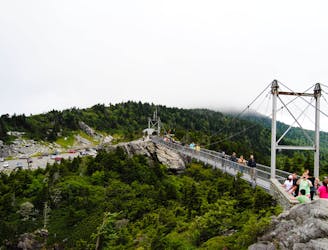
The trailhead is accessed by the Blue Ridge Parkway, often from the west. This is also one of the most memorable portion of the entire 469-mile scenic roadway. As the last piece of the roadway to be completed, the Linn Cove Viaduct faced delays in construction for nearly 20 years. Completed in 1987, its construction laid a foundation for construction techniques for years to come.
From the trailhead, this hike follows a short connector trail that ties into the Mountains to Sea Trail. This section of the MST is also coaligned with the Tanawaha Trail, a 13-mile path that parallels the Blue Ridge Parkway around Grandfather Mountain. According to Wikipedia, "the mountain boasts 16 distinct ecological communities" and is the highest peak along the eastern Blue Ridge.
Sources: https://www.blueridgeparkway.org/poi/linn-cove-viaduct/ https://en.wikipedia.org/wiki/GrandfatherMountain https://www.romanticasheville.com/roughridge.htm
Moderate
Hiking along trails with some uneven terrain and small hills. Small rocks and roots may be present.
2.5 km away
A short hike to a unique rock formation, and a great opportunity to stretch your legs after a drive.
Moderate Hiking
2.8 km away
A classic - yet difficult - hike to Calloway Peak in Grandfather Mountain State Park.
Difficult Hiking
3 km away
An out-and-back with stunning views from the Mile High Swinging Bridge in Grandfather Mountain SP.
Moderate Hiking
3.4 km away
A short hike beneath Grandfather Mountain with spectacular views of the surrounding Blue Ridge.
Moderate Hiking
4 km away

A difficult and steep path connecting NC-105 to the highest point on Grandfather Mountain, Calloway Peak.
Difficult Hiking
7.8 km away
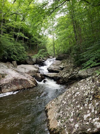
A beautiful loop including a high country meadow and pristine waterfalls.
Difficult Hiking

10 routes · Hiking

16 routes · Hiking
8 routes · Hiking · Trail Running
6 routes · Hiking