4.3 km away
Mountains to Sea Trail: Mitchell to NC-181
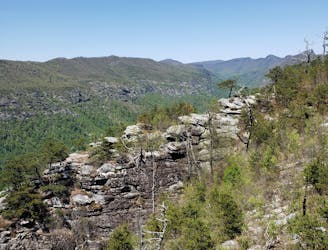
A segment of the Mountains to Sea Trail best known for its traverse through Linville Gorge.
Difficult Hiking
- Distance
- 95 km
- Ascent
- 3.8 km
- Descent
- 4.9 km
An incredibly challenging, yet rewarding, approach to Mount Mitchell.
Hiking Severe

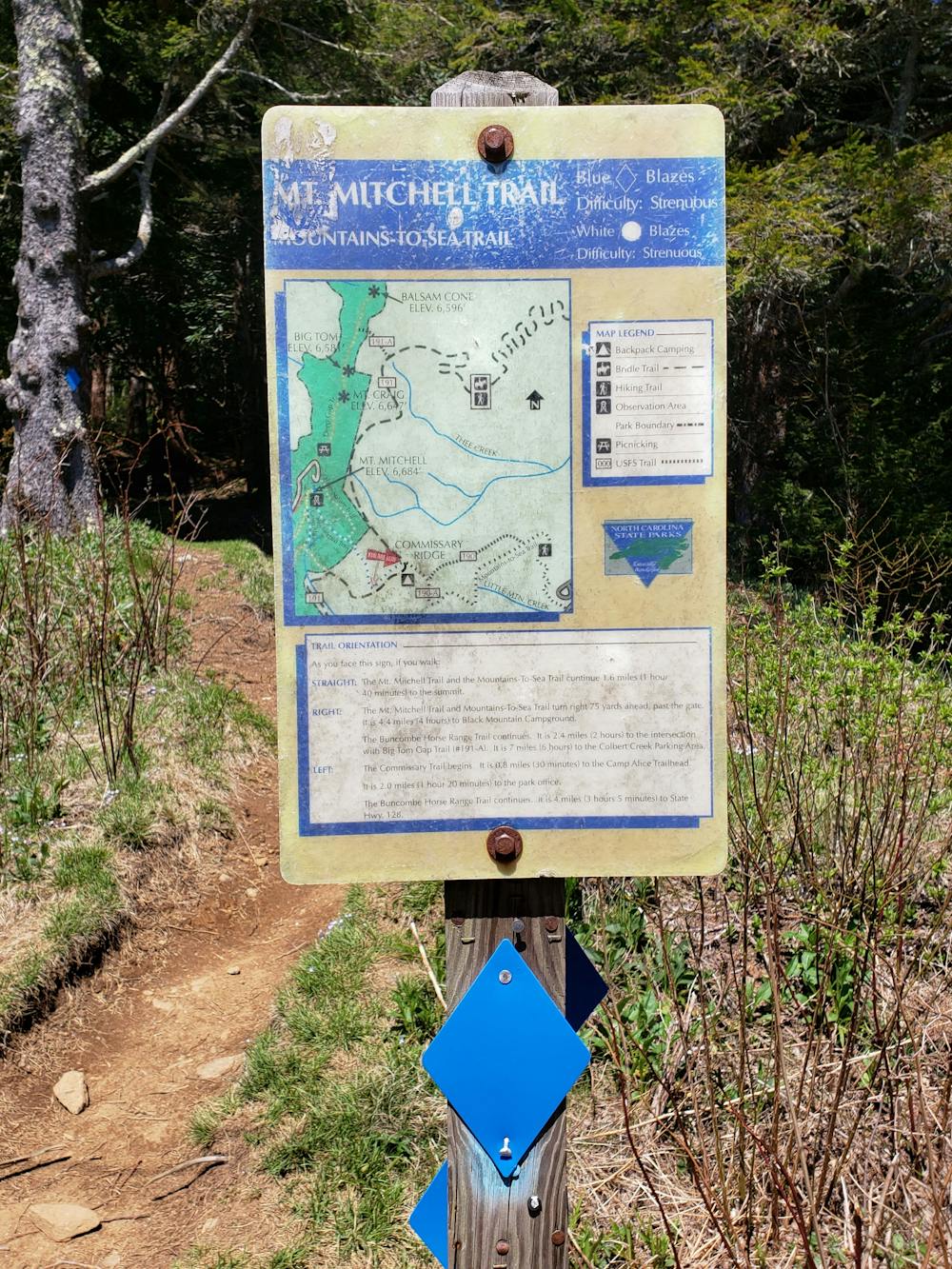
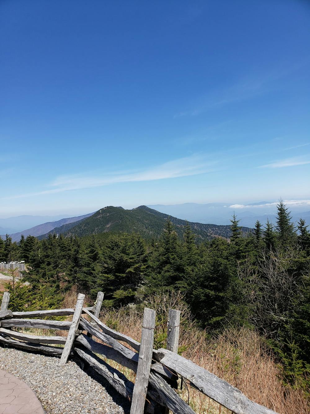
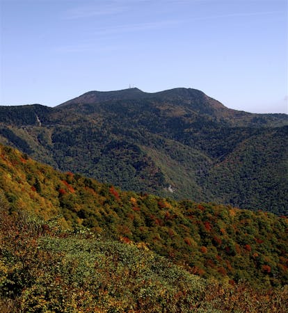
According to North Carolina State Park's official website, this is the primary route chosen to climb Mount Mitchell on foot. As the highest peak east of the Mississippi River, hikers have an ~6-mile trek between Black Mountain Campground to their destination atop the summit. Soaring high at 6,684 feet above sea level, the mountain is home to a unique ecosystem and provides incredible views of the surrounding Blue Ridge.
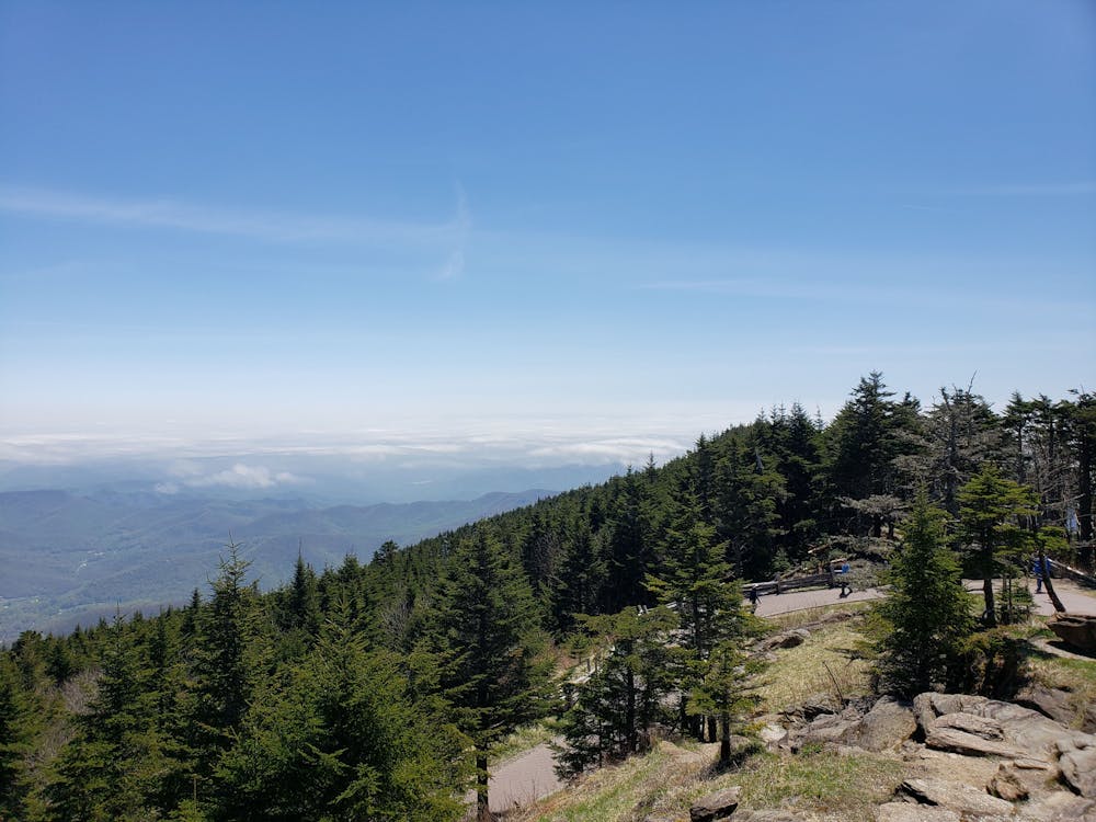
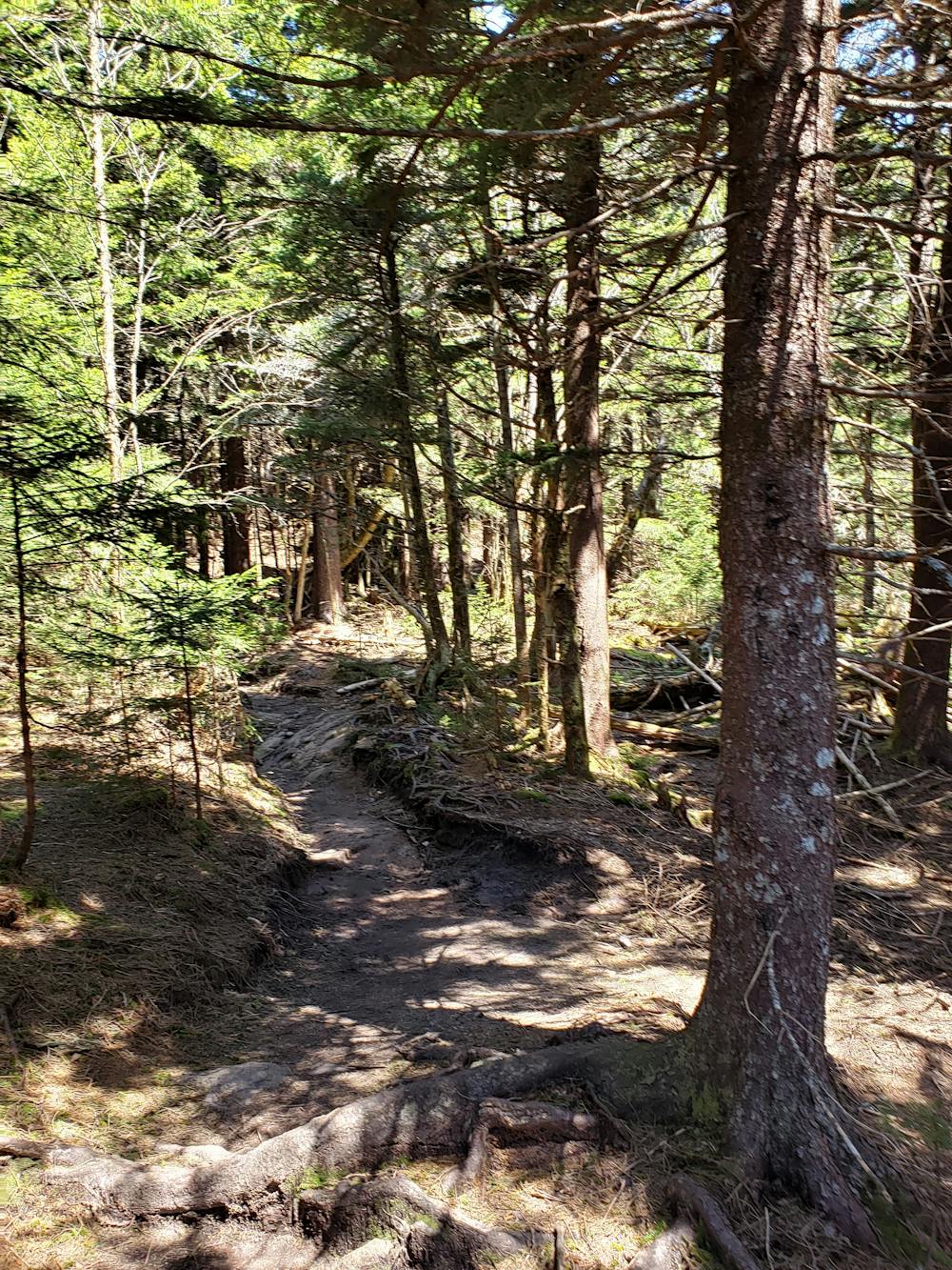
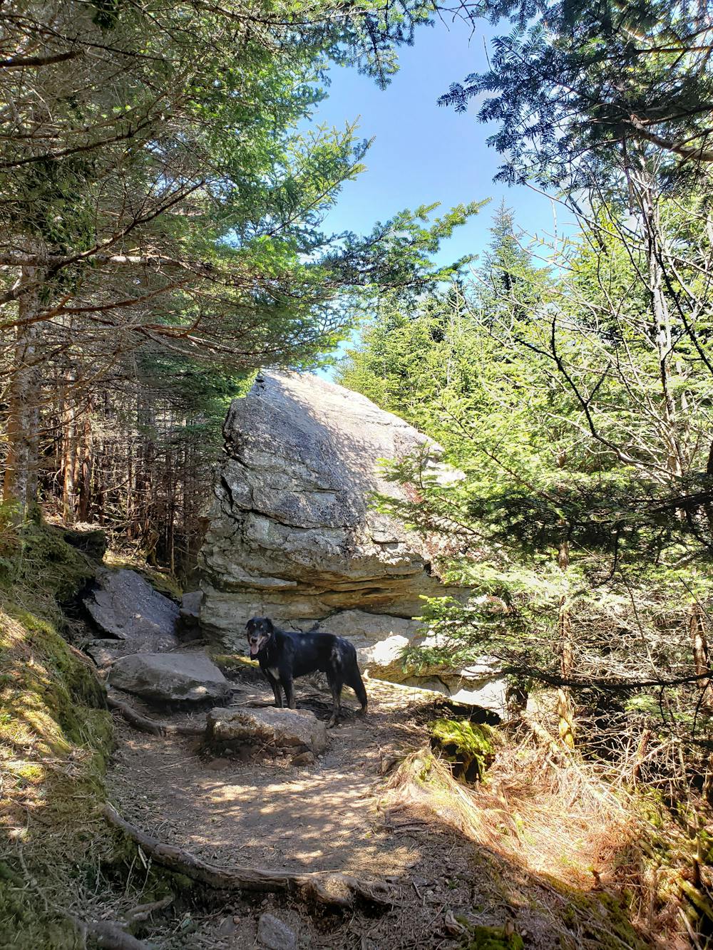
The hike up is incredibly challenging as the terrain transitions into the spruce-fir forest typically confined to the northern latitudes. As you near the summit, you'll notice how the harsh weather has taken its toll on the ecosystem. The frigid winter temperatures and high winds have killed many of the trees, and the area shows a resemblance to the Green and White Mountains of New England.
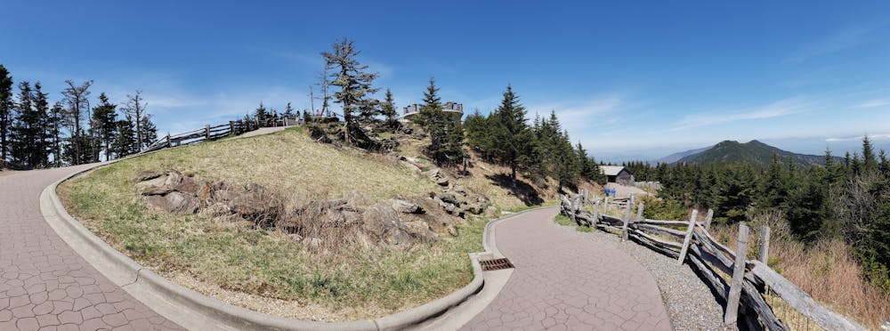
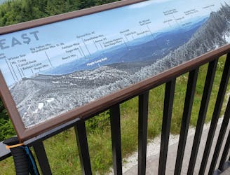
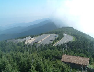
Upon reaching the summit, the Mount Mitchell Trail merges with a paved trail leading to the summit. Atop the observation deck, enjoy the sweeping views from the highest point east of the Mississippi River. A placard denotes the official summit, and the nearby parking area makes the summit accessible by car for the less adventurous.
While you could return the same way, this route circles the southern face of the summit before returning on the Mountain Mitchell Trail. Connect the Old Mitchell, Camp Alice, Commissary, and Buncombe Horse Trails back to the trail junction near Commissary Hill.
For those looking for a point-to-point option, NC State Parks states that, "arrangements can be made with (Hiker Transport) Yancey County Transit Authority at 828-682-6144 (requires 48-hour advanced notice and fee)."
Know that weather at such high elevation can change quickly and/or become dangerous. In the summer months, afternoon storms are not uncommon at higher elevations. In contrast, winter access to the park can be limited due to ice and snow. It is not uncommon for the temperature at the summit to be 20 (or more) degrees cooler than the nearby town of Asheville.
Sources: https://www.ncparks.gov/mount-mitchell-state-park/trails
Severe
Hiking challenging trails where simple scrambling, with the occasional use of the hands, is a distinct possibility. The trails are often filled with all manner of obstacles both small and large, and the hills are very steep. Obstacles and challenges are often unexpected and can be unpredictable.

Some trail sections have exposed ledges or steep ascents/descents where falling could cause serious injury.
Little chance of being seen or helped in case of an accident.
4.3 km away
A segment of the Mountains to Sea Trail best known for its traverse through Linville Gorge.
Difficult Hiking
4.4 km away
An easy, paved path to the observation platform on Mount Mitchell.
Easy Hiking
5.2 km away
A classic hike to the summit of Mount Mitchell, the highest point east of the Mississippi River.
Difficult Hiking
9.7 km away
A wild loop with waterfalls, sweeping views, and a trek past an abandoned mica mine.
Difficult Hiking
7 routes · Hiking

7 routes · Hiking

10 routes · Hiking

16 routes · Hiking

17 routes · Hiking · Trail Running