140 m away
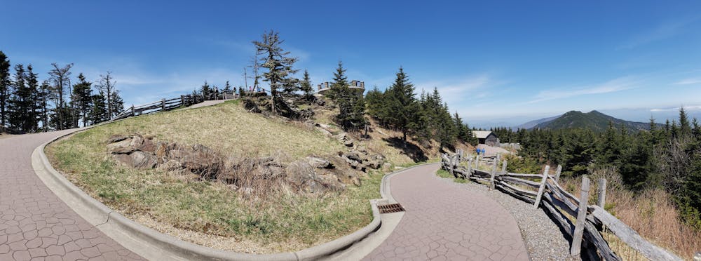
Mount Mitchell Summit Trail
An easy, paved path to the observation platform on Mount Mitchell.
Easy Hiking
- Distance
- 660 m
- Ascent
- 30 m
- Descent
- 30 m
A segment of the Mountains to Sea Trail best known for its traverse through Linville Gorge.
Hiking Difficult

At nearly 1,200 miles long, the Mountains-to-Sea Trail is North Carolina's premier long-distance hiking trail. Connecting the Great Smoky Mountains to the Outer Banks, this portion of the trail is best known for its traverse through Linville Gorge.
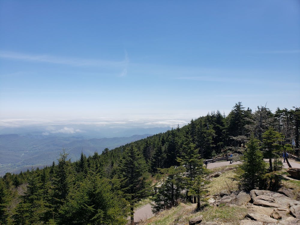

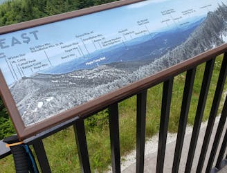
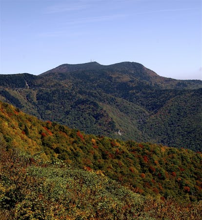
This segment begins with a long, steady descent from Mount Mitchell, following the same path as the Mount Mitchell Trail. According to North Carolina State Park's official website, this is the primary route chosen to climb Mount Mitchell on foot. As the highest peak east of the Mississippi River, hikers have an ~6-mile trek between Black Mountain Campground to their destination atop the summit.
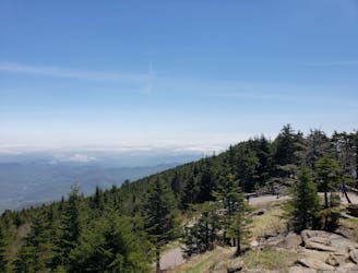
Passing through the campground, the MST crosses the South Toe River before beginning a long steady climb. Ahead, the trail re-enters the Blue Ridge Parkway corridor for a short stretch before diverting east and following the Woods Mountain Trail. Take a short spur to the official summit to enjoy some excellent views from 3,600'.
A descent down the ridge, followed by a short climb leads into a major road crossing at US-221. For thru-hikers, this is an excellent opportunity to resupply. The small town of Marion lies just to the south.
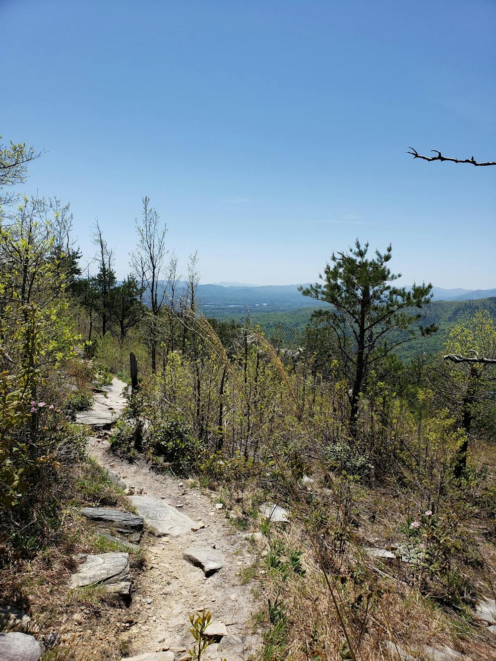
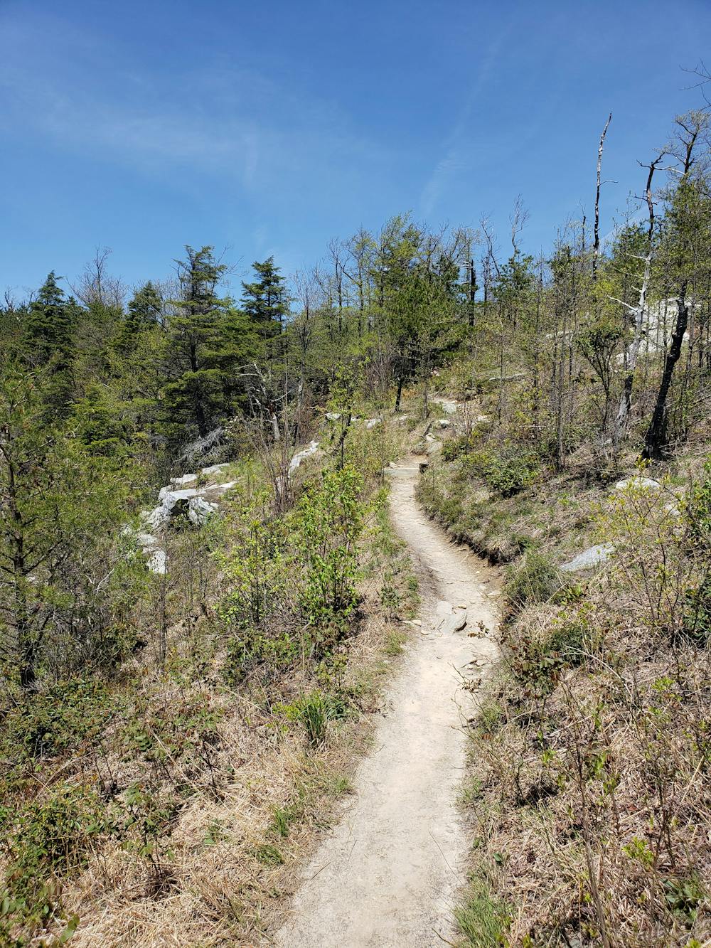
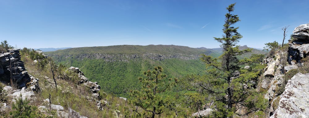
Continue east on the trail as it climbs to another ridge. Several named summits and a few clearings provide incredible views along the way. Linville River lies ahead, the gateway to an epic stretch of trail through the wilderness. As of 2019, a bridge across the river was damaged by flooding, requiring hikers to ford the river.
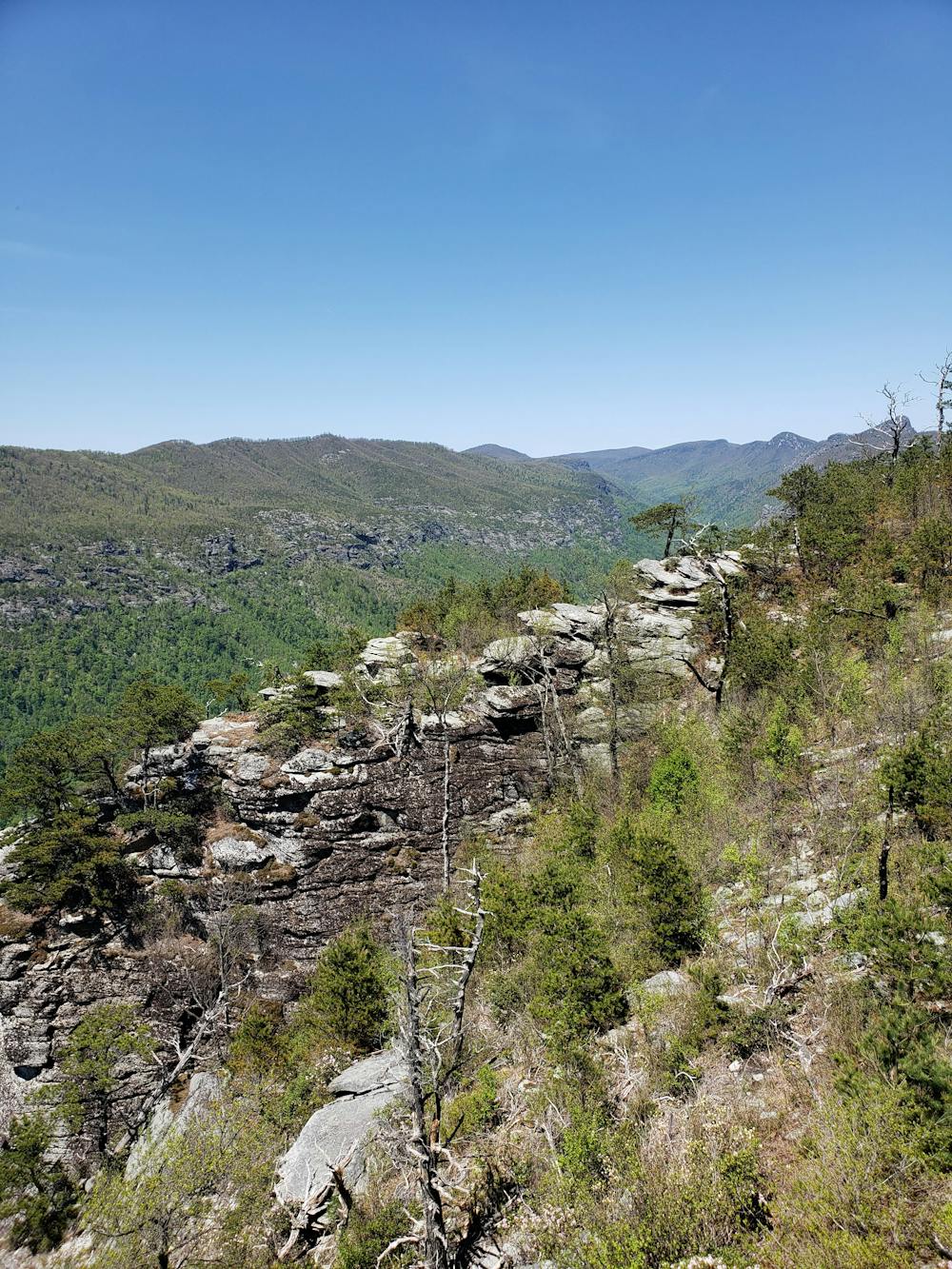
Ahead, make your way up the trail along the eastern rim of the gorge as it summits several popular and picturesque mountains. Shortoff, The Chimneys, and Table Rock Mountain are all incredibly beautiful and an excellent stretch of the trail to complete a shorter thru-hike. A popular option is to begin at Table Rock, hike the MST to Shortoff Mountain, then end at the Wolf Pit Trailhead.
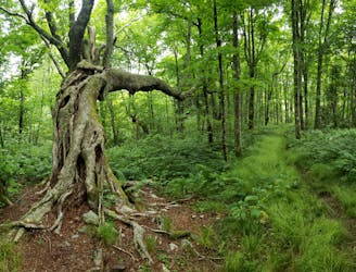
Plenty of primitive camping opportunities lie along this stretch, and the rock bluffs make a popular destination for rock climbing as well.
After a steady descent from Table Rock, the final portion of this segment follows Steels Creek Trail nearly to NC-181. A small dirt pull-off serves as the eastern terminus for the segment.
Sources: https://mountainstoseatrail.org/
Difficult
Hiking trails where obstacles such as rocks or roots are prevalent. Some obstacles can require care to step over or around. At times, the trail can be worn and eroded. The grade of the trail is generally quite steep, and can often lead to strenuous hiking.

Some trail sections have exposed ledges or steep ascents/descents where falling could cause serious injury.
Little chance of being seen or helped in case of an accident.
140 m away
An easy, paved path to the observation platform on Mount Mitchell.
Easy Hiking
2.5 km away
A classic hike to the summit of Mount Mitchell, the highest point east of the Mississippi River.
Difficult Hiking
4.3 km away
An incredibly challenging, yet rewarding, approach to Mount Mitchell.
Severe Hiking
6.5 km away
An epic ridgetop traverse connecting the Blue Ridge Parkway to NC-197.
Difficult Hiking
7 km away
A wild loop with waterfalls, sweeping views, and a trek past an abandoned mica mine.
Difficult Hiking
7 routes · Hiking

7 routes · Hiking

10 routes · Hiking

16 routes · Hiking

17 routes · Hiking · Trail Running