3.9 km away
Red Butt Falls
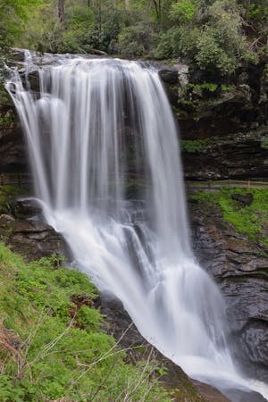
A long, steady waterfall with a cavernous overhang, deep potholes, and unique flora - deep in Panthertown Valley.
Moderate Hiking
- Distance
- 8.5 km
- Ascent
- 257 m
- Descent
- 257 m
A short hike in Panthertown with two waterfalls and an impressive overlook of the valley.
Hiking Difficult

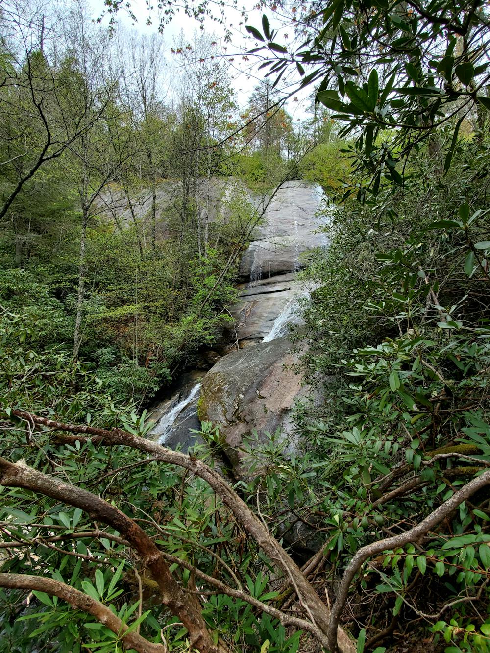
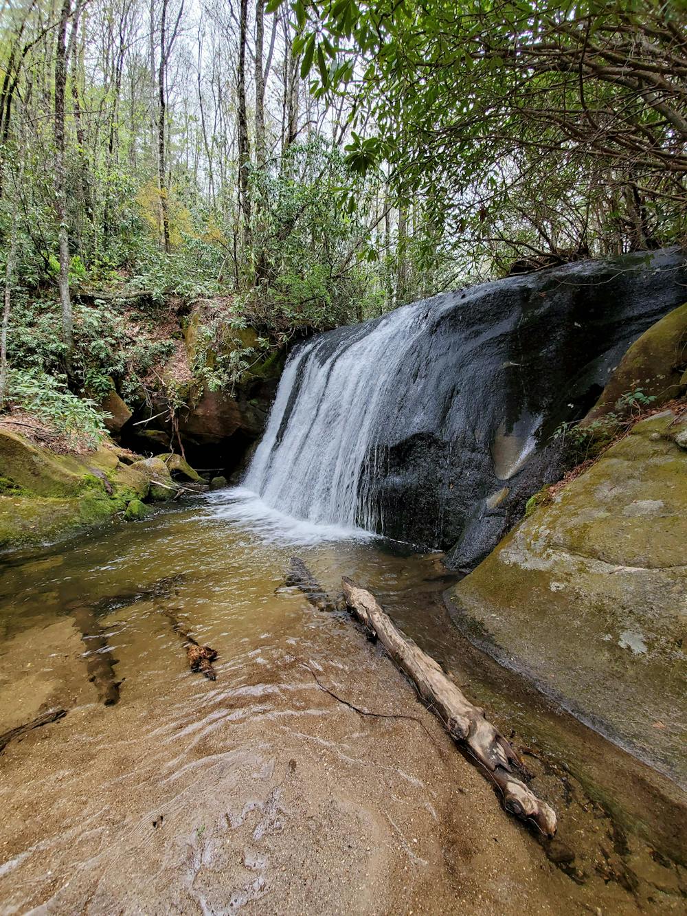
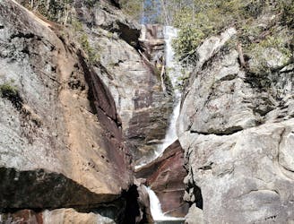
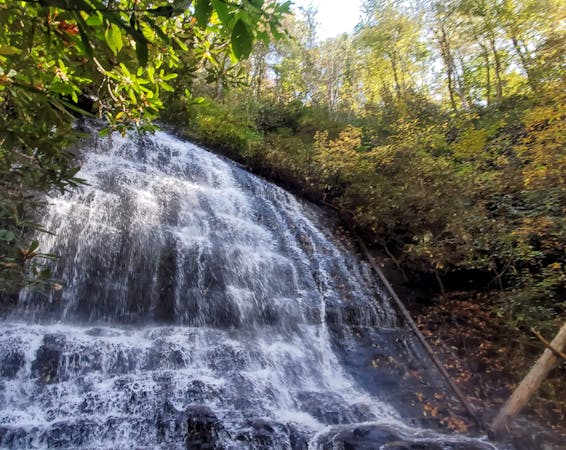
This short, yet strenuous, hike includes two of Panthertown's many waterfalls, and one of its most coveted views on this 2-mile loop. Wilderness Falls is an epic backcountry waterfall trickling down a massive rock face, while the contrasting Frolicktown Falls offers a peaceful riverside view of a small 15' waterfall cascading over a former road. The hike begins just 15 minutes from Cashiers or Lake Glenville. There are no facilities at the trailhead other than a porta potty.
From the trailhead, follow the gravel road behind the closed gate, also known as Panthertown Valley Trail. After a few minutes, you'll see a sign for Wilderness Falls trail to the right — follow that. There is a trail registry located along the way denoting a mandatory "registration," but it hasn't been checked in years.
The trek down to Wilderness Falls is steep and straightforward, but there is one often-missed intersection to watch for. The path naturally veers to the right to an open rock face with some partial views, while the official trail actually heads left and further down to the base of the waterfall. Look for the green 2x6 blaze. While there are some views to be had, you are near the top of the waterfall, which can be incredibly dangerous — if not deadly — should you wander further.
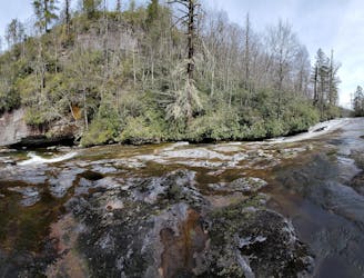
Ahead, you'll be welcomed with a view of Wilderness Falls, and just a few minutes away, Frolicktown comes not long after, accessible via a side trail. You will hear both before you see them.
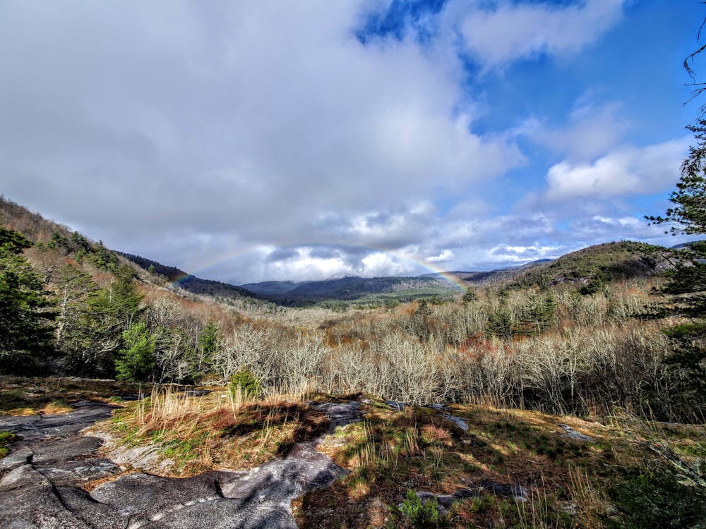
Leaving Frolicktown, keep left at the next "Y" in the road, then left at the next junction with Panthertown Valley Trail. It leads straight back to the parking area, but don't pass up the views from Salt Rock Overlook along the way. They are incredible, and if you can get there after a recent summer rainstorm, you might even witness a full rainbow arching its way over the valley.
Note: Panthertown Valley is extremely difficult to navigate without a local map, or guide. There are over two dozen listed waterfalls (and many more), but only a few are listed on the USFS map. Stop at any local outfitter and grab a map, or hire a local guide such as White Dot Adventures to show you around.
Difficult
Hiking trails where obstacles such as rocks or roots are prevalent. Some obstacles can require care to step over or around. At times, the trail can be worn and eroded. The grade of the trail is generally quite steep, and can often lead to strenuous hiking.

The trail contains some obstacles such as outcroppings and rock which could cause injury.

Little chance of being seen or helped in case of an accident.
3.9 km away
A long, steady waterfall with a cavernous overhang, deep potholes, and unique flora - deep in Panthertown Valley.
Moderate Hiking
7.2 km away
A steep trail with fixed ropes leading to one of the most spectacular waterfalls in Western North Carolina.
Difficult Hiking
5 routes · Hiking
10 routes · Hiking