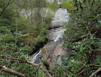
Silver Run Falls

A short, family-friendly waterfall hike less than 10 minutes from Cashiers.
Easy Hiking
- Distance
- 353 m
- Ascent
- 10 m
- Descent
- 10 m
Whether you’re planning a visit to Cashiers or Highlands, or looking for a day trip from Asheville, this guidebook will introduce you to four of the best waterfall hikes along North Carolina’s “Blue Wall.”
Hiking Easy, Moderate, Difficult
Also known as the “Blue Wall,” the Cashiers-Highlands Plateau is the gateway into the Blue Ridge Mountains. Massive rock faces tower over steep river gorges lined with an endless array of waterfalls. While this is not a complete waterfall guide of the region, this guidebook showcases 5 must-do waterfall hikes between Lake Toxaway and Highlands on the Highway 64 corridor.
To see the highest waterfall east of the Rockies, first stop at Whitewater Falls just outside of Lake Toxaway. There is a paved path to a stunning overlook of the falls, or you could make your way down a steep staircase for an even more impressive view! This is a National Forest Fee Area, so be sure to bring along some cash for the self-service kiosk. The hike is also completely paved to the main overlook, so you can leave your gear in the car – just be sure to bring a camera so you can take a photo!
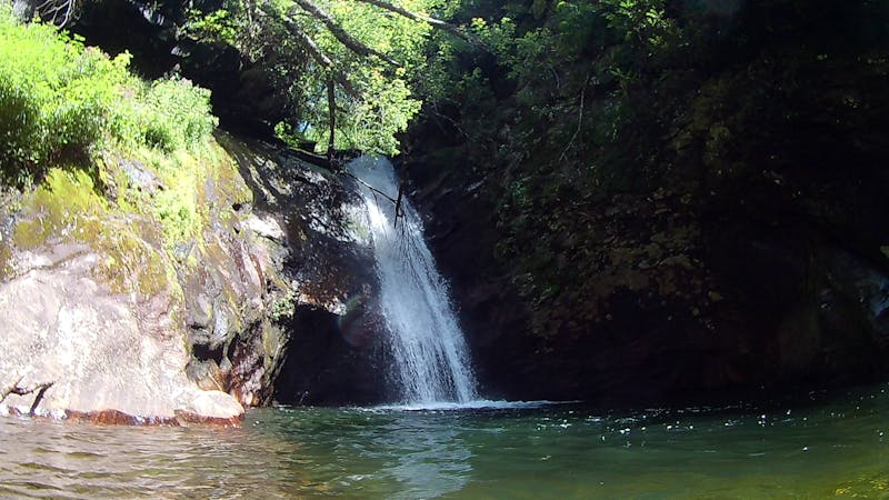
Just outside of Cashiers and south on NC-107, Silver Run Falls is a great roadside waterfall less than ¼-mile from the road. The path is mostly gravel and boardwalks, so you don’t even have to get your feet wet! Bring your swimsuit though—this summer swimming hole is one you do not want to pass up.
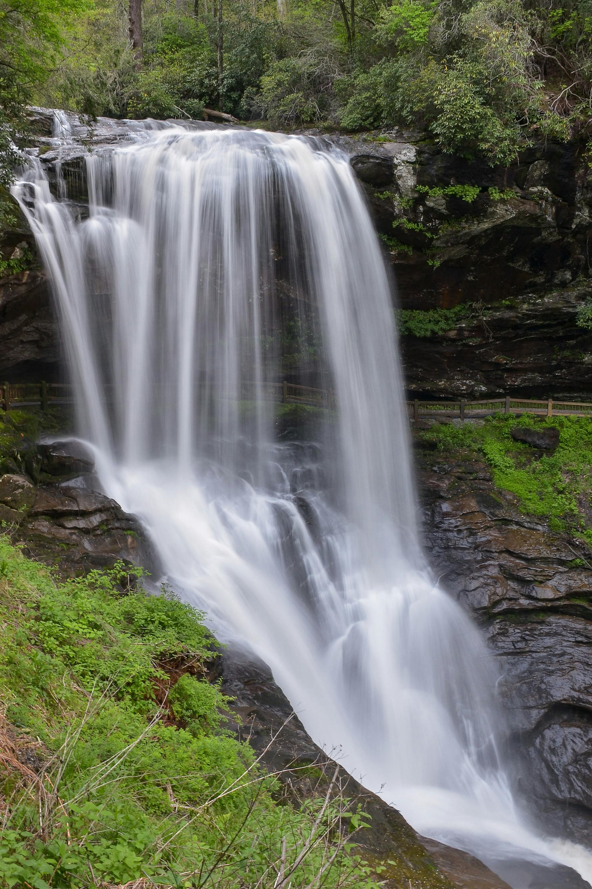
High Falls and Dry Falls are two waterfalls in the area that are often confused due to their names. Dry Falls is a short hike just outside of Highlands in the Cullasaja Gorge and a popular spot for those visiting the area. The path is short, easy, and well-maintained as it plummets down a short staircase and ultimately – behind the falls! Dry Falls is easily one of the most recognized waterfalls in the area, and it shouldn’t take more than 30 minutes to complete the trek.
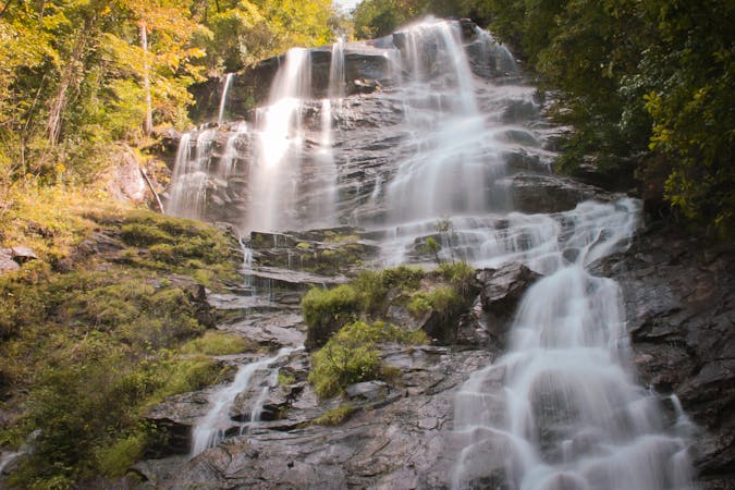
In contrast, High Falls below Lake Glenville is the longest route to make this list. From the top, it’s only 1/2-mile down to the waterfall, but it's rather steep. Instead, start from the bottom and enjoy an easier route with an added waterfall along the way! Nearly the entire path is along an old roadbed that can be muddy at times, so bring a good pair of hiking boots, or wear your sandals and find a spot beneath the falls to cool off. High Falls is a hidden gem and a stunning waterfall for anyone visiting Cashiers, Glenville, or even Sylva.
Last – but definitely not least – is a hike in Panthertown Valley outside of Cashiers. Panthertown is one of the most coveted outdoor destinations in the eastern US, but it's incredibly difficult to navigate. Consider stopping by Highland Hiker prior to hiking this loop and grab one of the local maps. This circuit to Wilderness and Frolicktown Falls may seem easy to find at first glance, but the number of people who get lost in the valley is astonishing. Wilderness Falls is even a favorite for lead guide and owner of White Dot Adventures, a local outfitter focused on hiking and running tours in the region. The massive waterfall may not have the volume of the other options on this list, but it holds true to its name with backcountry vibes that make you feel like you are deep in the jungle.
Sources: White Dot Adventures | Private Hiking and Running Tours
A short, family-friendly waterfall hike less than 10 minutes from Cashiers.
Easy Hiking
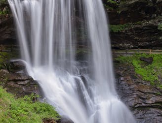
A short walk to an impressive waterfall you can walk behind!
Easy Hiking
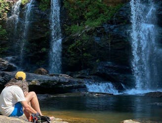
A massive, two-tiered waterfall below Lake Glenville full of swimming holes.
Moderate Hiking
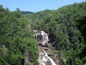
A short walk to a view of the highest waterfall in North Carolina!
Moderate Hiking
A short hike in Panthertown with two waterfalls and an impressive overlook of the valley.
Difficult Hiking

58 routes · Hiking
10 routes · Hiking
7 routes · Hiking

7 routes · Hiking
16 routes · Hiking
6 routes · Hiking
9 routes · Hiking

10 routes · Hiking

16 routes · Hiking
10 routes · Hiking