2.7 km away
Farlow Gap and Daniel Ridge Loop
Widely regarded as the most technical, challenging trail in Pisgah National Forest.
Extreme Mountain Biking
- Distance
- 18 km
- Ascent
- 719 m
- Descent
- 719 m
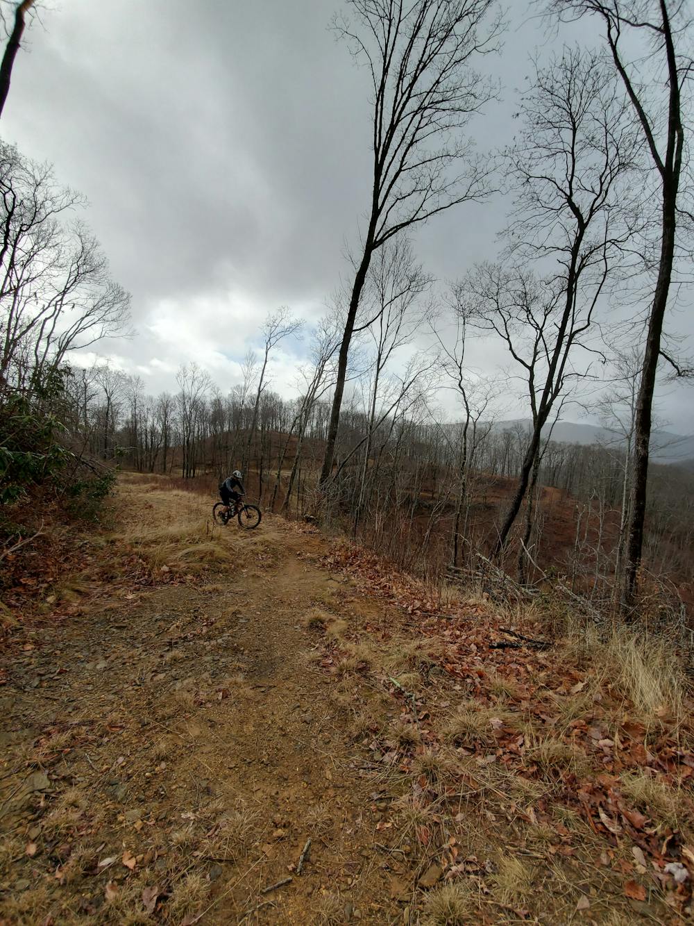
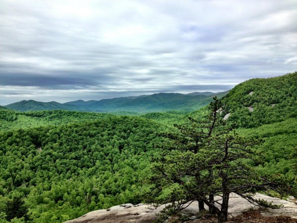
A rugged doubletrack loop with epic views and waterfalls.
Mountain Biking Easy

This remote gravel ride offers epic views and then passes multiple waterfalls in Courthouse Valley. While it is doable on a gravel bike, parts of this loop are quite chunky and may be difficult to negotiate on narrower tires. Over half of the route is on gated and unmaintained Forest Service roads, so don't expect well-kept gravel.
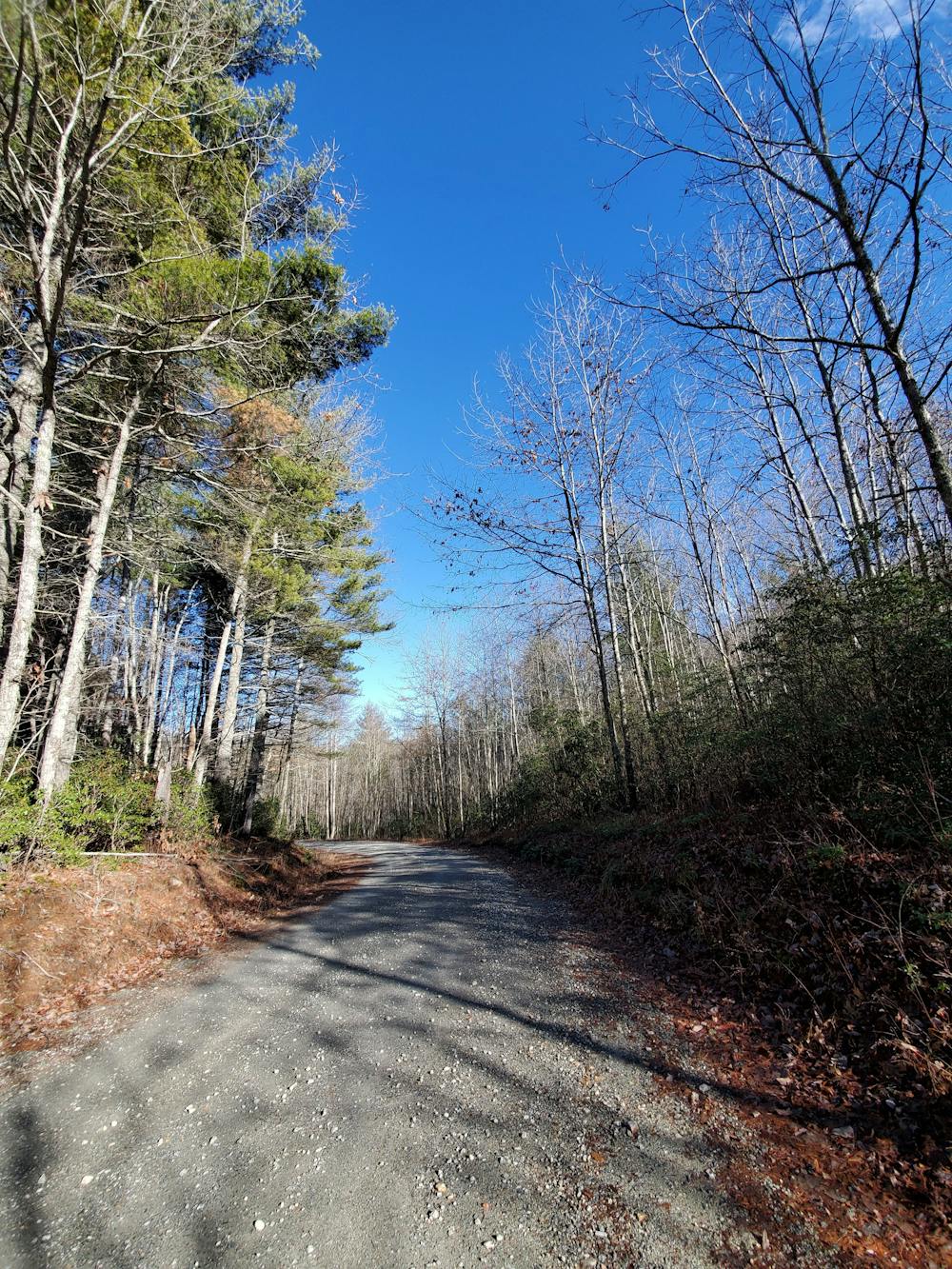
As mapped, this route begins at Gloucester Gap on Davidson River Road. From Brevard you'll head to the Fish Hatchery and keep driving up the road to the trailhead. Alternatively, you could head over to NC-215 and head up Indian Creek Road to the start.
The route is best ridden counter-clockwise though it could be fun reversed too. It begins with a steady ascent to a high point, then descends into a large logging clearing. Keep right on the well-cleared path that leads north. On the map, there is a small connector that appears to head down to Courthouse Creek Road, but it was destroyed and completely blocked by the logging in 2019.
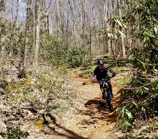
Then next leg of the ride is extremely quiet and will get significantly more chunky. Most locals consider it rideable on a gravel rig but will give you the disclaimer that it's rough at times. If you wish to forego the adventure and uncertainty, you could climb the infamously steep Pilot Mountain Road to Farlow Gap, then pick up the loop via Kiesee Creek. Pilot Mountain Road was graded and saw significant work in 2019 and is open to vehicles except during winter and spring freeze/thaw cycles.
Now that the chunky doubletrack is out of the way, you've got a long descent ahead of you. There is one large river crossing that will require you to get your feet wet, so bear that in mind. It's shallow but wide, so you could just ride straight through and hope not to get your feet too wet.
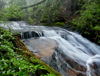
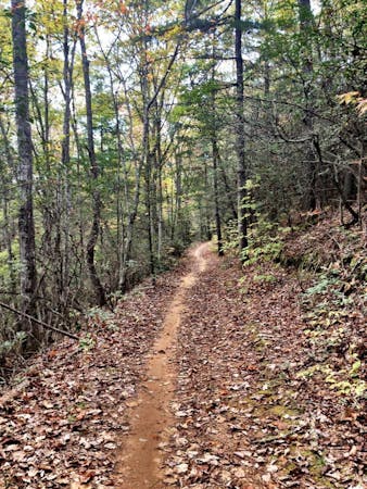
Just beyond the junction with Chestnut Ridge Road (to the right), look for a small, well-traveled trail down to a waterfall. It's less than a 5-minute walk and worth the detour.
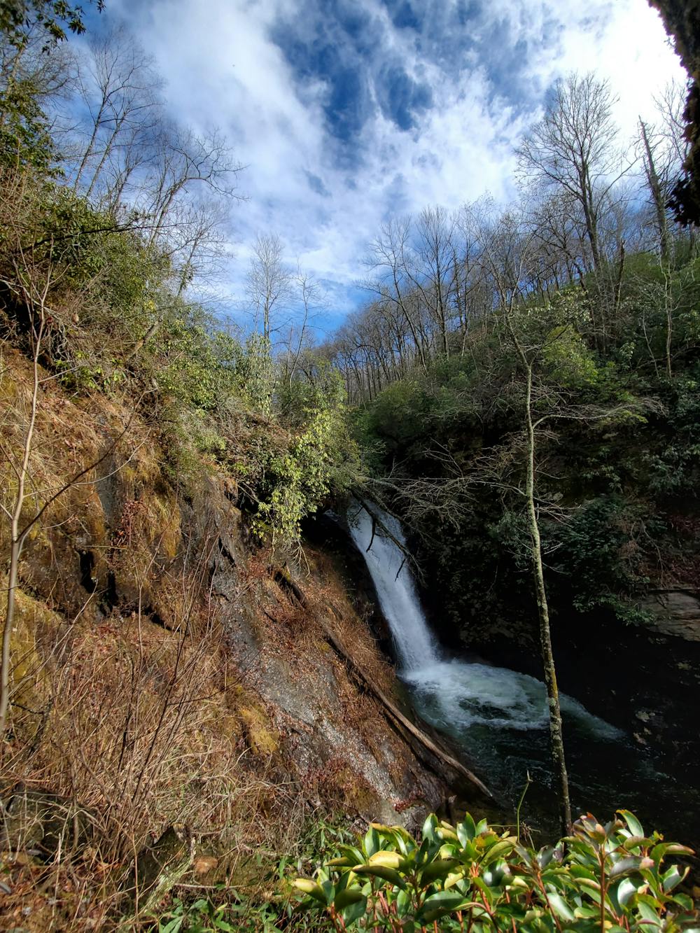
When you reach Courthouse Creek Road, the loop continues to the left, but head right first for another side trip down to Courthouse Falls. You can either leave your bike at the trailhead and hike the 0.4-miles in, or ride Summey Cove Trail to the falls. It is open to bikes, but is usually quite wet and includes a couple of bridges over low spots. Wikipedia describes the falls as "a narrow chute into a natural amphitheater of bedrock," and it's known as the popular summer swimming hole. If you'd rather visit the falls on another day, check out this hike instead.
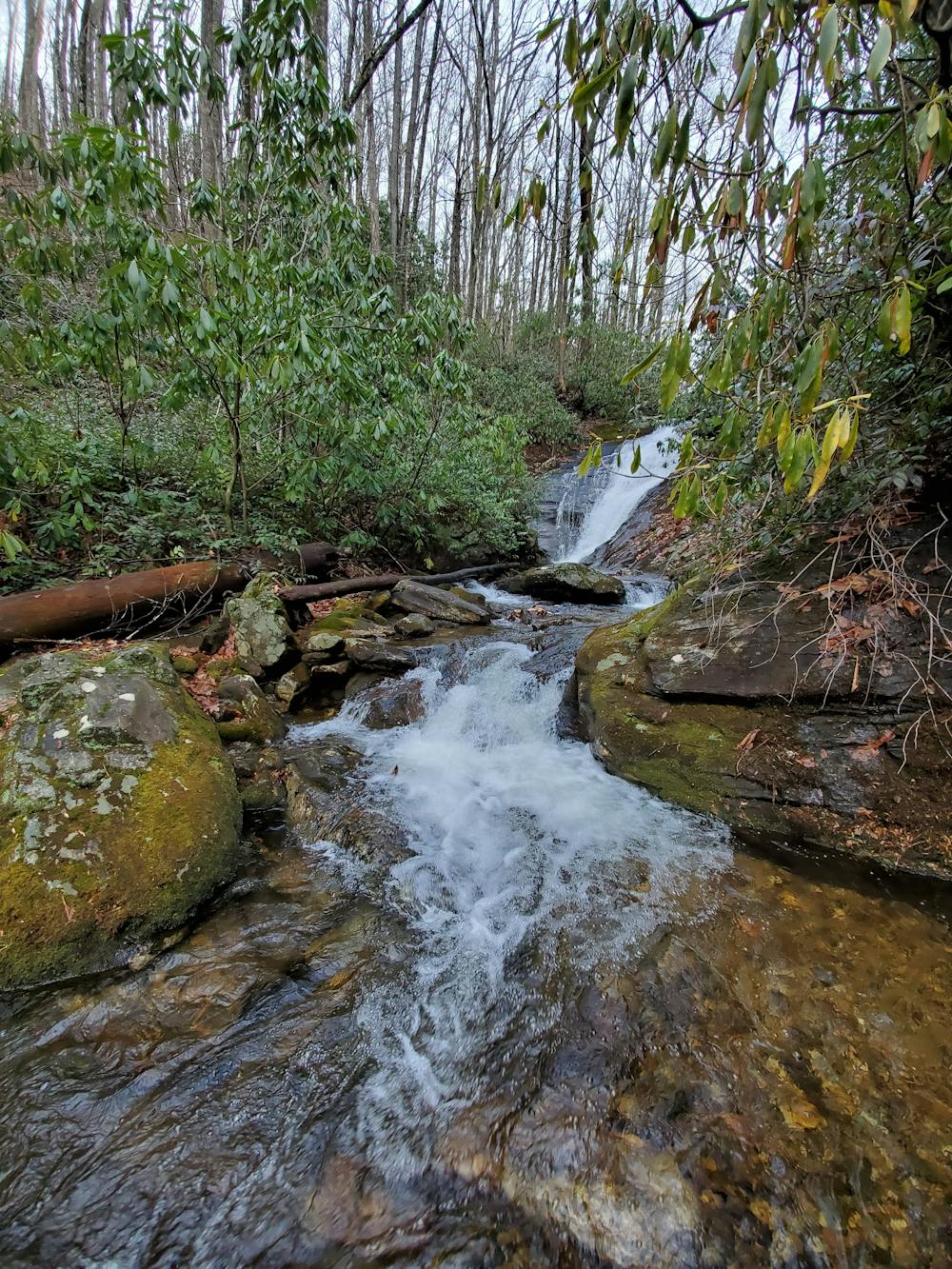
The remainder of the trip is straightforward. Simply head back the way you came on Courthouse Creek Road then follow it all the way down to NC-215. There are plenty of creekside views and even a couple of other waterfalls on the way. The road is typically closed to traffic during the winter months as well.
At NC-215, turn left and follow the pavement for a mile or two. At Indian Creek Road, turn left and begin a slow, steady climb back to Gloucester. As you do, notice the beautiful pine trees that line the way.
Easy
Mostly smooth and non-technical singletrack with unavoidable obstacles 2in/5cm tall or less. Avoidable obstacles may be present. Ideal for beginner riders.
2.7 km away
Widely regarded as the most technical, challenging trail in Pisgah National Forest.
Extreme Mountain Biking
8.8 km away

Flowy but steep singletrack rideable from downtown Brevard.
Difficult Mountain Biking
9 routes · Mountain Biking
3 routes · Mountain Biking
8 routes · Mountain Biking