4.3 km away
Latourell Falls Loop
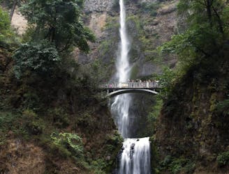
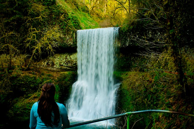
Two majestic waterfalls in basalt amphitheaters, both along the same hiking loop and within an easy drive from Portland.
Moderate Hiking
- Distance
- 3.2 km
- Ascent
- 204 m
- Descent
- 197 m
A long but rewarding hike high above a famous river
Hiking Difficult

This is an exceptional hike which can be done as a linear route, or as a return trip to the summit from either Bridal Veil or the Wahkeena Picnic Site.
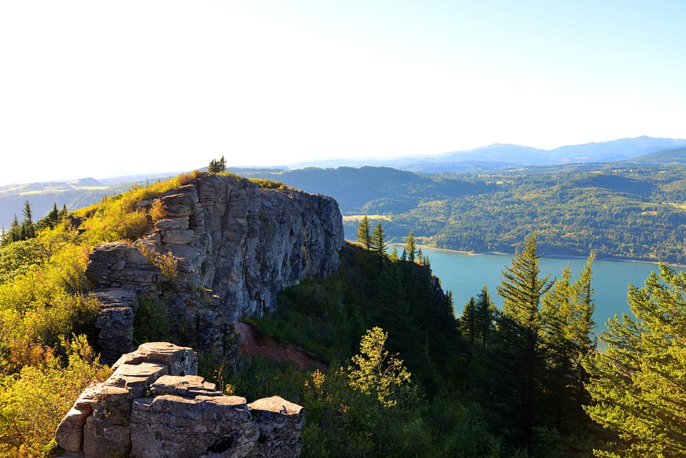
As you start your trip on the Angels Rest Trail, you'll wind through lush forests filled with towering Douglas fir and western red cedar trees. The trail starts off with a moderate incline, gradually gaining elevation as you make your way up the mountainside.
As you climb, the trail offers glimpses of the surrounding Columbia River Gorge, with breathtaking views of the river, lush valleys, and majestic peaks. Be sure to take breaks along the way to soak in the stunning vistas and take plenty of photos of the panoramic scenery.
One of the highlights (literally!) of the Angels Rest Trail is reaching the summit, where - in good weather - you'll be rewarded with awe-inspiring views of the Columbia River Gorge stretching out below. From this vantage point, you can see iconic landmarks such as Beacon Rock, Cape Horn, and the Bridge of the Gods.
Whether carrying on along the mountain's long summit ridge, or returning to the car, enjoy the views and then continue your journey.
Difficult
Hiking trails where obstacles such as rocks or roots are prevalent. Some obstacles can require care to step over or around. At times, the trail can be worn and eroded. The grade of the trail is generally quite steep, and can often lead to strenuous hiking.

The trail contains some obstacles such as outcroppings and rock which could cause injury.

Little chance of being seen or helped in case of an accident.
4.3 km away
Two majestic waterfalls in basalt amphitheaters, both along the same hiking loop and within an easy drive from Portland.
Moderate Hiking
4.7 km away
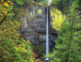
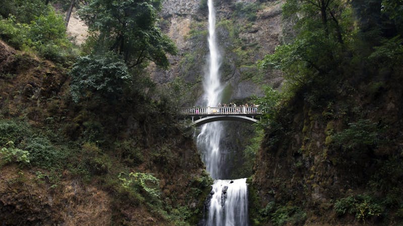
The tallest waterfall in the state of Oregon is a truly spectacular sight to behold!
Moderate Hiking
10 routes · Hiking · Trail Running
5 routes · Hiking
7 routes · Hiking