218 m away
Zigler Trail
An easy but scenic hike along an old water flume.
Easy Hiking
- Distance
- 2.2 km
- Ascent
- 32 m
- Descent
- 32 m
Easy in-town hike to a scenic overlook.
Hiking Easy

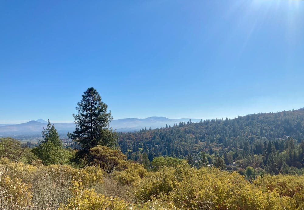
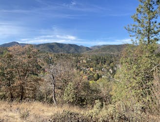
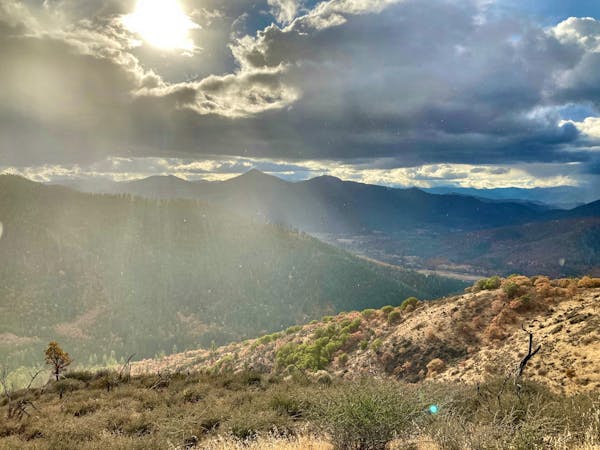
This short loop to Panorama Point offers a mellow yet secluded hike to a scenic vista overlooking Jacksonville, with views out into the Rogue Valley beyond.
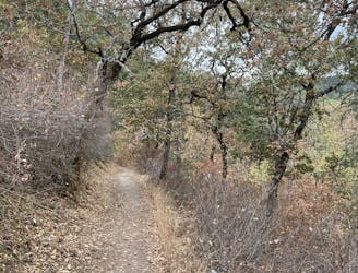
The hike begins at Britt Park and heads into the Britt Woodlands. While any number of trail combinations could get you to Panorama Point, including a much more direct out-and-back route, the loop mapped here visits the overlook and returns to the trailhead without using the same trail twice. This allows the would-be hiker to enjoy unique scenery around every turn in the trail.
Along the entire hike, you'll enjoy the serenity of the woodlands, hiking under the cover of the forest canopy the whole time. Only at Panorama Point will you find a break in the trees for a view of your surroundings, but a few benches placed on top of the hill allow you to sit and contemplate the natural world around you. Take some time to slow down and simply soak in the forest.
This hike is so convenient that you can even walk to the start from downtown Jacksonville. Few towns have trails so closely integrated into the fabric of the community, making Jacksonville a true gem.
Easy
Walking along a well-kept trail that’s mostly flat. No obstacles are present.

The path is on completely flat land and potential injury is limited to falling over.
Close to help in case of emergency.
218 m away
An easy but scenic hike along an old water flume.
Easy Hiking
791 m away
Short loop to a beautiful view over Jacksonville.
Easy Hiking
2.2 km away

Mellow hike through a lush valley
Easy Hiking
7.7 km away

Enjoy an incredible effort-to-view ratio on Applegate Ridge!
Easy Hiking
4 routes · Hiking

52 routes · Mountain Biking · Freeride Skiing · Gravel Biking · Hiking · Road Biking

11 routes · Hiking