4.4 km away
Elowah Falls and Upper McCord Creek Falls
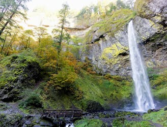
A combo of two waterfalls on one short but steep hike in the Columbia River Gorge.
Moderate Hiking
- Distance
- 4.1 km
- Ascent
- 220 m
- Descent
- 220 m
Hike up a steep-walled gorge to find two unique waterfalls, and witness the resilience of this forest following a wildfire.
Hiking Moderate

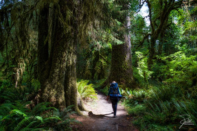
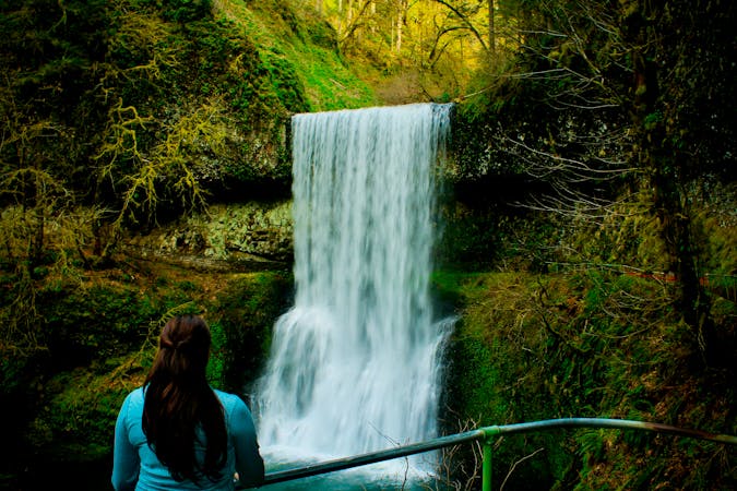
Wahclella Falls is one of the jaw-dropping waterfalls of the Columbia River Gorge, not far from Portland. Though Wahclella is certainly no secret, it’s less well known than nearby cascades like Multnomah or Bridal Veil. That is perhaps because Wahclella requires a longer walk to reach. It’s not a difficult hike, but has some hills, and necessitates sure footing in some places due to the steepness.
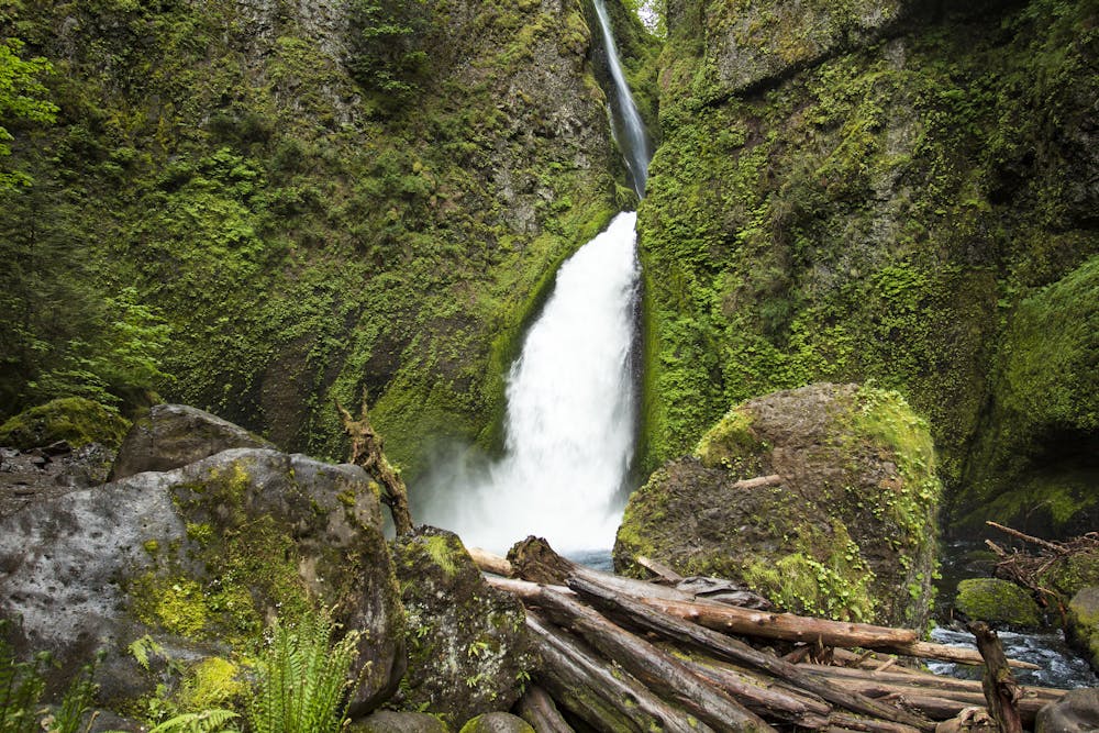
From the parking area, the trail begins on a paved access road that leads to a fish hatchery dam. This section is short, however, and beyond the dam the trail narrows to a dirt footpath. Simultaneously the surrounding canyon begins to narrow, and you’ll hear the roar of a waterfall just ahead. A bridge crosses directly in front of Munra Falls, a giant natural waterslide almost within arm’s reach. Continuing onward through the gorge, which is typically green and humid, look closely for signs of wildfires from recent years. You can still find burned trunks and scars of landslides, but vegetation has bounced back quickly, and recovery is well underway.
The trail becomes steeper and rockier, climbing to meet basalt cliffs. Some sections are narrow and may be nerve-racking if wet and slippery. Eventually the path turns downhill, and descends in tight switchbacks to the bottom of the gorge. Cross a bridge, and then another, then maneuver through some boulders to finally reach your view of the falls. Here, within a moss-draped amphitheater of stone, Wahclella Falls plunges out of a notch in the cliffs. You’ll see that it’s a two-tiered drop, with a taller stream way in the back of the cleft, and a lower cascade thundering out into a deep pool. The water is remarkably clear and blue. You may even spot fish, which swim up this creek to the base of the falls. On a hot day, this misty grotto stays pleasantly cool, but for much of the year it’s a chilly place to linger.
You may notice a closed-off extension of the trail. Though it used to make a loop, part of the trail is still closed due to damage from a wildfire in 2017. Until it reopens, the return to the trailhead is simply back the way you came.
Sources: https://www.fs.usda.gov/recarea/crgnsa/recarea/?recid=29992 https://www.oregonhikers.org/fieldguide/WahclellaFallsHike
Moderate
Hiking along trails with some uneven terrain and small hills. Small rocks and roots may be present.

Some trail sections have exposed ledges or steep ascents/descents where falling could cause serious injury.

Away from help but easily accessed.
4.4 km away
A combo of two waterfalls on one short but steep hike in the Columbia River Gorge.
Moderate Hiking
5.3 km away
The entire Washington segment of the Pacific Crest Trail.
Difficult Hiking
5.5 km away
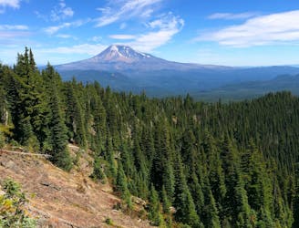
Miles 2146.9-2228.9 of the northbound PCT: Starting the trek into Washington with a prolonged climb from the Columbia River, then a rolling meander through forested hills to the foot of Mount Adams.
Moderate Hiking
5 routes · Hiking
10 routes · Hiking · Trail Running
7 routes · Hiking

72 routes · Hiking
10 routes · Hiking