4.4 km away
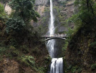
Wahclella Falls
Hike up a steep-walled gorge to find two unique waterfalls, and witness the resilience of this forest following a wildfire.
Moderate Hiking
- Distance
- 2.8 km
- Ascent
- 149 m
- Descent
- 149 m
A combo of two waterfalls on one short but steep hike in the Columbia River Gorge.
Hiking Moderate

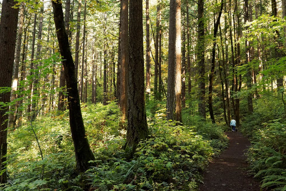
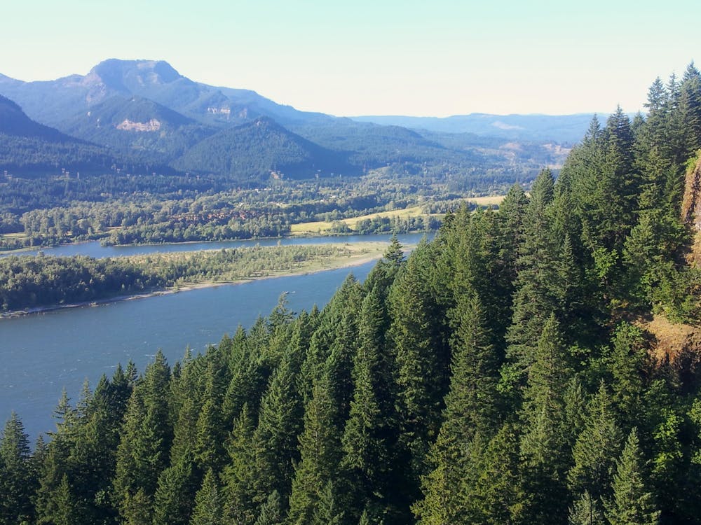
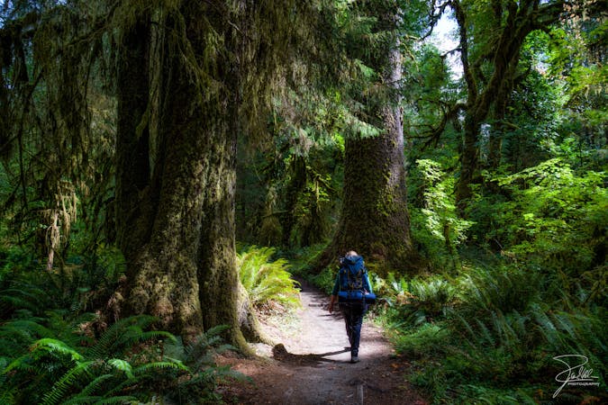
Elowah and Upper McCord are two of the several waterfalls you can see on moderate hikes in the Columbia River Gorge. No other hike offers a duo of waterfalls among such diverse scenery as this, however. Along with typically lush forest of towering conifers, on this hike you’ll also find lofty views over the river from cliffside vantage points. Though the hike is not long, it has some steep parts and some drop-offs from the trail. The sheerest edges are protected with handrails, but the terrain may be difficult for small children or anyone afraid of heights.
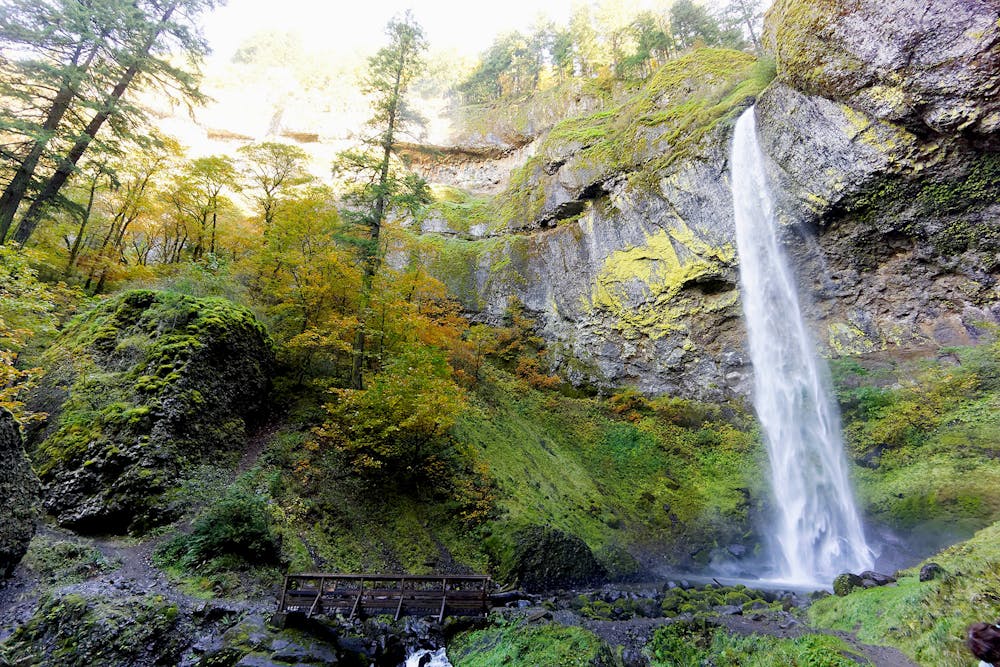
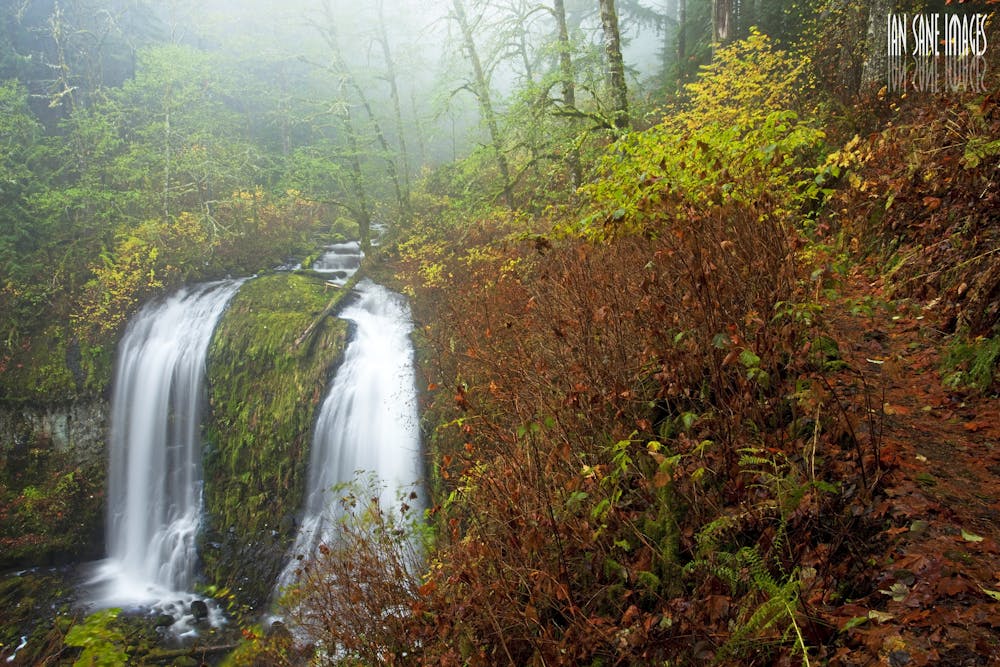
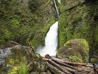
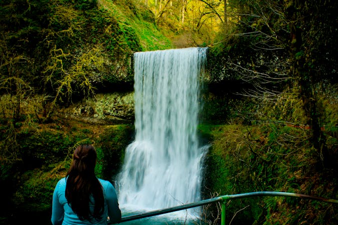
If you want to avoid the steepest parts, you can stick to the lower trail and still see the more impressive of the two waterfalls. There, at Elowah Falls, you’ll step into a sunny amphitheater of overhanging basalt, where the water plunges in freefall for more than 200 feet, crashing into a pool surrounded by mossy boulders.
To continue to the upper falls, backtrack to a junction, then head up the rockier trail heading farther uphill. On this path to Upper McCord Creek Falls is where you’ll encounter the exposed sections, but they come with phenomenal views. The waterfall is in fact only one highlight. You’ll also find a panorama of the river gorge, and you’ll reach an overlook of both waterfalls in the same view. Impressive trailwork has been done here to cross rock-strewn slopes and cliff faces.
Nearing the waterfall, the trail cuts through a stone grotto that’s dripping with water and draped in ferns. Turn the corner from there to find Upper McCord, which is a different spectacle than Elowah Falls. It’s a 60-foot forked waterfall, splitting into twin arms around a moss-cloaked pillar of basalt, framed on all sides by curtains of foliage.
All along these trails, but especially on the way to Upper McCord Creek Falls, you’ll notice nature’s recovery from wildfire and erosion. Some blackened trunks and landslide scars are evidence of past burns, but the vegetation is quickly bouncing back. Due to lingering damage and occasional rockfall on these steep slopes, the trails sometimes close for repairs. Check the state park webpage to make sure it’s open before you go.
Sources: https://www.oregonhikers.org/fieldguide/ElowahFallsLoopHike https://www.oregonhikers.org/fieldguide/UpperMcCordCreekFallsHike https://stateparks.oregon.gov/index.cfm?do=park.profile&parkId=114
Moderate
Hiking along trails with some uneven terrain and small hills. Small rocks and roots may be present.

Some trail sections have exposed ledges or steep ascents/descents where falling could cause serious injury.

Away from help but easily accessed.
4.4 km away
Hike up a steep-walled gorge to find two unique waterfalls, and witness the resilience of this forest following a wildfire.
Moderate Hiking
9.6 km away
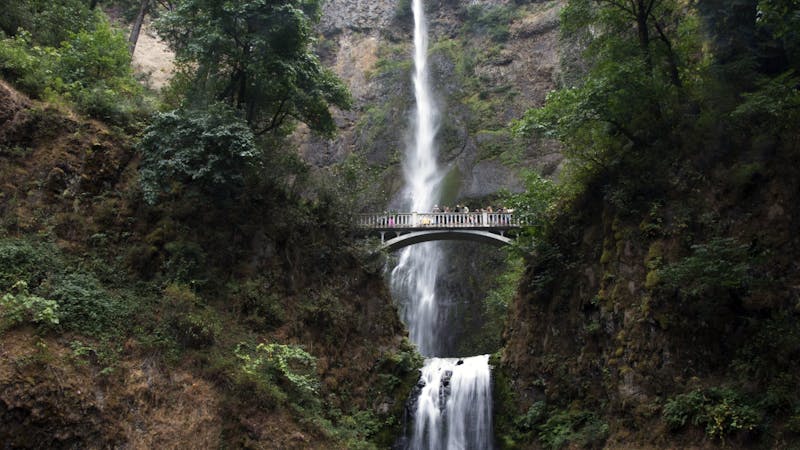
The tallest waterfall in the state of Oregon is a truly spectacular sight to behold!
Moderate Hiking
9.6 km away
The entire Washington segment of the Pacific Crest Trail.
Difficult Hiking
9.8 km away
Miles 2146.9-2228.9 of the northbound PCT: Starting the trek into Washington with a prolonged climb from the Columbia River, then a rolling meander through forested hills to the foot of Mount Adams.
Moderate Hiking
5 routes · Hiking
10 routes · Hiking · Trail Running
5 routes · Hiking
7 routes · Hiking

72 routes · Hiking
10 routes · Hiking