
16 routes · Mountain Biking
One of the most famous trails in Oregon, the singletrack is entertaining and the views are second to none!
Mountain Biking Difficult

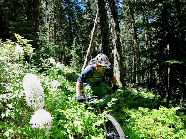
The McKenzie River Trail (MRT) graces lists of the best mountain bike trails in the nation—and even the world—going back decades. This historic trail has long been a favorite, with sweet singletrack alternating between buff flow and challenging lava rock. But what sets this trail apart from the crowd is the incredible scenery and ecosystem that you ride through.
Measuring almost 26 miles (42km) one-way, the MRT is best done as a shuttle. Numerous commercial shuttles are available across the region. For instance, Cog Wild in Bend, Oregon shuttles this trail, despite being located 60 miles (97km) from the trailhead. It's just that famous.
While technically this is a shuttle ride, it's unequivocally a cross country shuttle. While riders will lose more elevation than they gain along this route, the overall loss isn't significant. Expect to do a fair bit of climbing, but most of the climbs are mellow and short.
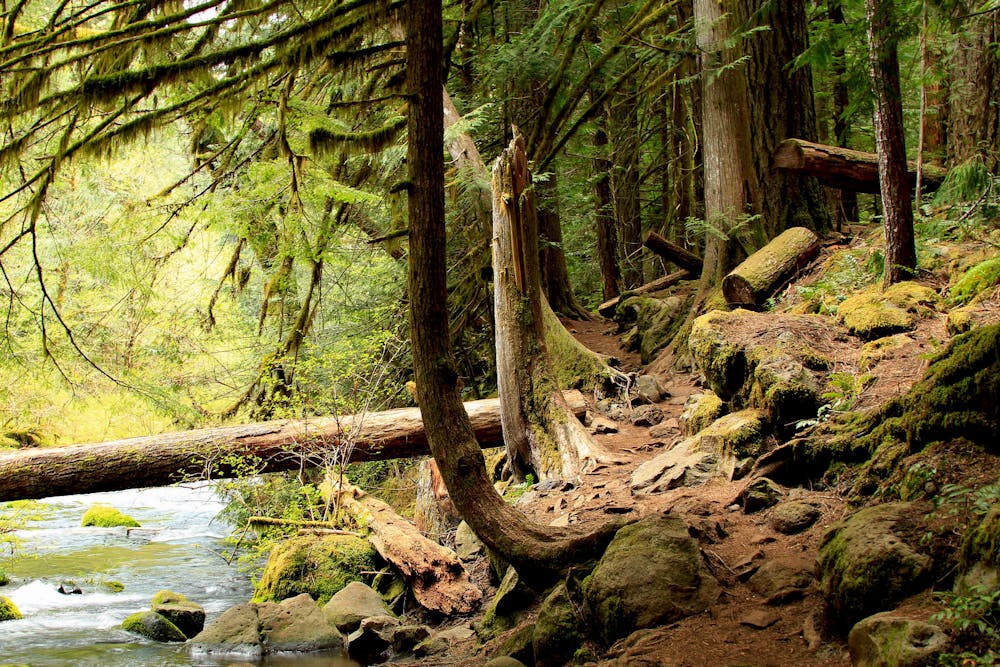
As the singletrack follows the McKenzie River, it twists and turns through a steep, narrow valley. When this area of Oregon was logged off, the loggers weren't able to cut the trees due to the steepness of the terrain, so the singletrack winds through beautiful stands of towering Douglas Firs.
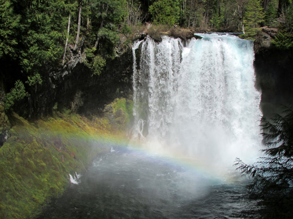
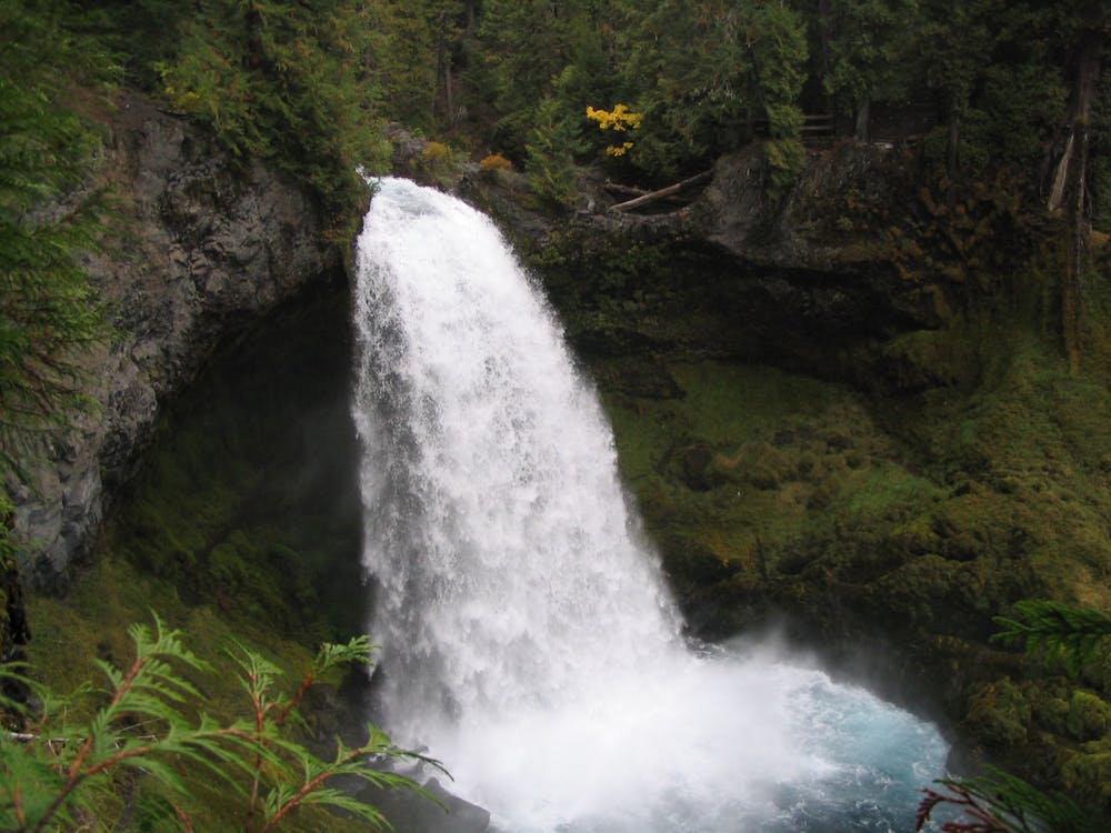
Along the way, the trail passes the aptly-named Clear Lake, with crystal-clear water. Once the river flows out of the lake, roaring waterfalls provide a soundtrack to the singletrack ripping and incredible opportunities for photo stops. Pedaling through the towering virgin timber alongside one of the most picturesque rivers imaginable in a lush Pacific Northwest environment is a sensory experience that will force you to simply immerse yourself in the present moment.
The trail tread itself alternates from smooth, flowy singletrack to jagged lava rock, and back again. The lava rock is sharp and challenging, requiring total attention. While many of the lava fields are relatively flat, some of the downhill-oriented rock gardens provide ripping descents—but an XC bike would still be capable.
Despite its 26-mile length, the end of the MRT comes all too soon. The final half of the trail isn't nearly as enchanting as the first half, so savor the sweetest portions while you can!
Difficult
Mostly stable trail tread with some variability featuring larger and more unavoidable obstacles that may include, but not be limited to: bigger stones, roots, steps, and narrow curves. Compared to lower intermediate, technical difficulty is more advanced and grades of slopes are steeper. Ideal for upper intermediate riders.

The trail contains some obstacles such as outcroppings and rock which could cause injury.
Away from help but easily accessed.
16 routes · Mountain Biking
5 routes · Mountain Biking

24 routes · Mountain Biking

15 routes · Mountain Biking