1.8 km away
Brown Mountain Loop
A delightful backcountry mountain biking experience!
Moderate Mountain Biking
- Distance
- 31 km
- Ascent
- 609 m
- Descent
- 609 m
Mine some loam on a trail that time forgot.
Mountain Biking Difficult

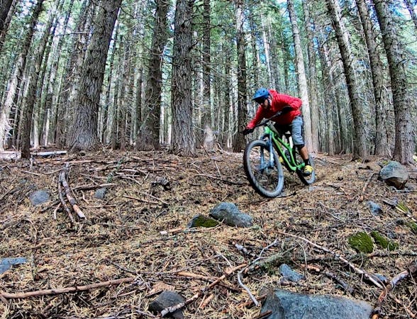
The Rye Spur Trail harkens back to the good old days of mountain biking when riders took to the forests and simply pedaled whatever singletrack they could find there. This old school national forest trail has been around for... who knows how long? Decades definitely, and maybe even longer. This is a trail that time forgot.

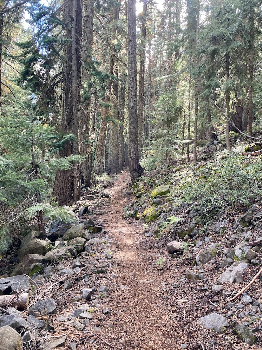
While time may have forgotten about Rye Spur, a small group of local riders haven't, and they keep cutting and clearing the major trees that fall across this trail. Even still, the trail tread is constantly covered in small sticks, pine needles, and leaves due to the limited traffic to beat it in.
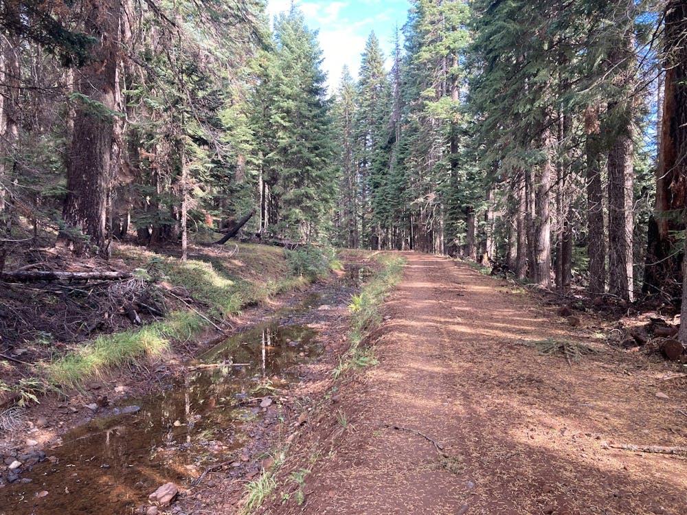
After pedaling up the dirt road, the route mapped here follows an aqueduct around the mountain, providing a scenic route to reach the shores of Fourmile Lake. Take a moment to have a snack and enjoy the stunning views of McLoughlin before you continue on.
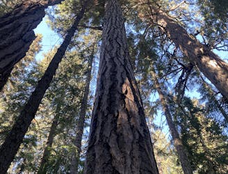
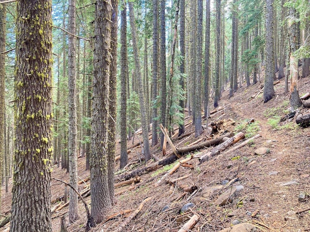
Even though it feels like you've already been climbing for hours, another even steeper climb faces you on the singletrack. However, the beautiful ancient forest and the almost invisible trail will keep you highly entertained as you gain elevation.
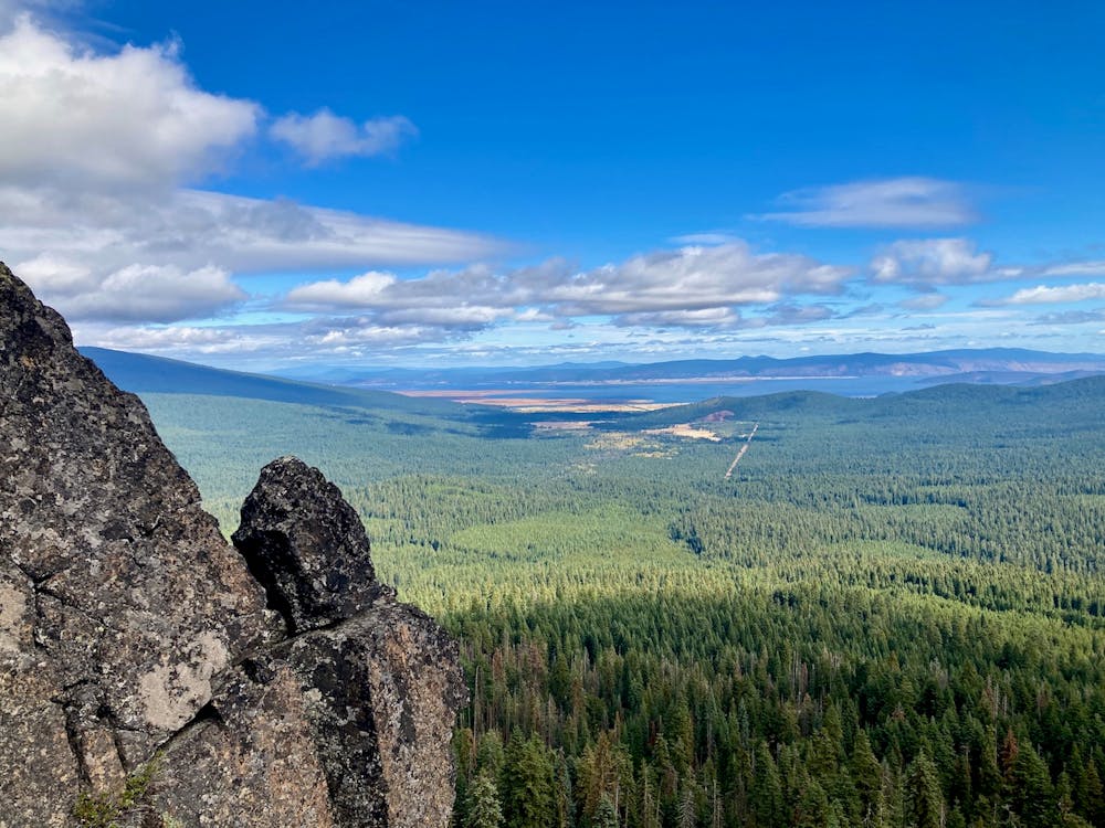
Eventually, you'll break out of the trees at a viewpoint near the top of the mountain. The vista from this exposed section is simply stunning, and demands another snack break to take it all in.
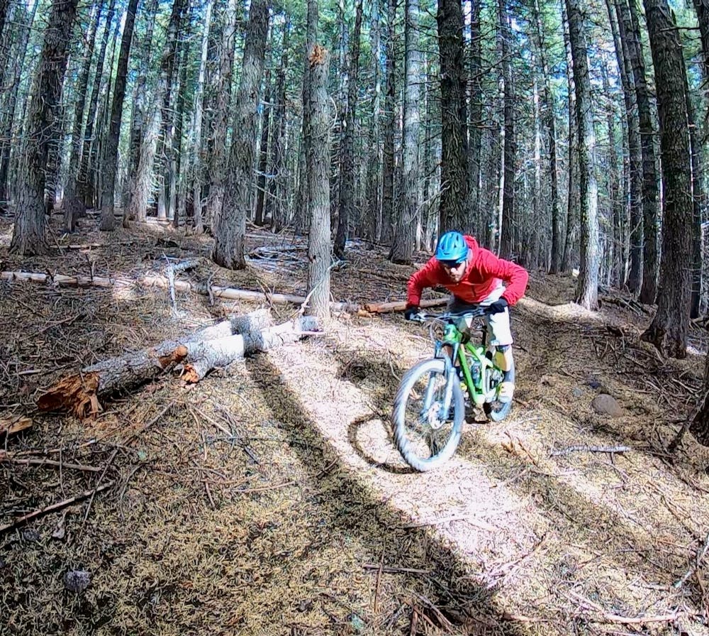
Finally, it's time to descend!
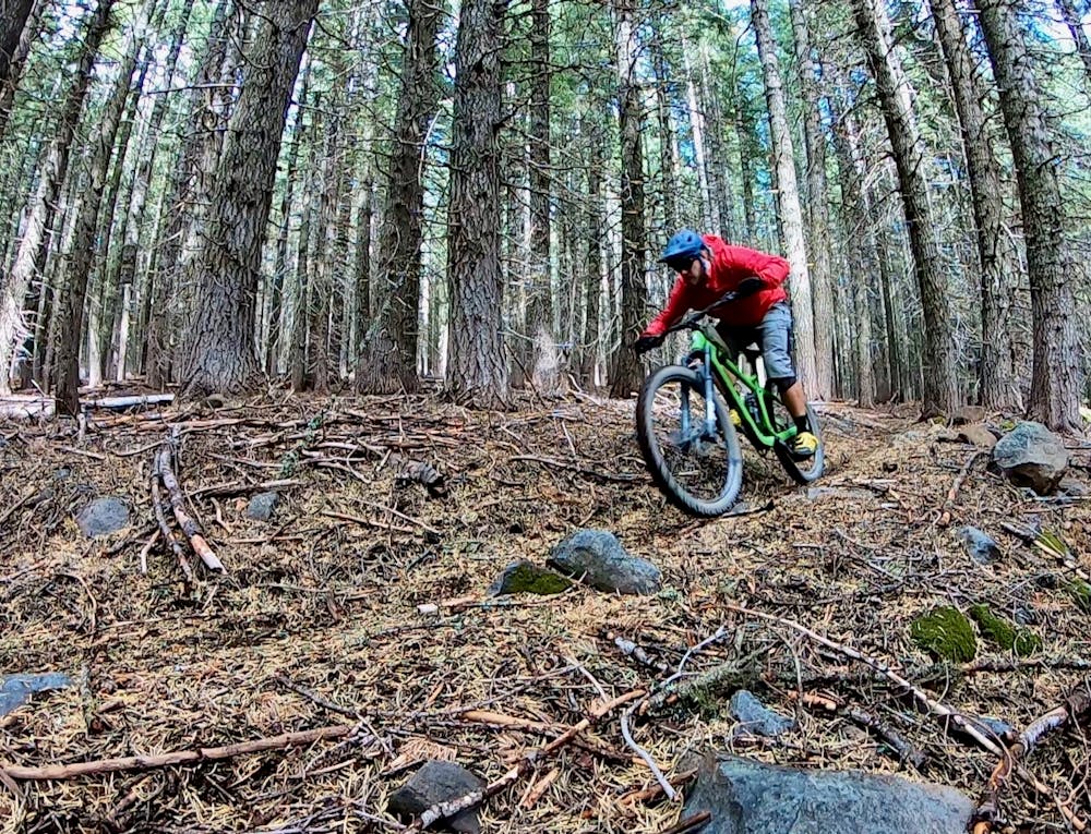
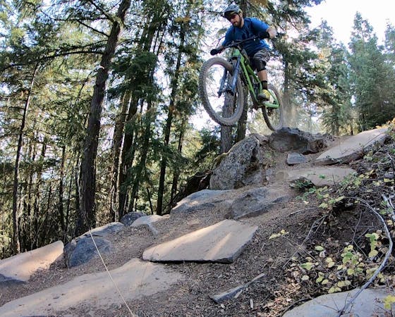
The rip down Rye Spur is relatively non-technical, but it's fast and furious! The trail drops down the blackest, loamiest singletrack imaginable. As dark black dirt flies up and hits you in the shins, you'll wonder how it's possible that you have this brown pow all to yourself.
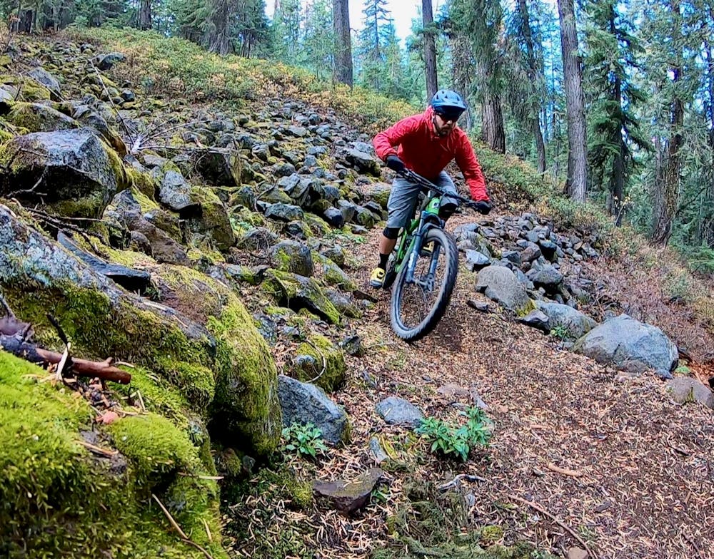
The trail does negotiate a few rock gardens and root webs, but overall, it's high-speed loam ripping punctuated by a few sharp turns. Some of these turns can be railed, and others you'll need to slow down for. This ripping descent is over all too quickly.
Difficult
Mostly stable trail tread with some variability featuring larger and more unavoidable obstacles that may include, but not be limited to: bigger stones, roots, steps, and narrow curves. Compared to lower intermediate, technical difficulty is more advanced and grades of slopes are steeper. Ideal for upper intermediate riders.

The trail contains some obstacles such as outcroppings and rock which could cause injury.

In the high mountains or remote conditions, all individuals must be completely autonomous in every situation.
1.8 km away
A delightful backcountry mountain biking experience!
Moderate Mountain Biking

20 routes · Mountain Biking
13 routes · Mountain Biking

52 routes · Mountain Biking · Freeride Skiing · Gravel Biking · Hiking · Road Biking
4 routes · Mountain Biking