104 m away
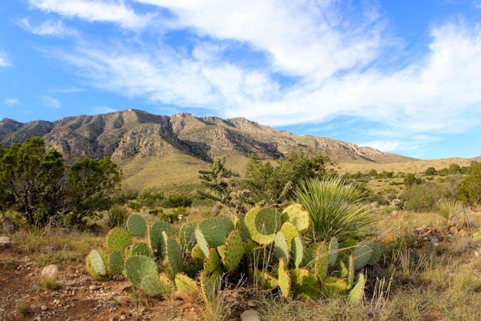
Indian Meadow Nature Trail

An easy, short walk from the Dog Canyon Campground where you can "discover the plants and animals of a meadow in the secluded north section of the park."
Easy Hiking
- Distance
- 1.5 km
- Ascent
- 32 m
- Descent
- 32 m
Hike during our past trip in november of 2020
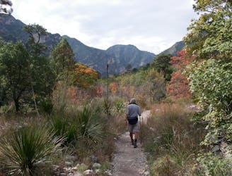
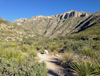
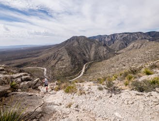
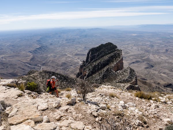
Hiking Severe

This is a popular hiking route which is generally considered to be severe. It's very remote, it features medium exposure and is typically done between September and April. From a low point of 1.9 km to the maximum altitude of 2.4 km, the route covers 22 km, 1005 vertical metres of ascent and 1005 vertical metres of descent.
Great views but extremely challenging
Severe
Hiking challenging trails where simple scrambling, with the occasional use of the hands, is a distinct possibility. The trails are often filled with all manner of obstacles both small and large, and the hills are very steep. Obstacles and challenges are often unexpected and can be unpredictable.

The trail contains some obstacles such as outcroppings and rock which could cause injury.

Little chance of being seen or helped in case of an accident.
104 m away
An easy, short walk from the Dog Canyon Campground where you can "discover the plants and animals of a meadow in the secluded north section of the park."
Easy Hiking
7.9 km away
An out-and-back hike on the McKittrick Canyon Trail to "The Notch," a stunning overlook.
Difficult Hiking
7.9 km away
A short hike highlighting local wildlife, plants, and geology.
Moderate Hiking
7.9 km away
An absolutely stunning hike high above McKittrick Canyon.
Difficult Hiking
10 routes · Hiking
4 routes · Hiking