2.5 km away
Mount Olympus
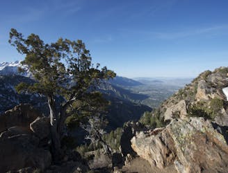
Mount Olympus is one of the most visible and well known peaks along the Wasatch Front.
Easy Alpine Climbing
- Distance
- 10 km
- Ascent
- 1.3 km
- Descent
- 1.3 km
A fun and technical climb up the West Slabs of Mount Olympus, Salt Lake City.
Alpine Climbing Difficult

This climb begins at a small trailhead on Thousand Oaks Dr. at the end of the road and heads up a set of wooden stairs. From this well-trafficked trail continue up switchbacks until you hit a rocky gully.
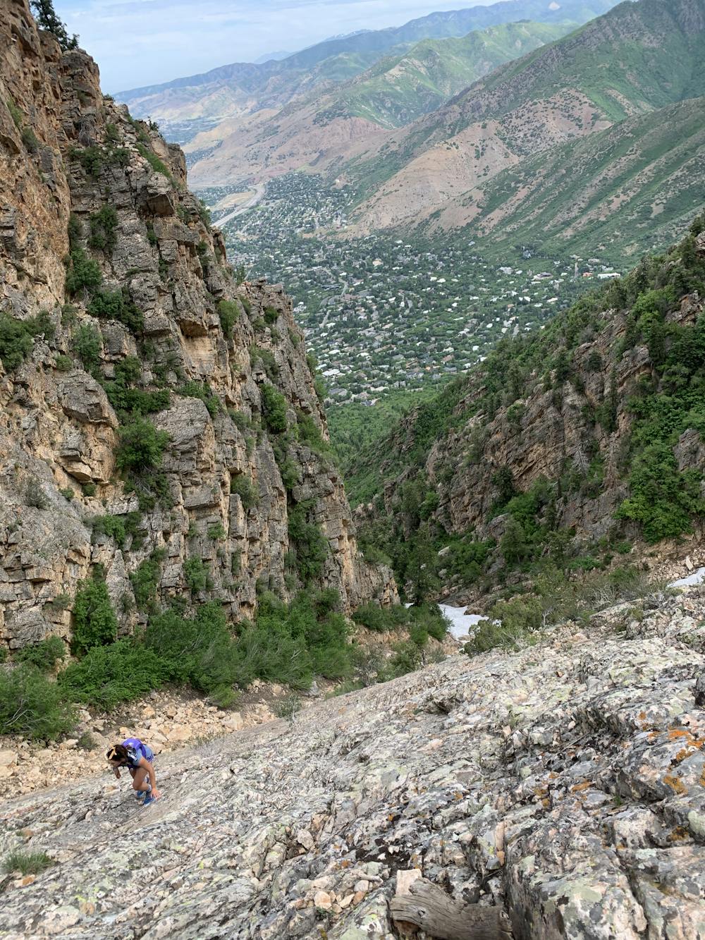

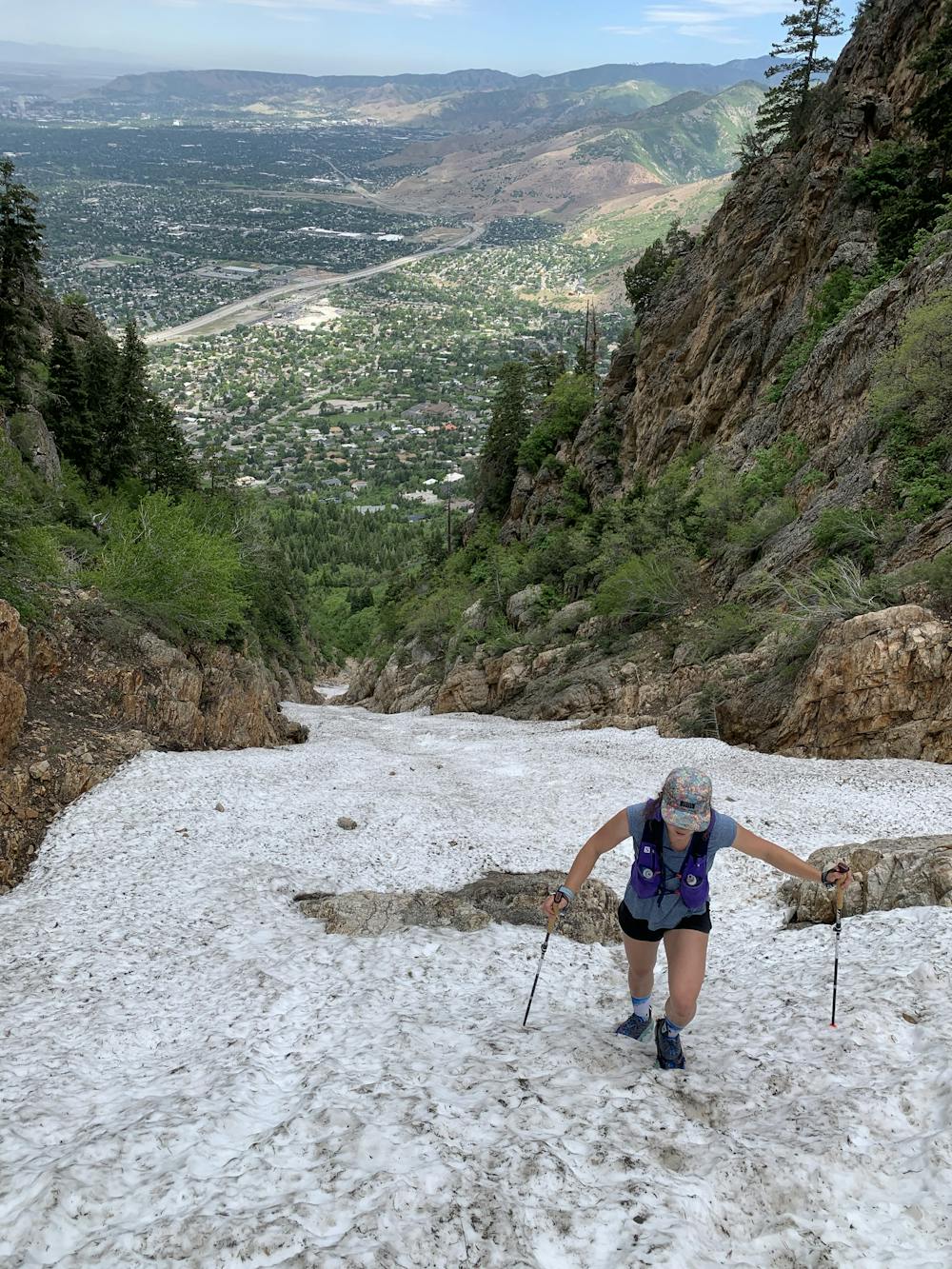
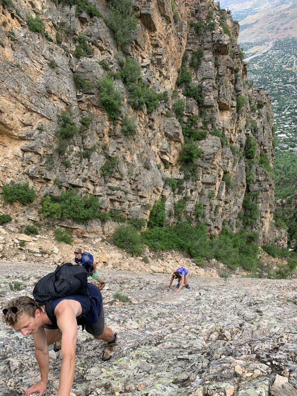
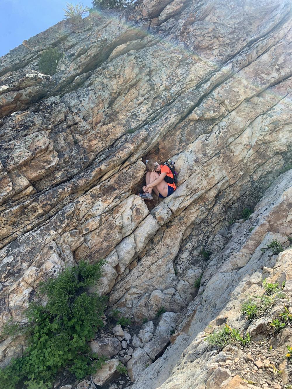
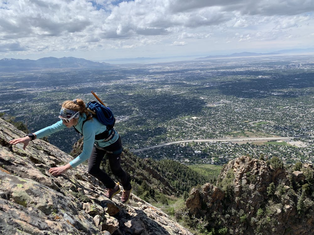
Head up the rocky gully until reaching the V-shaped face of the slabs. After completing the approach, there is about 1500 vertical feet of class 5.5 climbing. For less experienced climbers it's advised to use ropes and equipment to climb and scramble the Slabs. More experienced climbers who are comfortable on exposed terrain may choose to free solo, hike, scramble, or trail run the route.
There are many different ways you can go up the West Slabs. Don't be fooled - the adventure continues after the summit, as the way down can be a little tricky. Follow the trail down a gully (lookers right of the Olympus Slabs). Watch out for rockfall and be prepared to downclimb some sections.
The other option is to rappel down, for rappelling you'd need a harness, rope, rappel device, and climbing knowledge. There are a few trees with anchors that can be set up for rappels. You can traverse across the rocky ridge until it drops off and then head down into the drainage. You can descend the unmarked rocky gully where you can spot a few tree anchors set up for rappel. This part is achievable to down climb for experienced climbers, but note that these sections are prone to rockfall and one should be very cautious. Head straight down the drainage until you hit a small saddle where you notice a small sandy and rocky footpath. Then head right towards the base of where you started, climbing up the slabs and back down the same route as the approach.
Difficult
The beginning of truly technical terrain which might involve pitched climbing on rock and/or ice, exposed terrain and complex route finding in ascent and descent. Equivalent to AD, AD+

Much of the route is difficult to protect and a fall could be disastrous at certain points.

Away from help but easily accessed.
2.5 km away
Mount Olympus is one of the most visible and well known peaks along the Wasatch Front.
Easy Alpine Climbing

10 routes · Alpine Climbing · Hiking