8 m away
Emerald Pools
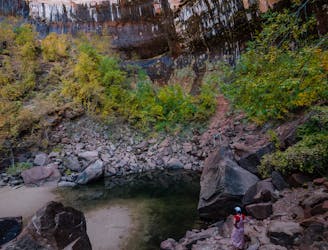
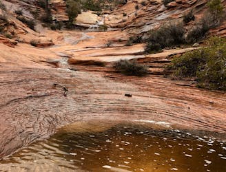
The Emerald Pools provide a cool, refreshing oasis.
Moderate Hiking
- Distance
- 3.3 km
- Ascent
- 155 m
- Descent
- 155 m
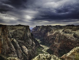
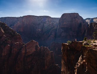
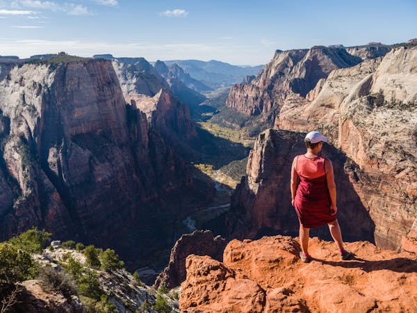
Zion National Park's iconic vertigo-inducing hike to a heavenly view.
Hiking Severe

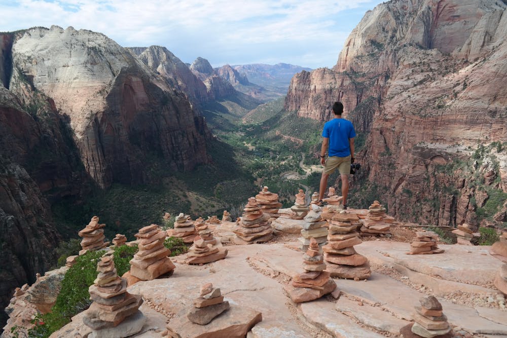
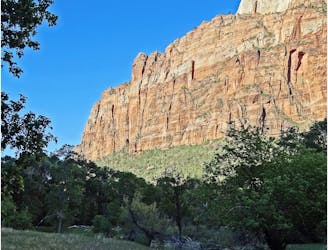
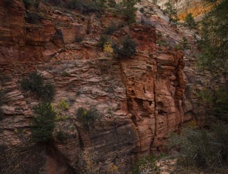
The Angels Landing Trail is the world-renowned must-do of Zion National Park, notorious for "the chains" that guard the final overlook. The chains are an upward traverse of an exposed ridgeline that drops away sheerly for hundreds of feet. In the steepest parts, steps are cut in the rock, and chains are anchored for support, but a slip can certainly be fatal. The difficulty is mostly mental, however, and anyone of average physical fitness who is not afraid of heights can make the trek. Conquering your fear is well worth it for the view at the end—a panorama up and down Zion Canyon, in the middle of this great gorge, with the river far below and rim high above.
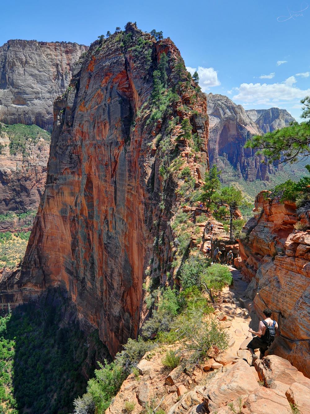
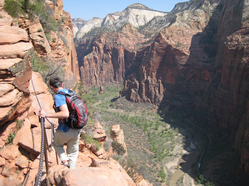
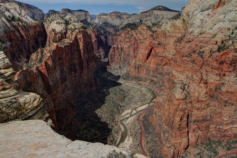
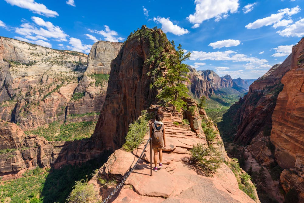
Reaching the chains requires a sustained uphill hike on a well-maintained trail. It begins as a gradual slope along the river then climbs a sunny set of switchbacks into a shady side canyon. The grade then lessens for a while before another set of switchbacks to reach the ridgeline and a trail junction. Here there is a restroom and flat spot to rest, but no drinking water or other supplies. The chains come shortly after, leading out the ridge to the top of its spectacular prow in the main canyon.
Anyone unsure about the chains should turn around after the junction where the trail gains the ridgeline. Views are still quite rewarding from here, and there is no shame in avoiding the risk of the chains.
The hike is 2.4 miles one way and approximately 1500 feet elevation gain to the Angels Landing viewpoint beyond the chains.
Sources https://utah.com/zion-national-park/angels-landing https://www.citrusmilo.com/zionguide/angelslanding.cfm
Severe
Hiking challenging trails where simple scrambling, with the occasional use of the hands, is a distinct possibility. The trails are often filled with all manner of obstacles both small and large, and the hills are very steep. Obstacles and challenges are often unexpected and can be unpredictable.

Some trail sections are extremely exposed where falling will almost certainly result in serious injury or death.

Close to help in case of emergency.
8 m away
The Emerald Pools provide a cool, refreshing oasis.
Moderate Hiking
9 m away
Spectacular journey from high elevation to low among Zion National Park's vertical canyon walls.
Difficult Hiking
9 m away
The West Rim Trail takes hikers away from the crowds.
Difficult Hiking
1 km away
Short, easy trail between Zion Lodge and the Angels Landing Trail in the main area of Zion National Park.
Easy Hiking
1.7 km away
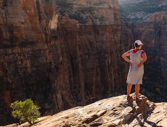
This hike climbs four steep miles to a stunning overlook.
Difficult Hiking
1.7 km away
Hidden Canyon combines chains, scrambling and an arch.
Difficult Hiking
1.7 km away
An otherworldly dripping springs.
Easy Hiking
2.9 km away
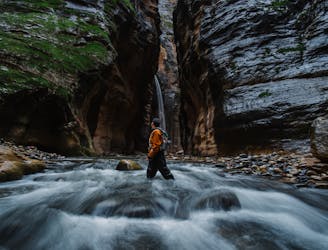
One-of-a-kind hike through a flowing stream, between soaring sandstone walls, in one of the world's most dramatic slot canyons
Moderate Hiking
5.1 km away
Short and sweet hike to sweeping views of lower Zion Canyon.
Moderate Hiking
5.3 km away
Easy off-trail adventure in a gorgeous side canyon of Zion National Park.
Difficult Hiking
11 routes · Hiking

25 routes · Alpine Climbing · Hiking

10 routes · Hiking

10 routes · Hiking

63 routes · Alpine Climbing · Hiking