182 m away
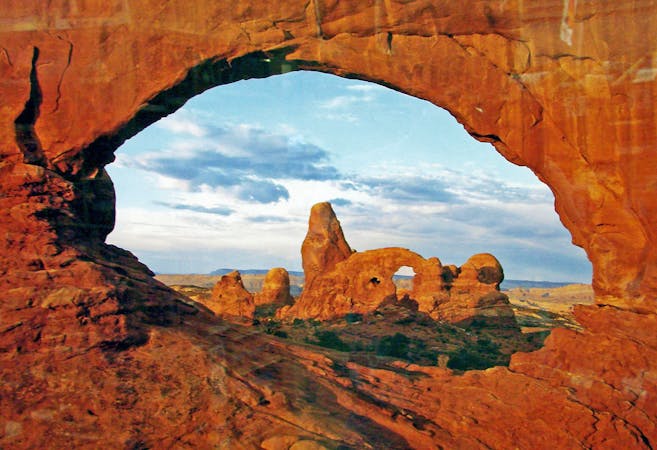
The Windows
Home to the largest concentration of natural arches in the world!
Moderate Hiking
- Distance
- 1.9 km
- Ascent
- 50 m
- Descent
- 50 m
One of the easiest hikes in Arches National Park leads to one of the best views!
Hiking Easy

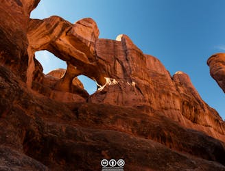
If you're looking for a short, easy hike in Arches National Park with a massive payoff, it's tough to beat the short jaunt to Double Arch!
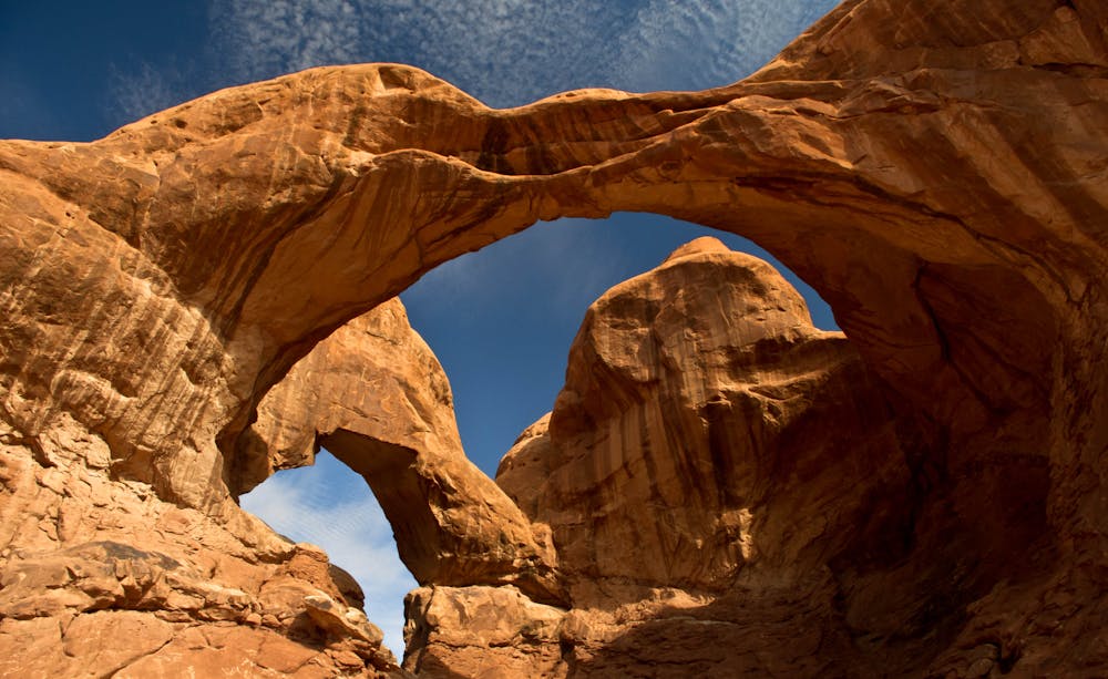
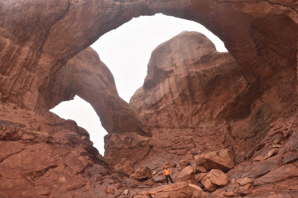
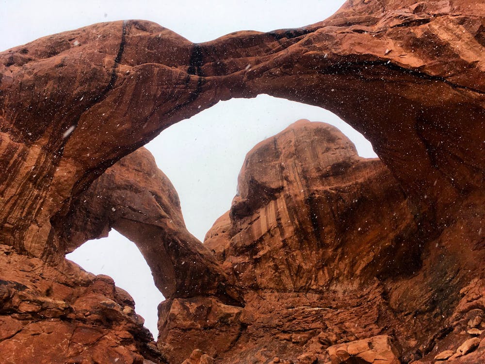
Double Arch is a rock formation consisting of two arches connected on one end. Located "within the Windows area of Arches National Park, an area with the largest concentration of natural arches in the entire world," according to Utah.com, this formation was created "by downward water erosion from atop the sandstone, rather than from side-to-side water erosion."
The trailhead is large and well-developed to handle the near-constant traffic that Double Arch receives. A short 0.3-mile short, flat hike from the trailhead will bring you to the base of the arches themselves. The hike presents no technical difficulties. Indeed, it may be one of the easiest hikes in the Moab area… but the impressive views at the end make it a must-do!
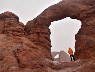
The adventurous can opt to scramble up the rocks to stand beneath the arches themselves. This scramble is radically more technical than the mellow, flat trail, so only attempt if you're confident in your footing.
However you choose to experience the arches, be sure to bring a camera and take a few snapshots—Double Arch is simply breathtaking!
Easy
Walking along a well-kept trail that’s mostly flat. No obstacles are present.

The path is on completely flat land and potential injury is limited to falling over.
Close to help in case of emergency.
182 m away
Home to the largest concentration of natural arches in the world!
Moderate Hiking
5.5 km away
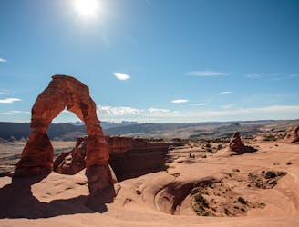
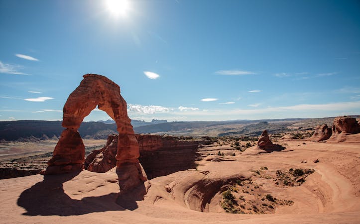
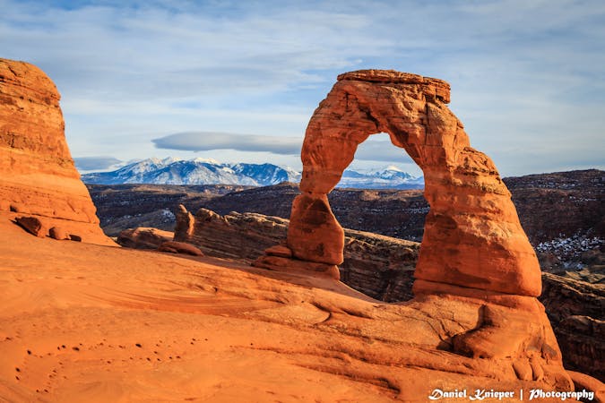
Hike to the iconic arch in Arches National Park.
Moderate Hiking
6.5 km away
This off-trail hiking area provides one of Moab's most challenging—and rewarding—hiking experiences.
Extreme Hiking
8.7 km away
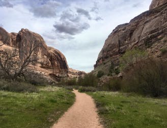
A family-friendly hike with gorgeous views the entire way.
Moderate Hiking
6 routes · Hiking
14 routes · Hiking
4 routes · Mountain Biking · Hiking

25 routes · Alpine Climbing · Hiking

10 routes · Hiking

10 routes · Hiking

63 routes · Alpine Climbing · Hiking