4 km away
Upper Muley Twist Canyon
Covering both the panoramic crest of the Waterpocket Fold and the depths of an arch-studded canyon, Upper Muley Twist has it all.
Severe Hiking
- Distance
- 15 km
- Ascent
- 461 m
- Descent
- 461 m
Link-up of canyons in Capitol Reef and Grand Staircase-Escalante, through some of the most spectacularly-sculpted stone anywhere along the Hayduke.
Hiking Severe

If you’re thru-hiking the Hayduke Trail, you’ve already wandered through many miles of enchanting sandstone canyons by the time you get to Section 6, but this stretch through Capitol Reef National Park and Grand Staircase-Escalante National Monument has some of the most gorgeous gorges yet. A handful of these slots on their own make bucket list hiking destinations for many people, but the Hayduke manages to combine them in one truly memorable linkup. They are Lower Muley Twist, Middle Moody, the Escalante River, and Coyote Gulch.
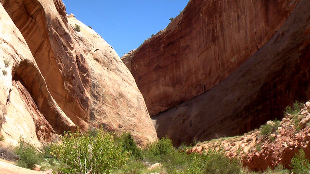
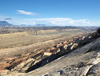
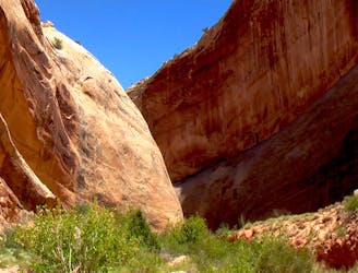
The section starts with Lower Muley Twist, a sinuous canyon through red sandstone in Capitol Reef National Park. As you wind for miles through this high-walled gorge, you’ll encounter narrows, rock towers, and huge alcoves. Water is usually scarce, but a reliable source comes after you exit the canyon at Muley Tanks, which are sizeable natural potholes in the white sandstone reef.
Next comes the ascent of Red Slide, a long, loose slope that leads back over the reef and to an old wagon road through juniper forest above. Crossing the ridge at Circle Pass grants vantage over the desert sprawling on both sides. From there you’ll descend a bouldery drainage into Middle Moody Canyon, which gradually entrenches into gray sandstone, forming a picturesque section of narrows. This canyon sometimes flows with water, but don’t count on it.
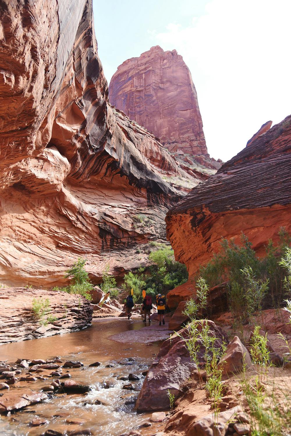
When the narrows end, continue through a broad, sunny valley all the way to the confluence with Moody Creek, a narrower gorge which soon meets the Escalante River in its famously serpentine canyon. You’ll meet flowing water there, and follow it for many meandering miles among towering walls, soaring arches, and deepening shadows. The hike along the Escalante is notoriously arduous, however, because of deep mud and thick brush. Many thru-hikers recommend an alternate route. It’s also possible to packraft the river instead of hiking if flows are adequate.
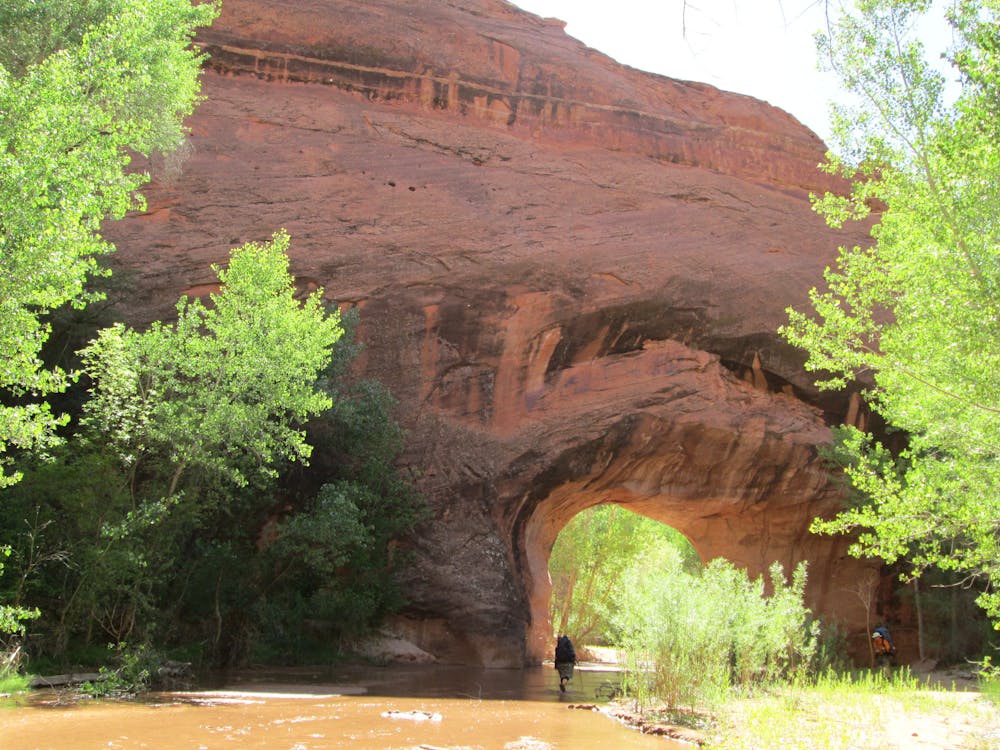
The exit from the Escalante comes at Coyote Gulch, which is one of the most popular hikes in the area. The going is considerably easier than in the Escalante. You’ll still traipse in and out of the stream and have to scramble rocks here and there, but with worn trails along the banks instead of bushwhacking. The legendary scenery of Coyote Gulch includes huge natural bridges, tall fins, waterfalls, calm pools, and petroglyphs. Leaving the Gulch at Hurricane Wash soon leads out of the narrows and into open desert, toward the trailhead at Hole-in-the-Rock Road.
Sources: http://www.hayduketrail.org/TheRoute.html https://www.little-package.com/blog/2017/11/hayduke-trail-tips http://www.acrossutah.com/wordpress/hike-guide-lower-muley-twist/ http://www.acrossutah.com/wordpress/coyote-gulch/ https://caltopo.com/m/5J0S https://caltopo.com/m/6V45 https://www.postholer.com/journal/Hayduke-Trail/2013/buck30/2013-05-20/SECTION-NOTES-FOR-FUTURE-HIKERS/37920
Severe
Hiking challenging trails where simple scrambling, with the occasional use of the hands, is a distinct possibility. The trails are often filled with all manner of obstacles both small and large, and the hills are very steep. Obstacles and challenges are often unexpected and can be unpredictable.

Some trail sections have exposed ledges or steep ascents/descents where falling could cause serious injury.

In the high mountains or remote conditions, all individuals must be completely autonomous in every situation.
4 km away
Covering both the panoramic crest of the Waterpocket Fold and the depths of an arch-studded canyon, Upper Muley Twist has it all.
Severe Hiking
5.1 km away
One variation on Lower Muley Twist, this route goes over the wildly exposed Post Cutoff Trail, then wanders the most spectacular reaches of the twisting canyon.
Severe Hiking

14 routes · Hiking
8 routes · Hiking

10 routes · Hiking