4 m away
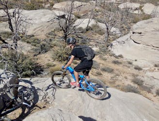
Jem Trails Loop
Flowy, easy-to-access singletrack with gorgeous views, and the occasional challenging section.
Moderate Mountain Biking
- Distance
- 26 km
- Ascent
- 369 m
- Descent
- 369 m
Hurricane's token IMBA Epic loop delivers the views, along with many miles of singletrack.
Mountain Biking Difficult

It would be intriguing to learn why Hurricane Rim was designated as the token IMBA Epic ride for the renowned destination of Hurricane, Utah, and not the internationally-renowned Gooseberry Mesa. Did IMBA at one time not consider slickrock riding to be worthy of Epic status? Did Gooseberry not offer enough mileage to be considered "Epic?" The decisions once made may now be lost to the mists of time... we may never know the real answer.
Regardless of how the decision was made, this ~25-mile loop anchored by the Hurricane Rim Trail still reigns as the region's IMBA Epic ride, and it fits the bill as a challenging, long-distance cross-country mountain bike route.
When you look at the stats, 25 miles and 2,300 feet of climbing doesn't necessarily sound too challenging... but these numbers belie the punchiness of the climbs along Hurricane Rim. Along the Rim, the trail grunts straight up a series of short, steep climbs, followed by blazing fast descents down into the next gullies.
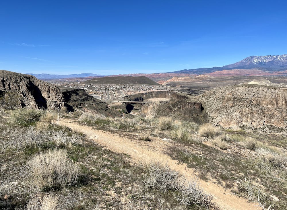
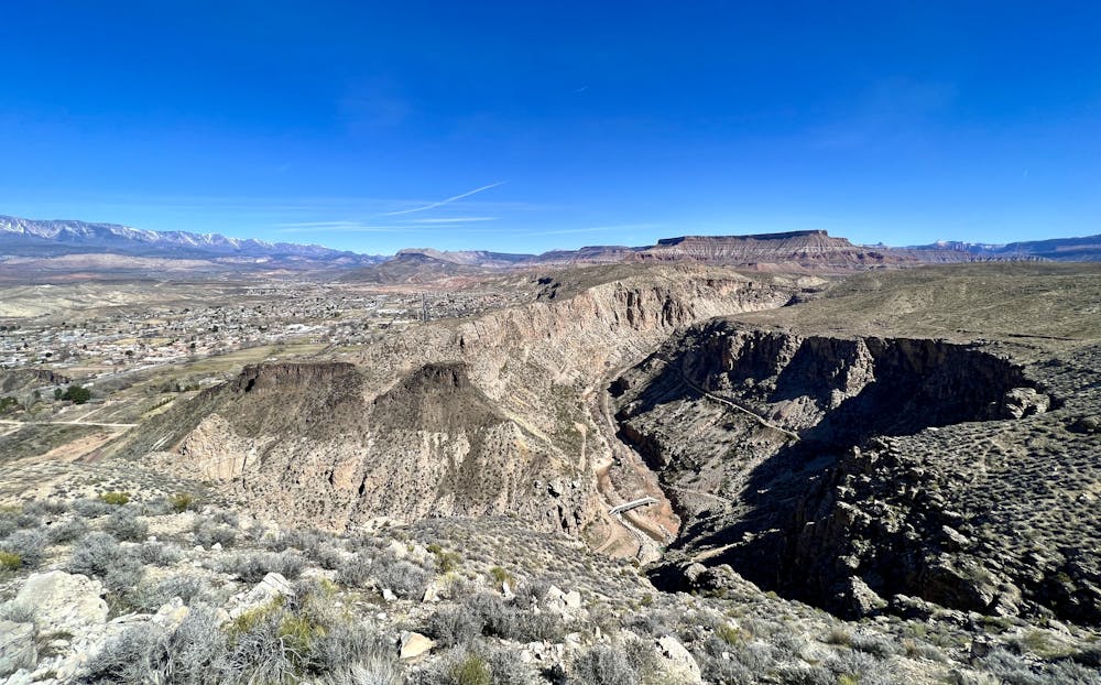
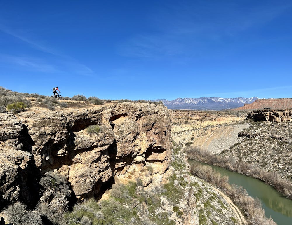
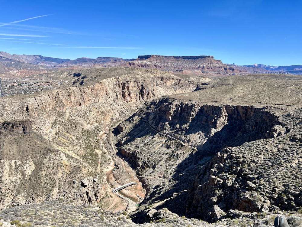
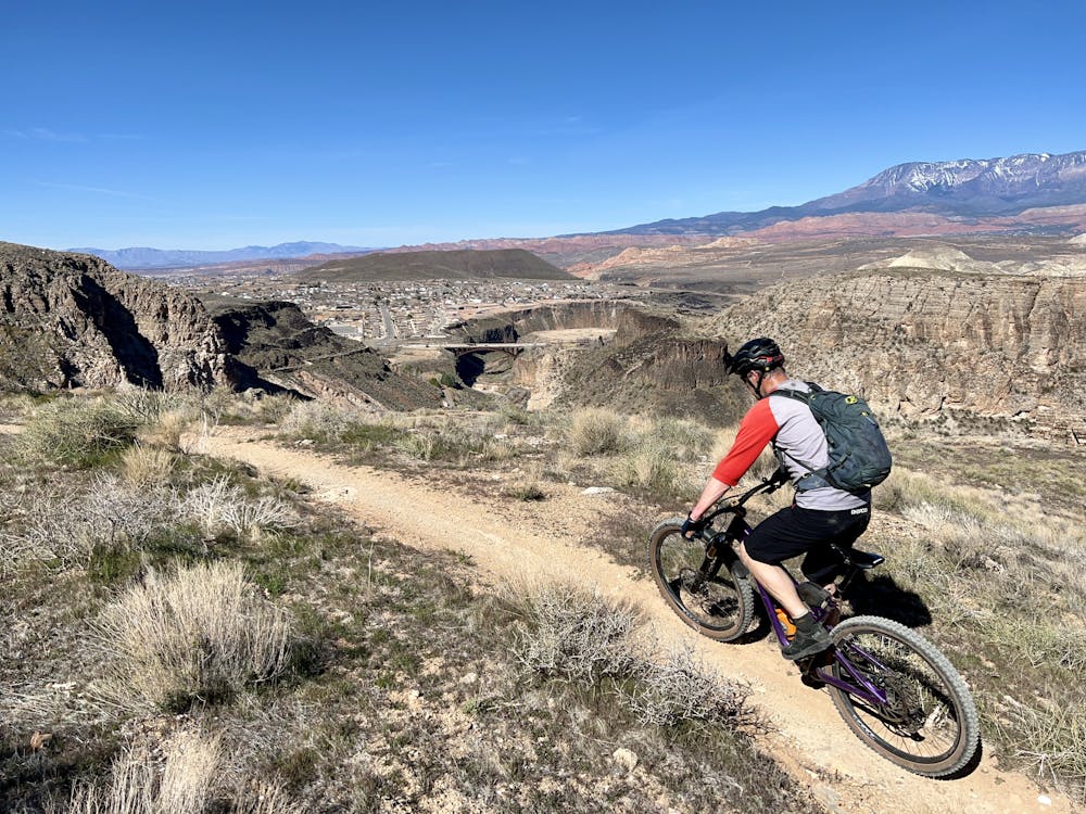
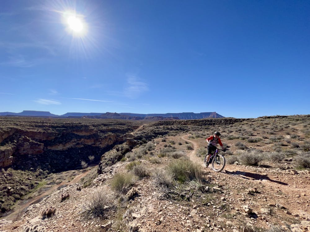
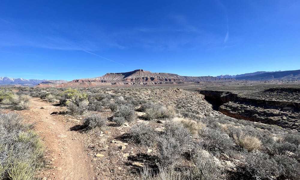
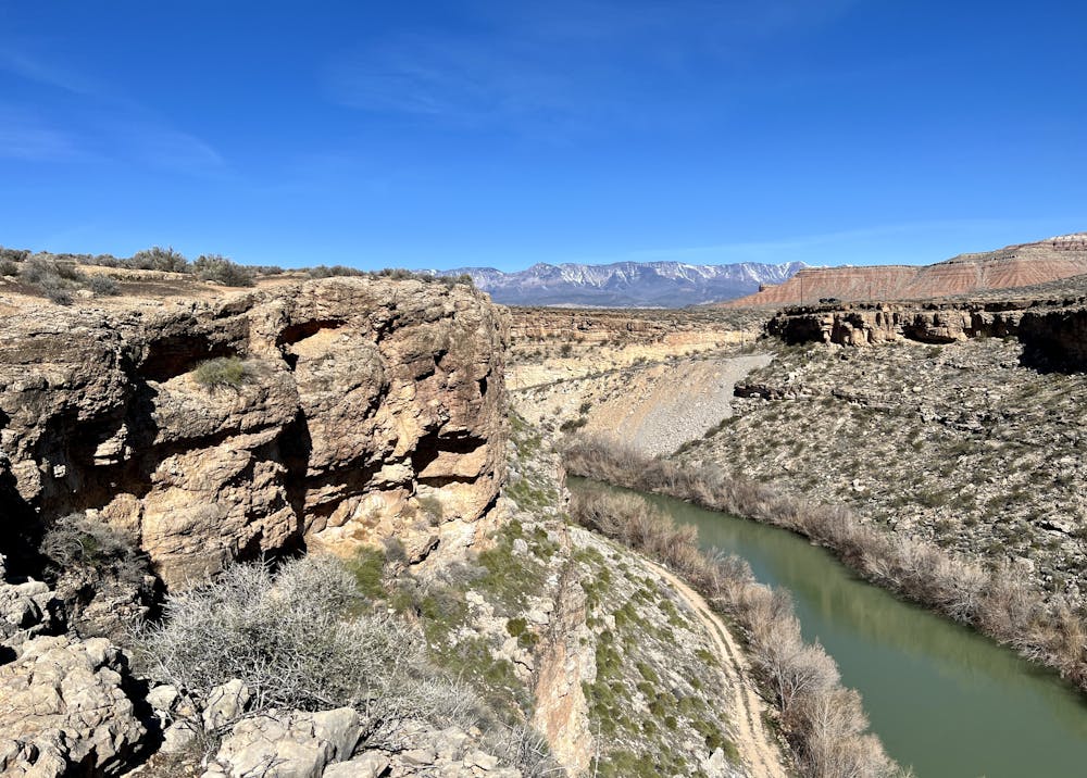
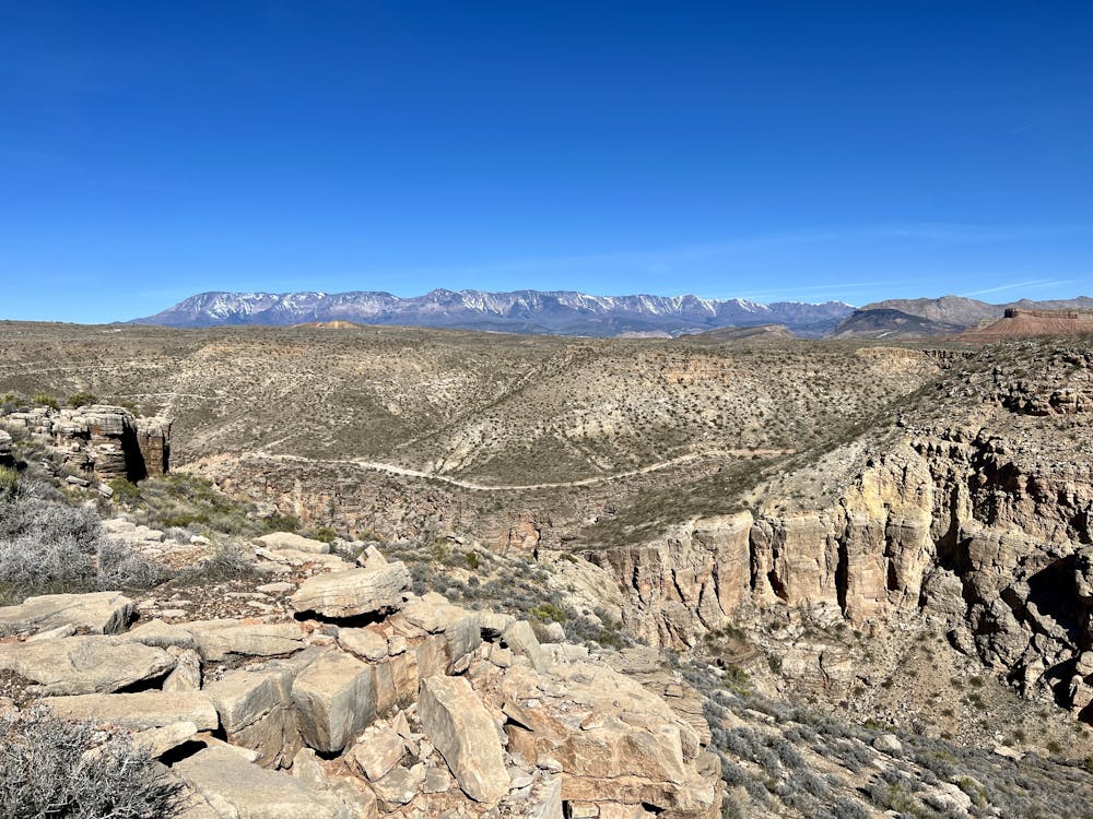
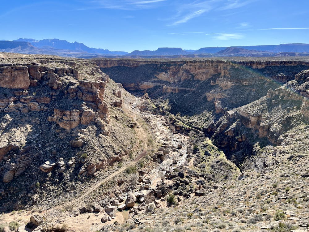
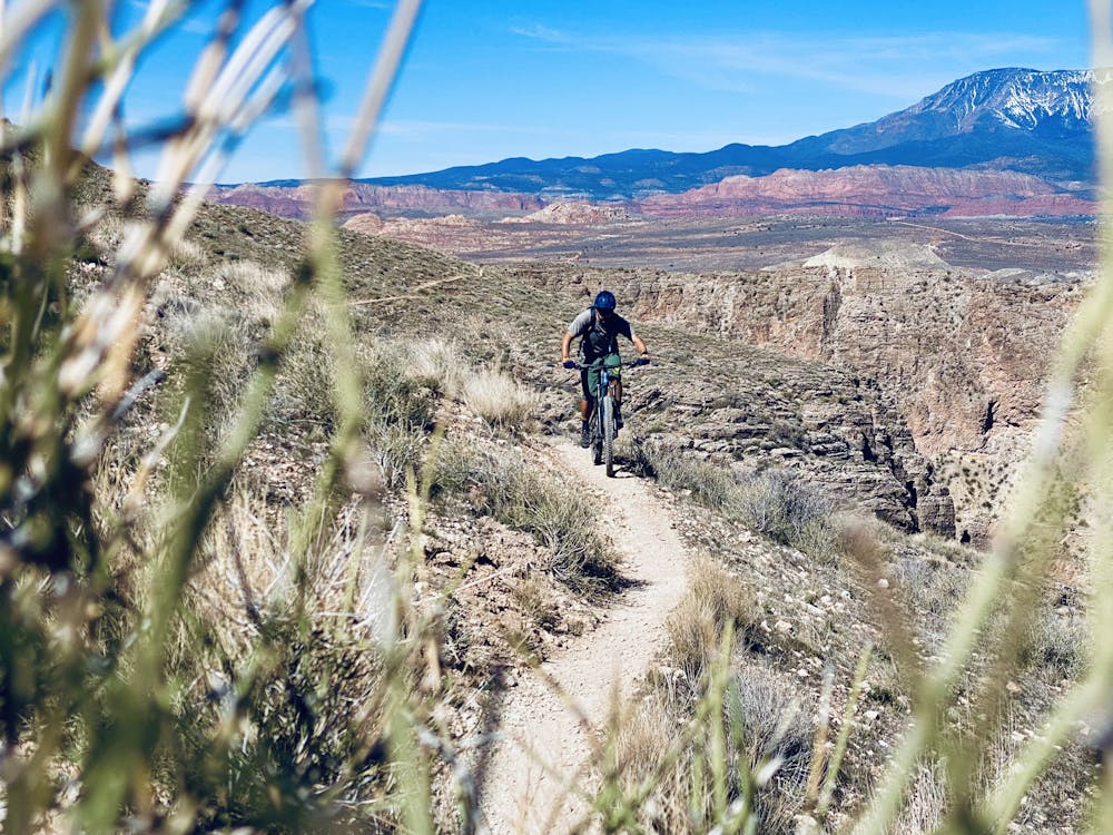
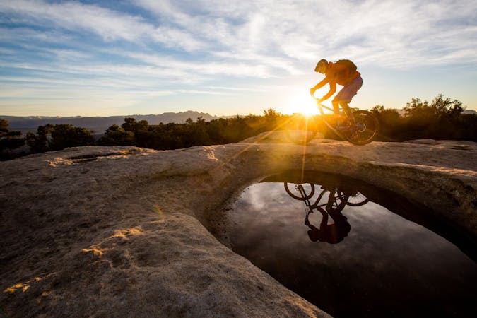
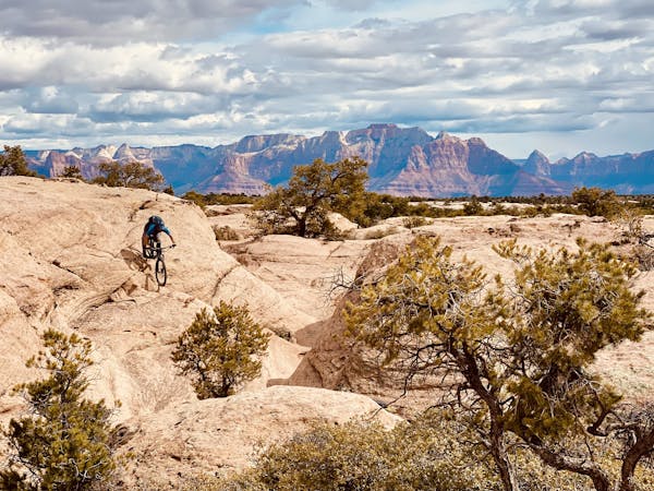
Thankfully, the incredible views will help distract you from the pain. The Hurricane Rim trail follows the edge of Hurricane Fault, which is one of the longest earthquake faults in the world. It runs 250km in a north-south direction. (Source) Through this section, the fault consists of jagged upthrust cliffs rising above a narrow valley hundreds of feet below, through which flows the stunning Virgin River. Take your time to enjoy the many vistas along the way, as these views are out of this world!
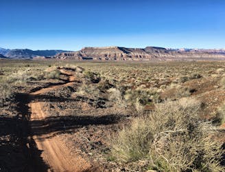
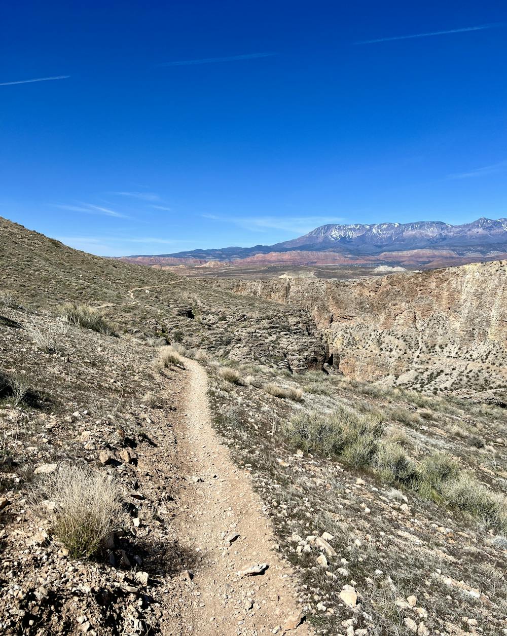
The singletrack along the rim alternates between flowy, mostly smooth trail, and a rough track filled with blocky square-edged rocks. These boulders also make forward progress feel like a challenge, with the abrupt edges threatening to leap out and flat your tire.
After pedaling along the incredible rim for about 7.5 miles, you'll cross the highway and then begin the longest climb of the ride. On the other side of the highway, you'll grind up the mesa on a combination of old doubletrack and singletrack, including the Goulds Rim trail. You'll then connect to the Gould trail and re-cross the highway to rejoin the Jem Trails. This climbing segment covers about 8 miles and 1,150 vertical feet.
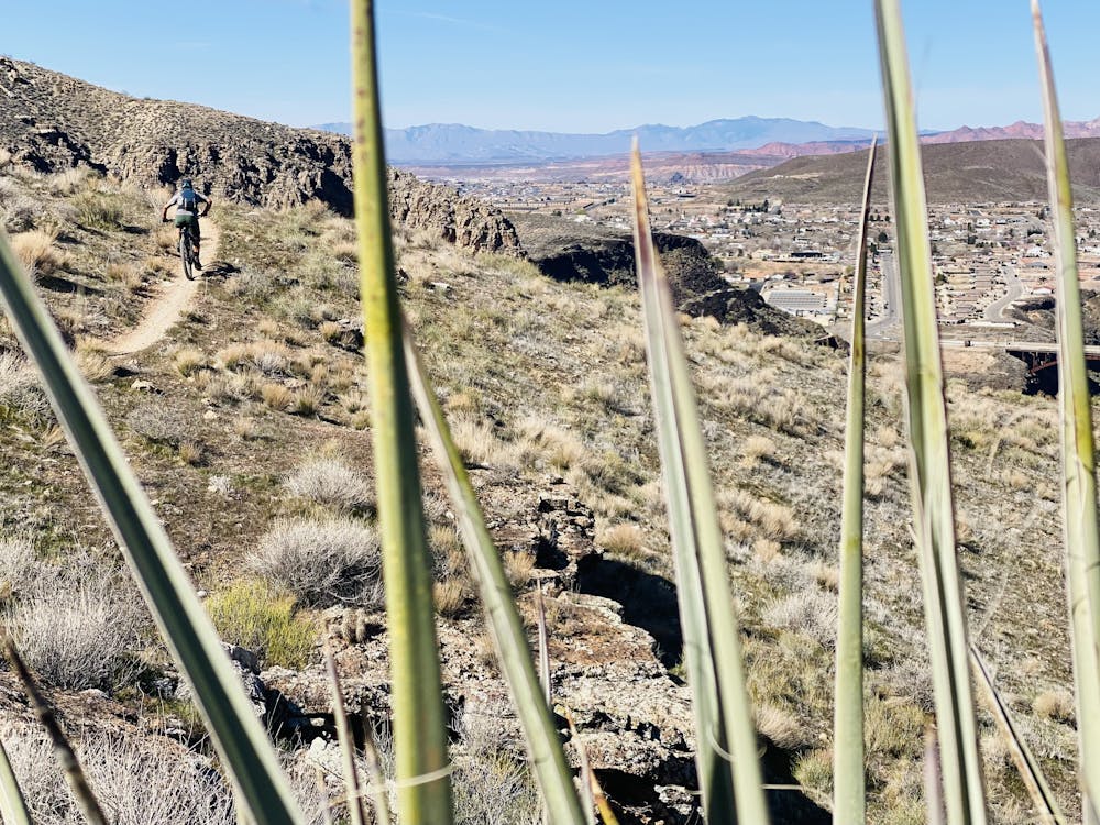
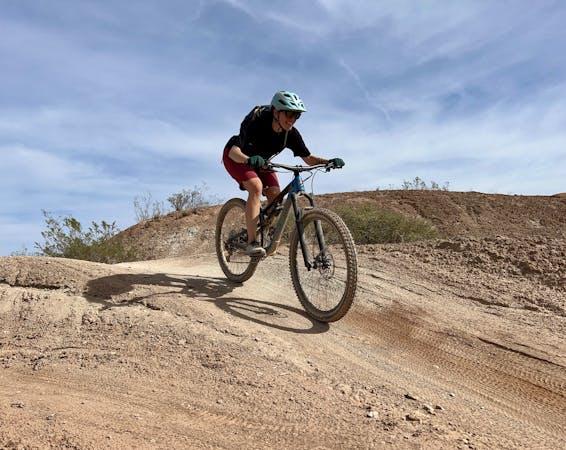
Finally, all of your work will pay off! You've reached the high point of the loop, and it's time to descend back to the trailhead. The descent follows the iconic Jem Trail all the way back. This smooth, mellow singletrack trail is fast, flowy, and fun! Some low berms keep riders flowing quickly through the singletrack, and small jumps provide opportunities for air. Some portions of the Jem Trail are chunky and technical, but those stretches of rock are all short-lived. This flowy descent is a worthy reward for all the work you put in!
Difficult
Mostly stable trail tread with some variability featuring larger and more unavoidable obstacles that may include, but not be limited to: bigger stones, roots, steps, and narrow curves. Compared to lower intermediate, technical difficulty is more advanced and grades of slopes are steeper. Ideal for upper intermediate riders.

Some trail sections have exposed ledges or steep ascents/descents where falling could cause serious injury.

Away from help but easily accessed.
4 m away
Flowy, easy-to-access singletrack with gorgeous views, and the occasional challenging section.
Moderate Mountain Biking
6.8 km away
A flowier version of Gooseberry Mesa.
Severe Mountain Biking
7.4 km away
Rippled slickrock riding paired with extreme exposure and beautiful views from the mesa's rim.
Severe Mountain Biking
9.3 km away
This ride links together the outer loop Guacamole trails into a great 11-mile ride—perfect for upper intermediates—with plenty of advanced options as well.
Difficult Mountain Biking
6 routes · Mountain Biking

37 routes · Mountain Biking

25 routes · Mountain Biking

24 routes · Mountain Biking
9 routes · Mountain Biking
8 routes · Mountain Biking