790 m away
Major Tom

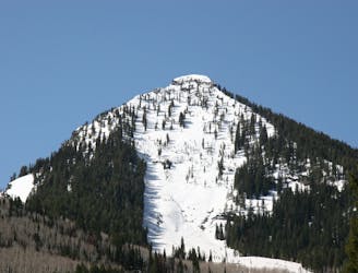
Major Tom is a steep and sporty couloir in a remote corner of the Wasatch that can have a few rappels to navigate!
Extreme Ski Touring
- Distance
- 3 km
- Ascent
- 3 m
- Descent
- 1.1 km

The approach to Major Tom starts at the Neff's Canyon trailhead and follows the canyon up until it branches into Thomas Fork and then reaches the ridge line.
Ski Touring Difficult

To access the Major Tom couloir, park at the Neff's Canyon trailhead in Olympus Cove. Follow the old road grade up into the canyon and take the left branch to head up into the main drainage of Neff's. The trail is narrow with overhanging trees and opens up into a junction. Take the path to the right into the woods and into Thomas Fork. There is an old summer trail you can follow that gains a sub ridge, and follows it into the upper reaches of the canyon. Once you enter the upper bowl of Thomas Fork, continue to the S, winding up through the pine forest cutting switchbacks until you gain the ridge. From there head E along the ridge keeping an eye on the S slopes, until you come to what is clearly the start to the chute.
Difficult
Serious gradient of 30-38 degrees where a real risk of slipping exists.
790 m away

Major Tom is a steep and sporty couloir in a remote corner of the Wasatch that can have a few rappels to navigate!
Extreme Ski Touring
1.5 km away

Memorial #1 is a very long and clean chute that runs off the ridge of the S summit of Mount Olympus.
Difficult Ski Touring
1.6 km away

Tolcat Canyon is the large and prominent chute that splits the N and S summits of Mount Olympus.
Difficult Ski Touring
1.6 km away

Memorial #3 is one of the classic steep lines on the backside of Mount Olympus with large dramatic rock lined walls.
Difficult Ski Touring
1.7 km away

This is the steepest and longest of the Memorials with excellent pitch and beautiful rock lined walls.
Severe Ski Touring
2.2 km away

The Apollo Couloir is the shorter, mellower sister chute to the Zeus Couloir on the magnificent northwest face of Mount Olympus.
Extreme Ski Touring
2.3 km away

Medusa's Face is the most gawked over and coveted, but rarely skied lines in the Wasatch Mountains.
Extreme Ski Touring
6.8 km away

Stairs Gulch is 4,000 feet long, serious with a combination of a steep, technical chute and a flat, more mellow finish.
Difficult Ski Touring
8 km away

This is the huge avalanche path that's visible from the road on the N slope of Kessler Peak.
Difficult Ski Touring
8.1 km away

A big fun run off of Kessler Peak with some great chute and trees skiing involved.
Difficult Ski Touring