220 m away
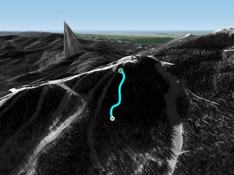
Roger's Chute

A fun little chute between National and Liftline.
Moderate Freeride Skiing
- Distance
- 195 m
- Ascent
- 0 m
- Descent
- 81 m
An expert glade with an interesting history.
Freeride Skiing Moderate

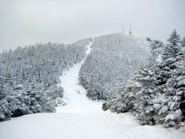
Partridge refers to the patch of woods between Goat and Liftline/National. This patch of woods is very popular on powder days. Partridge begins right where Haychute connects with Goat. There is a somewhat discreet entrance into the woods, since these woods are just a sliver at the top, it doesn’t look like there’s anything there. The further down you go, the wider this patch of woods gets, leaving a deep evergreen forest for you to explore. As you continue down, the woods become less steep and more deciduous until you hit midway. From here you can connect to Lower National of Liftline. Partridge originally got its name after the local who skied over a partridge in this very glade. He killed it instantly when he skied over it. Not wanting it to go to waste, he took it home and put it stew that night. The name stuck.
Moderate
Slopes become slightly steeper at around 25-30 degrees.

As well as the slope itself, there are some obstacles (such as rock outcrops) which could aggravate injury.
Away from help but easily accessed.
220 m away
A fun little chute between National and Liftline.
Moderate Freeride Skiing
226 m away

Popular woods between Upper National/Liftline and Starr
Difficult Freeride Skiing
311 m away
Very similar to Pipeline, with a different access point. Perfect for skiers looking for something tight and steep.
Difficult Freeride Skiing
393 m away

The most relentless inbounds line at Stowe
Severe Freeride Skiing
393 m away

A Stowe Classic, Goat Glades is the popular glade to skiers left of Goat.
Moderate Freeride Skiing
542 m away

One of the oldest ski trails in the USA and a great run for advanced skiers.
Moderate Freeride Skiing
626 m away

Steep chutes with trees and cliffs, accessed by a sidestepping traverse.
Difficult Freeride Skiing
812 m away

While it may not have any ledges, it does have plenty of room for turns.
Moderate Freeride Skiing
867 m away

A popular patch of woods that are always fun to ski.
Moderate Freeride Skiing
924 m away

A fun little freeride zone in the shadow of The Nose.
Difficult Freeride Skiing
12 routes · Freeride Skiing