66 m away
Triple Treasure

A popular patch of woods that are always fun to ski.
Moderate Freeride Skiing
- Distance
- 311 m
- Ascent
- 0 m
- Descent
- 115 m
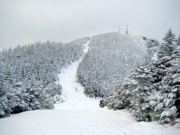
While it may not have any ledges, it does have plenty of room for turns.
Freeride Skiing Moderate

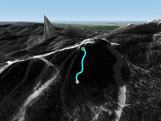
Another popular unmarked glade off the Triple. This is one of those glades that has a name that doesn’t make any sense. When you’re buddy says “let’s go ski The Ledges”, you probably picture something off Mansfield a big cliff line, rather than a sliver of woods off the Mountain Triple. You have the option to enter from either Hackett’s Highway or Hayride. The top portion is a well spaced but can be busy in early season. Once you get lower down, the patch of woods is only a few ski lengths across, but still too nice not to ski. Eventually a river gully obstructs the path and funnels you into Hacketts Highway.
Moderate
Slopes become slightly steeper at around 25-30 degrees.

As well as the slope itself, there are some obstacles (such as rock outcrops) which could aggravate injury.

Close to help in case of emergency.
66 m away
A popular patch of woods that are always fun to ski.
Moderate Freeride Skiing
674 m away

A fun little chute between National and Liftline.
Moderate Freeride Skiing
754 m away

Popular woods between Upper National/Liftline and Starr
Difficult Freeride Skiing
812 m away

An expert glade with an interesting history.
Moderate Freeride Skiing
1.1 km away
Very similar to Pipeline, with a different access point. Perfect for skiers looking for something tight and steep.
Difficult Freeride Skiing
1.1 km away

The most relentless inbounds line at Stowe
Severe Freeride Skiing
1.2 km away

A Stowe Classic, Goat Glades is the popular glade to skiers left of Goat.
Moderate Freeride Skiing
1.3 km away

One of the oldest ski trails in the USA and a great run for advanced skiers.
Moderate Freeride Skiing
1.4 km away

Steep chutes with trees and cliffs, accessed by a sidestepping traverse.
Difficult Freeride Skiing
1.6 km away

A summer hiking trail that requires serious tree skiing skills to negotiate.
Moderate Freeride Skiing
12 routes · Freeride Skiing