422 m away
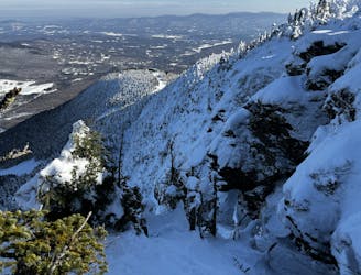
Kitchen Wall Traverse

A long traverse, under a massive icefall leads to some fun low angle glades
Moderate Freeride Skiing
- Distance
- 710 m
- Ascent
- 1 m
- Descent
- 147 m
This is the "best" trail down Upper Kitchen Wall!
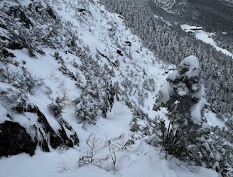
Freeride Skiing Extreme

This is a popular freeride skiing route which is generally considered to be extreme. It's very remote, it features high exposure (e3) and is typically done between January and February. From a low point of 993 m to the maximum altitude of 1.2 km, the route covers 396 m, 0 vertical metres of ascent and 184 vertical metres of descent. It's graded 5.4 and Labande grade 6. You'll need rope to complete it safely.
So it's not the only way you can go down, but preferably this is a very fun one. I boot-packed up, and it certainly makes the decent safer. But, of course, it becomes more manageable if you go further to the left on the wall.
Extreme
Extreme skiing terrain above 45 degrees. These routes are reserved for experienced experts.

In case of a fall, death is highly likely.
Little chance of being seen or helped in case of an accident.
422 m away
A long traverse, under a massive icefall leads to some fun low angle glades
Moderate Freeride Skiing
432 m away
A hero line with wild exposure
Extreme Freeride Skiing
533 m away

A fun little freeride zone in the shadow of The Nose.
Difficult Freeride Skiing
587 m away

A popular glade involving a mandatory icefall
Moderate Freeride Skiing
635 m away
A an exposed, hanging chute that is quite technical.
Severe Freeride Skiing
646 m away

The remnants of a classic New England ski trail.
Moderate Freeride Skiing
718 m away

Steep chutes with trees and cliffs, accessed by a sidestepping traverse.
Difficult Freeride Skiing
791 m away

A summer hiking trail that requires serious tree skiing skills to negotiate.
Moderate Freeride Skiing
814 m away

Climbing Gully serves as the approach for Mount Mansfield, but it also makes a great ski line.
Difficult Freeride Skiing
839 m away

A Stowe Classic, Goat Glades is the popular glade to skiers left of Goat.
Moderate Freeride Skiing
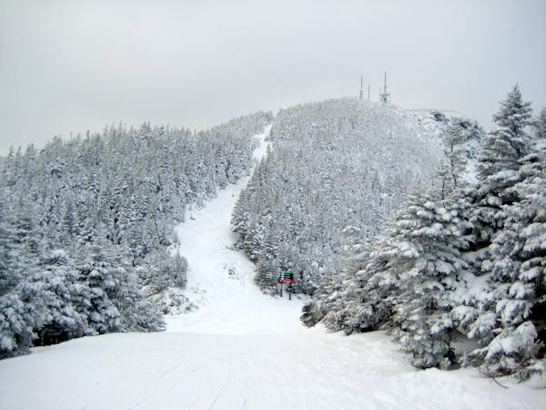
12 routes · Freeride Skiing